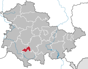
Ilm-Kreis (Ilm-Kreis)

- district in Thuringia, Germany
 Hiking in Ilm-Kreis
Ilm-Kreis, located in the state of Thuringia, Germany, offers a diverse range of hiking opportunities with beautiful landscapes, rich history, and charming villages. Here are some highlights of hiking in this area:
1.
- Thuringian Forest: The Ilm-Kreis is part of the Thuringian Forest (Thüringer Wald), which is a popular destination for hiking. The trails here vary in difficulty and length, catering to all levels of hikers. The Wanderweg (hiking trail) network is well-marked and includes various scenic routes.
- Goethe Trail: This famous trail near Weimar follows in the footsteps of the renowned poet Johann Wolfgang von Goethe and offers stunning views of the surrounding landscapes.
- Premium Hiking Trails: There are several premium hiking trails in the region, such as the Rennsteig, which is one of the oldest and most famous hiking trails in Germany, stretching over 170 kilometers along the ridge of the Thuringian Forest.
2.
- Natural Beauty: The Ilm-Kreis features dense forests, rolling hills, and picturesque valleys. The area is rich in biodiversity and offers opportunities to see various plant and animal species.
- Viewpoints: There are multiple lookout points along the trails where you can enjoy breathtaking views of the Thuringian Forest and the valleys below.
3.
- Historic Villages: While hiking, you'll have the chance to explore charming villages like Ilmenau, which has a rich history and some interesting architecture.
- Castles and Ruins: Hiking paths may lead you to historical landmarks such as castles and ruins, allowing for a cultural experience in addition to physical activity.
4.
- Weather Considerations: The weather can change quickly, so it's a good idea to check forecasts and dress in layers. Waterproof gear is recommended.
- Trail Etiquette: Stay on marked trails, and be mindful of nature and wildlife. Practice "Leave No Trace" principles to preserve the environment.
- Equipment: Good hiking boots and appropriate clothing are essential. Bringing along a backpack with water, snacks, and a map or GPS device is advisable.
5.
- Accommodations: You can find a range of accommodations, from hotels to guesthouses, to suit different preferences and budgets.
- Public Transportation: Ilm-Kreis is accessible by public transport, which makes it easier to reach trailheads without having to drive.
Conclusion
Overall, hiking in Ilm-Kreis can be a rewarding experience, combining physical activity with nature and culture. Whether you’re looking for a leisurely stroll or a challenging hike, this region of Thuringia has something to offer for every type of hiker.
- Country:

- Coordinates: 50° 45' 0" N, 11° 0' 0" E


- GPS tracks (wikiloc): [Link]
- AboveSeaLevel: 416 м m
- Area: 843.71 sq km
- Population: 109620
- Web site: http://www.ilm-kreis.de/
- Wikipedia en: wiki(en)
- Wikipedia: wiki(de)
- Wikidata storage: Wikidata: Q7878
- Wikipedia Commons Gallery: [Link]
- Wikipedia Commons Category: [Link]
- Wikipedia Commons Maps Category: [Link]
- Freebase ID: [/m/01w8m6]
- GeoNames ID: Alt: [6547391]
- VIAF ID: Alt: [134506134]
- OSM relation ID: [62419]
- GND ID: Alt: [4393702-0]
- archINFORM location ID: [8271]
- NUTS code: [DEG0F]
- BabelNet ID: [02625227n]
- German district key: 16070
Shares border with regions:

Suhl
- town in Thuringia, Germany
Hiking in Suhl
Suhl, located in the Thuringia region of Germany, is surrounded by stunning natural landscapes, making it a wonderful destination for hiking enthusiasts. The area is characterized by diverse terrains, including forests, hills, and picturesque valleys, offering a range of trails suitable for all skill levels....
- Country:
- Postal Code: 98711; 98530; 98529; 98527
- Local Dialing Code: 036782; 036846; 03681
- Licence Plate Code: SHL
- Coordinates: 50° 36' 38" N, 10° 41' 35" E
- GPS tracks (wikiloc): [Link]
- AboveSeaLevel: 422 м m
- Area: 103.02 sq km
- Population: 36208
- Web site: [Link]


Erfurt
- capital city of German federated state of Thuringia
Hiking in Erfurt
Hiking around Erfurt, the capital of Thuringia in central Germany, offers a unique blend of natural beauty and cultural experiences. The region is characterized by picturesque landscapes, rolling hills, and charming villages, as well as numerous trails suitable for all hiking levels. Here are some highlights to consider:...
- Country:
- Postal Code: 99099; 99098; 99097; 99096; 99095; 99094; 99092; 99091; 99090; 99089; 99087; 99086; 99085; 99084
- Local Dialing Code: 36204; 36203; 36202; 36208; 361
- Licence Plate Code: EF; LF; L
- Coordinates: 50° 58' 41" N, 11° 1' 45" E
- GPS tracks (wikiloc): [Link]
- AboveSeaLevel: 194 м m
- Area: 269.91 sq km
- Population: 211113
- Web site: [Link]