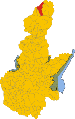
Incudine (Incudine)
- Italian comune
Incudine is a small and picturesque village located in the province of Brescia in the Lombardy region of Italy, nestled in the scenic Valle Camonica. Hiking in this area offers stunning views of the surrounding mountains, lush forests, and opportunities to explore rich cultural heritage.
Hiking Trails:
-
Valle di Campovecchio: This trail leads you through beautiful landscapes with stunning vistas of the valley and surrounding mountain ranges. It's a moderate trek ideal for those looking for a longer hike.
-
Monte Guglielmo: A popular destination for hikers, Monte Guglielmo offers various trails that vary in difficulty. The panoramic views from the summit are well worth the effort.
-
Sentiero dei Fiori: This trail features diverse flora and is particularly beautiful in spring and early summer. It's a less strenuous hike, making it suitable for families.
-
Circuito delle Malghe: This route connects various traditional mountain farms (malghe) in the area, allowing you to experience local culture, enjoy traditional cuisine, and hike through varying terrains.
Preparation:
- Weather: Check the weather conditions before heading out, as the area can experience rapid changes.
- Gear: Wear appropriate hiking boots, and consider bringing trekking poles for stability, especially on steeper trails.
- Water and Snacks: Carry enough water and energy-boosting snacks, particularly on longer hikes, where amenities may be limited.
- Navigation: Familiarize yourself with the trail maps and consider using GPS tools or mobile apps for hiking.
Wildlife and Nature: Be on the lookout for various wildlife, including deer, eagles, and other alpine fauna. The flora is rich, with many opportunities for photography, especially in bloom.
Hiking in Incudine provides not only a physical challenge but also a chance to immerse yourself in the natural beauty and tranquility of the Italian Alps. Whether you are a seasoned hiker or a beginner, there are trails suitable for all skill levels, making it an excellent destination for outdoor enthusiasts.
- Country:

- Postal Code: 25040
- Local Dialing Code: 0364
- Licence Plate Code: BS
- Coordinates: 46° 13' 20" N, 10° 21' 30" E


- GPS tracks (wikiloc): [Link]
- AboveSeaLevel: 910 м m
- Area: 19.67 sq km
- Population: 371
- Web site: http://www.comune.incudine.bs.it
- Wikipedia en: wiki(en)
- Wikipedia: wiki(it)
- Wikidata storage: Wikidata: Q104887
- Wikipedia Commons Category: [Link]
- Freebase ID: [/m/043phs]
- GeoNames ID: Alt: [6542597]
- VIAF ID: Alt: [238164957]
- OSM relation ID: [47017]
- ISTAT ID: 017083
- Italian cadastre code: E297
- LombardiaBeniCulturali toponym ID: 2000204
Shares border with regions:


Edolo
- Italian comune
Edolo is a charming town located in the Brescia province of Lombardy, Italy, surrounded by the stunning landscapes of the Adamello and Tonale mountains. It's an excellent destination for hiking enthusiasts, offering a variety of trails that cater to different skill levels. Here are some highlights of hiking in the Edolo area:...
- Country:

- Postal Code: 25048
- Local Dialing Code: 0364
- Licence Plate Code: BS
- Coordinates: 46° 10' 44" N, 10° 19' 48" E


- GPS tracks (wikiloc): [Link]
- AboveSeaLevel: 720 м m
- Area: 88.9 sq km
- Population: 4564
- Web site: [Link]


Monno
- Italian comune
Monno, located in the province of Brescia in Italy, is an excellent destination for hiking enthusiasts. Nestled in the beautiful landscape of the Lombardy region, it offers a variety of trails suitable for different skill levels, from leisurely walks to more challenging hikes....
- Country:

- Postal Code: 25040
- Local Dialing Code: 0364
- Licence Plate Code: BS
- Coordinates: 46° 12' 48" N, 10° 20' 26" E


- GPS tracks (wikiloc): [Link]
- AboveSeaLevel: 1066 м m
- Area: 31.03 sq km
- Population: 540
- Web site: [Link]


Vezza d'Oglio
- Italian comune
Vezza d'Oglio is a charming town located in the Camonica Valley in the Lombardy region of northern Italy. It serves as a gateway to numerous hiking opportunities in the surrounding areas. Here are some highlights and tips for hiking around Vezza d'Oglio:...
- Country:

- Postal Code: 25059
- Local Dialing Code: 0364
- Licence Plate Code: BS
- Coordinates: 46° 14' 20" N, 10° 23' 53" E


- GPS tracks (wikiloc): [Link]
- AboveSeaLevel: 1080 м m
- Area: 54.15 sq km
- Population: 1443
- Web site: [Link]

