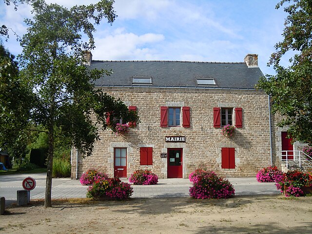
Inguiniel (Inguiniel)

- commune in Morbihan, France
- Country:

- Postal Code: 56240
- Coordinates: 47° 58' 35" N, 3° 16' 58" E


- GPS tracks (wikiloc): [Link]
- Area: 51.4 sq km
- Population: 2140
- Web site: https://www.inguiniel.fr
- Wikipedia en: wiki(en)
- Wikipedia: wiki(fr)
- Wikidata storage: Wikidata: Q71039
- Wikipedia Commons Category: [Link]
- Freebase ID: [/m/03c5nbc]
- GeoNames ID: Alt: [3012778]
- SIREN number: [215600891]
- BnF ID: [15265339h]
- PACTOLS thesaurus ID: [pcrtDPv07EU4zz]
- INSEE municipality code: 56089
Shares border with regions:


Persquen
- commune in Morbihan, France
- Country:
- Postal Code: 56160
- Coordinates: 48° 1' 46" N, 3° 11' 47" E
- GPS tracks (wikiloc): [Link]
- Area: 19.96 sq km
- Population: 335


Plouay
- commune in Morbihan, France
- Country:
- Postal Code: 56240
- Coordinates: 47° 54' 52" N, 3° 20' 2" E
- GPS tracks (wikiloc): [Link]
- AboveSeaLevel: 83 м m
- Area: 67.33 sq km
- Population: 5529
- Web site: [Link]


Kernascléden
- commune in Morbihan, France
- Country:
- Postal Code: 56540
- Coordinates: 48° 0' 22" N, 3° 19' 15" E
- GPS tracks (wikiloc): [Link]
- Area: 9.26 sq km
- Population: 422


Bubry
- commune in Morbihan, France
- Country:
- Postal Code: 56310
- Coordinates: 47° 57' 49" N, 3° 10' 23" E
- GPS tracks (wikiloc): [Link]
- Area: 69.09 sq km
- Population: 2379


Berné
- commune in Morbihan, France
- Country:
- Postal Code: 56240
- Coordinates: 47° 59' 42" N, 3° 23' 33" E
- GPS tracks (wikiloc): [Link]
- Area: 34.77 sq km
- Population: 1514


Lignol
- commune in Morbihan, France
- Country:
- Postal Code: 56160
- Coordinates: 48° 2' 15" N, 3° 16' 16" E
- GPS tracks (wikiloc): [Link]
- Area: 38.43 sq km
- Population: 885

Lanvaudan
- commune in Morbihan, France
- Country:
- Postal Code: 56240
- Coordinates: 47° 53' 58" N, 3° 15' 42" E
- GPS tracks (wikiloc): [Link]
- Area: 18.3 sq km
- Population: 792
- Web site: [Link]