
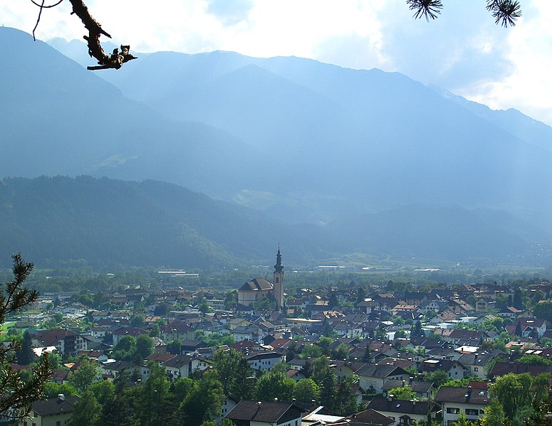
Innsbruck (Innsbruck)

- federated state capital of Tyrol, Austria
 Hiking in Innsbruck
Innsbruck, located in the heart of the Austrian Alps, is a fantastic destination for hikers of all skill levels. Surrounded by stunning mountain ranges, including the Nordkette, Patscherkofel, and Axamer Lizum, there are numerous trails offering breathtaking views, diverse landscapes, and varying degrees of difficulty.
Popular Hiking Areas around Innsbruck:
-
Nordkette Mountain Range:
- Pfriemesköpfl Hike: A moderate trail that offers panoramic views of Innsbruck and is accessible via the Nordkette cable car.
- Hafelekar: A more challenging hike that provides awe-inspiring views. You can take the cable car up and then hike down or vice versa.
-
Patscherkofel:
- Known for its beautiful trails, the area is also the site of the 1964 Olympic Winter Games. The hike to the summit is moderate and rewards hikers with stunning views of Innsbruck and the surrounding mountains.
-
Axamer Lizum:
- Offers a variety of trails, including easy walks and more challenging hikes. The area is less crowded than more popular spots, giving you a chance to enjoy nature in peace.
-
Stubai Valley:
- A bit further from Innsbruck, the Stubai Valley has many hiking options, from gentle walks to strenuous hikes like the ascent to the Stubai Glacier.
Tips for Hiking in Innsbruck:
-
Season: The best time for hiking is from late spring to early fall (May to October). Be sure to check the weather conditions and trail closures, especially if you're hiking in late fall or early spring.
-
Gear: Wear good hiking shoes and bring layers, as mountain weather can change quickly. It's also wise to carry a map, a first-aid kit, and sufficient water and snacks.
-
Guided Tours: If you're new to hiking or want to explore the region more thoroughly, consider joining a guided hike. Local guides can provide valuable insights and enhance your experience.
-
Public Transport: Innsbruck has excellent public transport options, including buses and trams that can take you to many trailheads.
-
Respect Nature: Always follow the Leave No Trace principles. Stay on marked trails, take your litter with you, and be considerate of wildlife and other hikers.
Innsbruck offers an incredible hiking experience with routes for everyone, so lace up your boots and enjoy the stunning natural beauty!
- Country:

- Postal Code: 6080; 6010–6040; 6020
- Local Dialing Code: 0512
- Licence Plate Code: I
- Coordinates: 47° 16' 0" N, 11° 23' 0" E


- GPS tracks (wikiloc): [Link]
- AboveSeaLevel: 574 м m
- Area: 105 sq km
- Population: 130894
- Web site: http://www.innsbruck.at/
- Wikipedia en: wiki(en)
- Wikipedia: wiki(de)
- Wikidata storage: Wikidata: Q1735
- Wikipedia Commons Gallery: [Link]
- Wikipedia Commons Category: [Link]
- Wikipedia Commons Maps Category: [Link]
- Freebase ID: [/m/0fhmy]
- GeoNames ID: Alt: [2775220]
- BnF ID: [11961873r]
- VIAF ID: Alt: [131336603]
- OSM relation ID: [4835169]
- GND ID: Alt: [4027096-8]
- archINFORM location ID: [1376]
- Library of Congress authority ID: Alt: [n79072777]
- MusicBrainz area ID: [0a19e07a-81e0-4bfe-a103-62c15ec45ecd]
- TGN ID: [7003249]
- Encyclopædia Britannica Online ID: [place/Innsbruck]
- Encyclopædia Universalis ID: [innsbruck]
- HDS ID: [6592]
- EMLO location ID: [4d40a2e5-c5c8-4856-977c-1de8f6477a86]
- Facebook Places ID: [114596688557481]
- Great Russian Encyclopedia Online ID: [2012628]
- Austrian municipality key: [70101]
- DMOZ ID: Alt: [Regional/Europe/Austria/Localities/Innsbruck/]
- Pleiades ID: [187516]
- National Library of Israel ID: [000187655]
- Klexikon article ID: [Innsbruck]
- BabelNet ID: [00046835n]
- Encyclopedia of Modern Ukraine ID: [12322]
- US National Archives Identifier: 10044879
Shares border with regions:
Zirl, Tyrol
- municipality in Austria
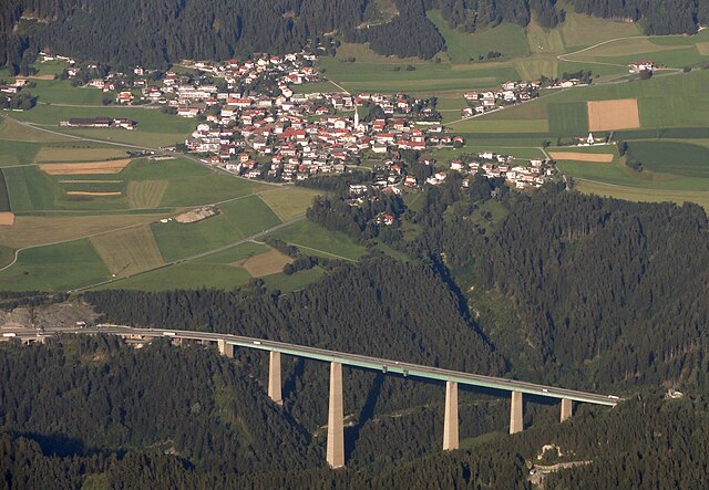
Hiking in Zirl, Tyrol
Zirl, located in Tyrol, Austria, is a charming village that serves as a great base for hikers looking to explore the stunning landscapes of the region. Here are some highlights and tips for hiking in and around Zirl:...
- Country:
- Postal Code: 6170
- Local Dialing Code: 05238
- Licence Plate Code: IL
- Coordinates: 47° 16' 24" N, 11° 14' 29" E
- GPS tracks (wikiloc): [Link]
- AboveSeaLevel: 622 м m
- Area: 57.24 sq km
- Population: 8162
- Web site: [Link]

Völs
- market town in Tyrol
Hiking in Völs
Völs, located in the Tyrol region of Austria, is a beautiful area for hiking enthusiasts. Nestled in the Innsbruck-Land District, it offers a variety of trails that cater to different skill levels, making it an excellent destination for both beginners and experienced hikers....
- Country:
- Postal Code: 6176
- Local Dialing Code: 0512
- Licence Plate Code: IL
- Coordinates: 47° 15' 0" N, 11° 20' 0" E
- GPS tracks (wikiloc): [Link]
- AboveSeaLevel: 574 м m
- Area: 5.62 sq km
- Population: 6738
- Web site: [Link]


Absam
- municipality in Austria
Hiking in Absam
Absam, located in Tyrol, Austria, is a beautiful area surrounded by the stunning scenery of the Alps, making it a fantastic destination for hiking enthusiasts. Here are a few key points about hiking in Absam:...
- Country:
- Postal Code: 6067
- Local Dialing Code: 05223
- Licence Plate Code: IL
- Coordinates: 47° 17' 0" N, 11° 30' 0" E
- GPS tracks (wikiloc): [Link]
- AboveSeaLevel: 632 м m
- Area: 51.92 sq km
- Population: 7112
- Web site: [Link]


Ampass
- municipality in Austria
Hiking in Ampass
Ampass is a charming village located in Tyrol, Austria, near the city of Innsbruck. It’s an excellent starting point for various hiking trails that showcase the stunning alpine landscapes of the region. Here are some highlights and tips for hiking in and around Ampass:...
- Country:
- Postal Code: 6070
- Local Dialing Code: 0512
- Licence Plate Code: IL
- Coordinates: 47° 16' 0" N, 11° 26' 0" E
- GPS tracks (wikiloc): [Link]
- AboveSeaLevel: 651 м m
- Area: 7.9 sq km
- Population: 1827
- Web site: [Link]

Mutters
- municipality in Austria
Hiking in Mutters
Mutters is a picturesque village located in the Tyrol region of Austria, nestled in the Stubai Valley, just a short distance from Innsbruck. It's known for its stunning alpine scenery, making it a fantastic destination for hiking enthusiasts. Here are some highlights and tips for hiking in Mutters:...
- Country:
- Postal Code: 6162
- Local Dialing Code: 0512
- Licence Plate Code: IL
- Coordinates: 47° 14' 0" N, 11° 22' 0" E
- GPS tracks (wikiloc): [Link]
- AboveSeaLevel: 830 м m
- Area: 19.0 sq km
- Population: 2202
- Web site: [Link]

Schönberg im Stubaital
- municipality in Austria
Hiking in Schönberg im Stubaital
Schönberg im Stubaital is a beautiful village located in the Stubai Valley of Tyrol, Austria, known for its stunning alpine scenery and outdoor activities, particularly hiking. Here are some highlights about hiking in this picturesque area:...
- Country:
- Postal Code: 6141
- Local Dialing Code: 05225
- Licence Plate Code: IL
- Coordinates: 47° 11' 11" N, 11° 24' 22" E
- GPS tracks (wikiloc): [Link]
- AboveSeaLevel: 1013 м m
- Area: 7.48 sq km
- Population: 1101
- Web site: [Link]

Seefeld in Tirol
- municipality in Austria
Hiking in Seefeld in Tirol
Seefeld in Tirol is a stunning destination for hiking enthusiasts, nestled in the Tyrol region of Austria. Known for its beautiful landscapes, the area offers a variety of trails suitable for all levels of hikers, from beginners to advanced. Here are some highlights and tips for hiking in Seefeld:...
- Country:
- Postal Code: 6100
- Local Dialing Code: 05212
- Licence Plate Code: IL
- Coordinates: 47° 19' 46" N, 11° 11' 21" E
- GPS tracks (wikiloc): [Link]
- AboveSeaLevel: 1180 м m
- Area: 17.4 sq km
- Population: 3440
- Web site: [Link]
Scharnitz
- municipality in Austria
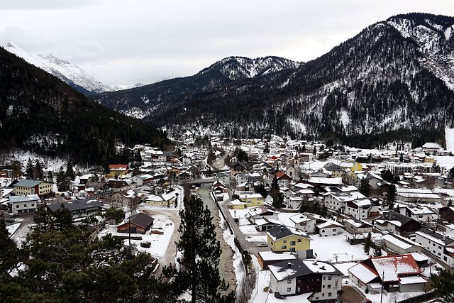
Hiking in Scharnitz
Scharnitz is a picturesque village located at the border between Germany and Austria, serving as a perfect starting point for various hiking adventures in the Tyrolean Alps. The area is known for its stunning natural beauty, diverse trails, and opportunities for outdoor activities....
- Country:
- Postal Code: 6108
- Local Dialing Code: 05213
- Licence Plate Code: IL
- Coordinates: 47° 23' 18" N, 11° 15' 54" E
- GPS tracks (wikiloc): [Link]
- AboveSeaLevel: 964 м m
- Area: 158.77 sq km
- Population: 1403
- Web site: [Link]


Götzens
- municipality in Austria
Hiking in Götzens
Götzens is a charming village located in the Tyrol region of Austria, near the city of Innsbruck. Known for its stunning Alpine scenery, it offers a range of hiking opportunities suitable for various skill levels. Here are some key highlights for hiking in the Götzens area:...
- Country:
- Postal Code: 6091
- Local Dialing Code: 05234
- Licence Plate Code: IL
- Coordinates: 47° 14' 10" N, 11° 18' 41" E
- GPS tracks (wikiloc): [Link]
- AboveSeaLevel: 868 м m
- Area: 10 sq km
- Population: 4062
- Web site: [Link]

Rum
- municipality in Austria
Hiking in Rum
Hiking in Rum, a picturesque village located in the Tyrol region of Austria, offers stunning views of the surrounding mountains and a range of trails suitable for all levels of hikers. Nestled at the foot of the Nordkette mountain range and near the city of Innsbruck, Rum provides a perfect mix of access to both natural beauty and local culture....
- Country:
- Postal Code: 6063
- Local Dialing Code: 0512
- Licence Plate Code: IL
- Coordinates: 47° 17' 14" N, 11° 27' 29" E
- GPS tracks (wikiloc): [Link]
- AboveSeaLevel: 621 м m
- Area: 8.6 sq km
- Population: 9190
- Web site: [Link]


Aldrans
- municipality in Austria
Hiking in Aldrans
Aldrans is a picturesque village located in the Tyrol region of Austria, just a few kilometers from Innsbruck. Its location near the mountains makes it an excellent base for hiking enthusiasts. Here are some highlights and suggestions for hiking in and around Aldrans:...
- Country:
- Postal Code: 6071
- Local Dialing Code: 0512
- Licence Plate Code: IL
- Coordinates: 47° 15' 0" N, 11° 26' 0" E
- GPS tracks (wikiloc): [Link]
- AboveSeaLevel: 760 м m
- Area: 8.89 sq km
- Population: 2684
- Web site: [Link]
Patsch
- municipality in Austria
Hiking in Patsch
Patsch, a charming village located near Innsbruck in Austria, offers a variety of hiking opportunities for outdoor enthusiasts. Nestled in the scenic Tyrolean Alps, this area is known for its stunning landscapes, making it a great destination for both casual walkers and experienced hikers....
- Country:
- Postal Code: 6082
- Local Dialing Code: 0512
- Licence Plate Code: IL
- Coordinates: 47° 12' 15" N, 11° 24' 55" E
- GPS tracks (wikiloc): [Link]
- AboveSeaLevel: 998 м m
- Area: 9.73 sq km
- Population: 1014
- Web site: [Link]

Natters
- municipality in Austria
Hiking in Natters
Natters is a charming village located in Tyrol, Austria, nestled in the foothills of the Alps, making it an excellent destination for hiking enthusiasts. Here are some highlights of hiking in and around Natters:...
- Country:
- Postal Code: 6161
- Local Dialing Code: 0512
- Licence Plate Code: IL
- Coordinates: 47° 14' 2" N, 11° 22' 24" E
- GPS tracks (wikiloc): [Link]
- AboveSeaLevel: 783 м m
- Area: 7.33 sq km
- Population: 2020
- Web site: [Link]

Lans
- village in Tyrol, Austria
Hiking in Lans
Lans, a picturesque village located in Tyrol, Austria, is known for its stunning alpine landscapes and its proximity to the city of Innsbruck. Hiking in and around Lans offers a diverse range of trails suitable for various skill levels, making it an excellent destination for outdoor enthusiasts. Here’s a brief overview of what you can expect:...
- Country:
- Postal Code: 6072
- Local Dialing Code: 0512
- Licence Plate Code: IL
- Coordinates: 47° 14' 18" N, 11° 25' 53" E
- GPS tracks (wikiloc): [Link]
- AboveSeaLevel: 867 м m
- Area: 6.03 sq km
- Population: 1096
- Web site: [Link]

Thaur
- municipality in Austria
Hiking in Thaur
Thaur, a small municipality located near Innsbruck in Tyrol, Austria, offers a variety of hiking opportunities set against the stunning backdrop of the Alps. The area is characterized by its beautiful landscapes, cultural heritage, and proximity to both gentle hills and more challenging alpine terrain, making it suitable for hikers of all skill levels....
- Country:
- Postal Code: 6065
- Local Dialing Code: 05223
- Licence Plate Code: IL
- Coordinates: 47° 17' 42" N, 11° 28' 19" E
- GPS tracks (wikiloc): [Link]
- AboveSeaLevel: 633 м m
- Area: 21.1 sq km
- Population: 3979
- Web site: [Link]