Natters (Natters)
- municipality in Austria
 Hiking in Natters
Natters is a charming village located in Tyrol, Austria, nestled in the foothills of the Alps, making it an excellent destination for hiking enthusiasts. Here are some highlights of hiking in and around Natters:
Trails and Routes
-
Natterer Alm: This is one of the most popular hiking destinations near Natters. It offers well-marked trails that lead to picturesque alpine meadows and provides stunning views of the surrounding mountains. You can enjoy a leisurely walk or a more challenging hike, depending on your preference.
-
Muttereralm: Accessible from Natters, the Muttereralm area offers a network of hiking trails that cater to all levels. The trails vary in difficulty and take you through beautiful landscapes dotted with wildflowers and offering panoramic views of the Innsbruck valley.
-
Stubai Valley: A bit further afield, the Stubai Valley is renowned for its breathtaking scenery and extensive hiking options. You can access various trails leading to glacial lakes, waterfalls, and impressive mountain peaks.
Difficulty Levels
The hiking trails around Natters range from easy walks suitable for families and beginners to more demanding routes for experienced hikers. Always check the trail difficulty and duration before setting out.
Scenic Views
One of the highlights of hiking in Natters is the stunning alpine scenery. The views include lush forests, crystal-clear streams, and breathtaking mountain vistas, especially as you ascend higher along the trails.
Seasonal Hiking
- Summer: Ideal for hiking, as the weather is typically warm and trails are accessible.
- Autumn: Stunning fall foliage adds a vibrant backdrop to your hikes.
- Winter: While hiking can still be done in winter, trails may be more challenging due to snow, and it's best to check local conditions.
Tips for Hiking in Natters
- Footwear: Wear sturdy hiking boots to navigate rocky and uneven terrain comfortably.
- Weather: Check the weather forecast before your hike, as conditions can change rapidly in the mountains.
- Map and GPS: While many trails are well-marked, having a map or a GPS device is advisable for more remote areas.
- Hydration and Snacks: Carry sufficient water and snacks, particularly for longer hikes.
- Respect Nature: Always stay on marked trails and follow local guidelines to preserve the environment.
Accessibility
Natters is easily accessible from Innsbruck, making it a great base for those wanting to enjoy the natural beauty of the Tyrolean Alps.
Whether you're looking for a casual stroll or an adventurous hike, Natters offers a variety of options that showcase the natural beauty of the region. Be sure to take your time to enjoy the landscapes and the fresh mountain air!
- Country:

- Postal Code: 6161
- Local Dialing Code: 0512
- Licence Plate Code: IL
- Coordinates: 47° 14' 2" N, 11° 22' 24" E


- GPS tracks (wikiloc): [Link]
- AboveSeaLevel: 783 м m
- Area: 7.33 sq km
- Population: 2020
- Web site: http://www.natters.tirol.gv.at/
- Wikipedia en: wiki(en)
- Wikipedia: wiki(de)
- Wikidata storage: Wikidata: Q681935
- Wikipedia Commons Category: [Link]
- Freebase ID: [/m/02w04x3]
- GeoNames ID: Alt: [2770913]
- VIAF ID: Alt: [168653691]
- GND ID: Alt: [4527278-5]
- archINFORM location ID: [4269]
- Library of Congress authority ID: Alt: [n80024739]
- Austrian municipality key: [70332]
Shares border with regions:

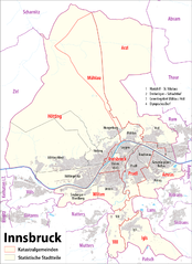
Innsbruck
- federated state capital of Tyrol, Austria
Hiking in Innsbruck
Innsbruck, located in the heart of the Austrian Alps, is a fantastic destination for hikers of all skill levels. Surrounded by stunning mountain ranges, including the Nordkette, Patscherkofel, and Axamer Lizum, there are numerous trails offering breathtaking views, diverse landscapes, and varying degrees of difficulty....
- Country:
- Postal Code: 6080; 6010–6040; 6020
- Local Dialing Code: 0512
- Licence Plate Code: I
- Coordinates: 47° 16' 0" N, 11° 23' 0" E
- GPS tracks (wikiloc): [Link]
- AboveSeaLevel: 574 м m
- Area: 105 sq km
- Population: 130894
- Web site: [Link]