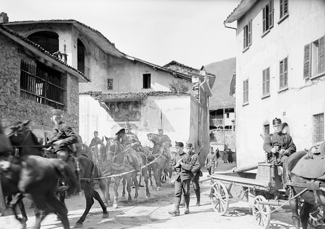
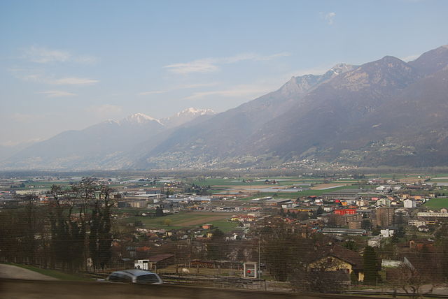
Isone (Isone)

- municipality in Switzerland
 Hiking in Isone
Isone is a charming municipality located in the Canton of Ticino, Switzerland. It offers a range of hiking opportunities that showcase the stunning landscapes and natural beauty of the region. Here are some details to consider for hiking in Isone:
Hiking Trails
-
Sentiero dei Pizzotti: This trail provides a moderate hike with picturesque views of the surrounding valleys and mountains. It's a great option for families and offers various viewpoints along the way.
-
Monte Ceneri: Accessing the higher elevations, this trail offers a more challenging hike with rewarding panoramic views from the summit. The diverse flora and fauna along the path add to the experience.
-
Nature Trails: Isone has several well-marked nature trails that feature educational signs about the local ecosystem. These trails are typically easier and great for nature enthusiasts who enjoy learning about their surroundings.
Accessibility
Most trails in and around Isone are accessible during the summer and early autumn months, generally from late spring to early autumn, depending on the weather conditions. Some higher-altitude trails may still have snow coverage in early summer.
Preparation
- Footwear: Make sure to wear sturdy hiking boots with good grip to handle different terrains.
- Weather: Check the weather forecast before heading out, as conditions can change rapidly in the mountains.
- Hydration and Snacks: Bring plenty of water and snacks to keep your energy up during the hike.
- Navigation: Although trails are generally well-marked, having a map or a GPS device can be beneficial, especially for less-traveled paths.
Safety Tips
- Inform someone about your hiking plans and expected return time.
- If you're hiking alone, choose well-trafficked trails.
- Always respect local wildlife and habitats along the trails.
Additional Activities
Isone is also known for its rich cultural history, with opportunities to explore local architecture, traditional Ticinese cuisine, and charming villages. If you have the time, consider combining your hike with some local sightseeing.
Hiking in Isone offers a blend of adventure and tranquility amidst breathtaking Swiss landscapes. Enjoy your outdoor activities!
- Country:

- Postal Code: 6810
- Local Dialing Code: 091
- Licence Plate Code: TI
- Coordinates: 46° 8' 1" N, 9° 0' 52" E


- GPS tracks (wikiloc): [Link]
- AboveSeaLevel: 1092 м m
- Area: 12.9 sq km
- Population: 378
- Web site: http://www.isone.ch
- Wikipedia en: wiki(en)
- Wikipedia: wiki(de)
- Wikidata storage: Wikidata: Q69804
- Wikipedia Commons Category: [Link]
- Freebase ID: [/m/0gxsfy]
- GeoNames ID: Alt: [7286152]
- VIAF ID: Alt: [245420652]
- OSM relation ID: [1684688]
- GND ID: Alt: [4680121-2]
- TGN ID: [1064126]
- HDS ID: [15064]
- Swiss municipality code: [5009]
Shares border with regions:


Sant'Antonino
- municipality in the canton of Ticino, Switzerland
Hiking in Sant'Antonino
Sant'Antonino, a picturesque village located in the heart of the Ticino region of Switzerland, offers a fantastic backdrop for hiking enthusiasts. Nestled in the foothills of the Swiss Alps, it allows hikers to immerse themselves in stunning landscapes, lush forests, and panoramic vistas....
- Country:
- Postal Code: 6592
- Local Dialing Code: 091
- Licence Plate Code: TI
- Coordinates: 46° 9' 0" N, 8° 59' 0" E
- GPS tracks (wikiloc): [Link]
- AboveSeaLevel: 226 м m
- Area: 6.64 sq km
- Population: 2513
- Web site: [Link]

Ponte Capriasca
- municipality in the canton of Ticino, Switzerland
Hiking in Ponte Capriasca
Ponte Capriasca is a charming village located in the Lugano district of southern Switzerland. Surrounded by the picturesque landscapes of the Ticino region, it offers a variety of hiking trails that cater to different skill levels. Here are some key points to consider for hiking in and around Ponte Capriasca:...
- Country:
- Postal Code: 6946
- Local Dialing Code: 091
- Licence Plate Code: TI
- Coordinates: 46° 4' 0" N, 8° 57' 0" E
- GPS tracks (wikiloc): [Link]
- AboveSeaLevel: 447 м m
- Area: 6.2 sq km
- Population: 1889
- Web site: [Link]


Capriasca
- municipality in the canton of Ticino, Switzerland
Hiking in Capriasca
Capriasca, located in the canton of Ticino in Switzerland, offers beautiful hiking opportunities amid stunning natural landscapes. The region is characterized by its picturesque villages, lush greenery, and breathtaking views of the surrounding mountains and Lake Lugano. Here are some highlights and tips for hiking in Capriasca:...
- Country:
- Postal Code: 6950
- Local Dialing Code: 091
- Licence Plate Code: TI
- Coordinates: 46° 4' 0" N, 8° 58' 0" E
- GPS tracks (wikiloc): [Link]
- AboveSeaLevel: 529 м m
- Area: 35.3 sq km
- Population: 6660
- Web site: [Link]
Cadenazzo
- municipality in Switzerland
Hiking in Cadenazzo
Cadenazzo is a picturesque village located in the Italian-speaking canton of Ticino, Switzerland. It's known for its beautiful landscapes, charming architecture, and proximity to several hiking trails that cater to different skill levels....
- Country:
- Postal Code: 6593
- Local Dialing Code: 091
- Licence Plate Code: TI
- Coordinates: 46° 8' 48" N, 8° 57' 0" E
- GPS tracks (wikiloc): [Link]
- AboveSeaLevel: 296 м m
- Area: 8.44 sq km
- Population: 2932
- Web site: [Link]


Camorino
- former municipality in Switzerland
Hiking in Camorino
Camorino is a charming location in the Canton of Ticino, Switzerland, known for its scenic beauty and hiking opportunities. Here are some points to consider if you’re planning to hike in the Camorino area:...
- Country:
- Postal Code: 6528
- Local Dialing Code: 091
- Licence Plate Code: TI
- Coordinates: 46° 9' 28" N, 9° 0' 43" E
- GPS tracks (wikiloc): [Link]
- AboveSeaLevel: 535 м m
- Area: 8.27 sq km
- Web site: [Link]
Pianezzo
- former municipality in Switzerland
Hiking in Pianezzo
Pianezzo, located near Lugano in the Swiss canton of Ticino, is a lesser-known but beautiful destination for hiking enthusiasts. The area offers a variety of trails that cater to different skill levels, allowing hikers to enjoy breathtaking views of the surrounding mountains and lakes. Here are some key points to consider when hiking in Pianezzo:...
- Country:
- Postal Code: 6582
- Local Dialing Code: 091
- Licence Plate Code: TI
- Coordinates: 46° 10' 0" N, 9° 2' 0" E
- GPS tracks (wikiloc): [Link]
- AboveSeaLevel: 491 м m
- Area: 8.03 sq km
- Web site: [Link]


Monteceneri
- municipality in the canton of Ticino, Switzerland
Hiking in Monteceneri
Monteceneri, located in the Canton of Ticino in Switzerland, offers a wonderful blend of natural beauty, rich history, and cultural experiences for hikers. Here's what you can expect when hiking in this picturesque region:...
- Country:
- Postal Code: 6802
- Local Dialing Code: 091
- Licence Plate Code: TI
- Coordinates: 46° 7' 30" N, 8° 55' 12" E
- GPS tracks (wikiloc): [Link]
- AboveSeaLevel: 554 м m
- Area: 36.9 sq km
- Population: 4502
- Web site: [Link]