Ponte Capriasca (Ponte Capriasca)

- municipality in the canton of Ticino, Switzerland
 Hiking in Ponte Capriasca
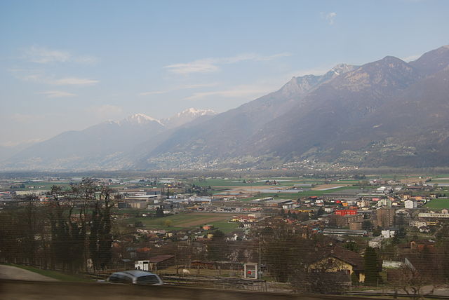
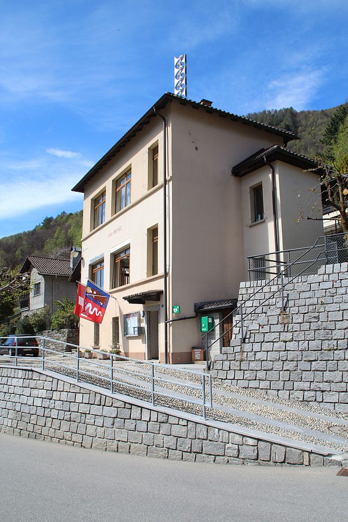
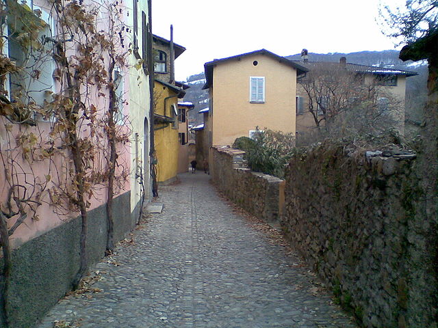
Ponte Capriasca is a charming village located in the Lugano district of southern Switzerland. Surrounded by the picturesque landscapes of the Ticino region, it offers a variety of hiking trails that cater to different skill levels. Here are some key points to consider for hiking in and around Ponte Capriasca:
Trails and Routes:
-
Easy Trails: For beginners or families, there are several gentle trails that circle the village and along the shores of Lake Lugano. These routes provide stunning views and are perfect for a leisurely hike.
-
Moderate Hikes: For those looking for more of a challenge, you can find trails that lead into the surrounding hills. One popular route is towards the nearby Monte Brè, where you'll encounter a mix of forest and panoramic viewpoints.
-
Challenging Trails: Experienced hikers should consider trails that lead to the higher altitudes of the surrounding mountains, such as Monte San Salvatore or Monte Generoso. These hikes often involve steep ascents but reward you with breathtaking views of the Lake Lugano and the surrounding area.
Scenic Features:
- Lakeside Views: Many trails offer views of Lake Lugano, making it a picturesque setting for nature photography.
- Cultural Landmarks: Along some trails, you might find historic churches and watchtowers that add a cultural touch to your hike.
- Flora and Fauna: The region is rich in biodiversity. Keep an eye out for local wildlife and enjoy the varied plant life.
Practical Tips:
- Weather: The weather can change rapidly in the mountains, so check conditions before heading out and dress in layers.
- Footwear: Good hiking boots are essential, especially for rocky or steep terrains.
- Hydration and Snacks: Carry enough water and snacks, as some trails may not have facilities for refueling.
- Maps and Guides: It’s helpful to have a map or a hiking app to follow trails and ensure you stay on course.
Getting There:
Ponte Capriasca is easily accessible by public transport from Lugano. The area is well connected by local buses, which makes it convenient to reach starting points for various hikes.
Conclusion:
Hiking in Ponte Capriasca offers a wonderful mix of natural beauty and cultural experiences. Whether you're a novice looking to enjoy peaceful trails or an experienced hiker seeking challenging routes, this region provides an excellent opportunity to explore the stunning landscapes of Ticino. Always remember to respect nature and follow local guidelines while hiking. Enjoy your adventure!
- Country:

- Postal Code: 6946
- Local Dialing Code: 091
- Licence Plate Code: TI
- Coordinates: 46° 4' 0" N, 8° 57' 0" E


- GPS tracks (wikiloc): [Link]
- AboveSeaLevel: 447 м m
- Area: 6.2 sq km
- Population: 1889
- Web site: http://www.pontecapriasca.ch
- Wikipedia en: wiki(en)
- Wikipedia: wiki(de)
- Wikidata storage: Wikidata: Q67733
- Wikipedia Commons Category: [Link]
- Freebase ID: [/m/0gz76h]
- GeoNames ID: Alt: [8469273]
- VIAF ID: Alt: [238142205]
- OSM relation ID: [1684739]
- GND ID: Alt: [4749446-3]
- HDS ID: [2197]
- Swiss municipality code: [5212]
Shares border with regions:
Cavargna
- Italian comune
Hiking in Cavargna
Cavargna is a picturesque village located in the Italian region of Lombardy, near the border with Switzerland. It's known for its stunning natural landscapes, making it a great destination for hiking enthusiasts. Here are some key points about hiking in Cavargna:...
- Country:

- Postal Code: 22010
- Local Dialing Code: 0344
- Licence Plate Code: CO
- Coordinates: 46° 5' 0" N, 9° 7' 0" E
- GPS tracks (wikiloc): [Link]
- AboveSeaLevel: 1071 м m
- Area: 14.98 sq km
- Population: 212
- Web site: [Link]


Capriasca
- municipality in the canton of Ticino, Switzerland
Hiking in Capriasca
Capriasca, located in the canton of Ticino in Switzerland, offers beautiful hiking opportunities amid stunning natural landscapes. The region is characterized by its picturesque villages, lush greenery, and breathtaking views of the surrounding mountains and Lake Lugano. Here are some highlights and tips for hiking in Capriasca:...
- Country:
- Postal Code: 6950
- Local Dialing Code: 091
- Licence Plate Code: TI
- Coordinates: 46° 4' 0" N, 8° 58' 0" E
- GPS tracks (wikiloc): [Link]
- AboveSeaLevel: 529 м m
- Area: 35.3 sq km
- Population: 6660
- Web site: [Link]
Cadenazzo
- municipality in Switzerland
Hiking in Cadenazzo
Cadenazzo is a picturesque village located in the Italian-speaking canton of Ticino, Switzerland. It's known for its beautiful landscapes, charming architecture, and proximity to several hiking trails that cater to different skill levels....
- Country:
- Postal Code: 6593
- Local Dialing Code: 091
- Licence Plate Code: TI
- Coordinates: 46° 8' 48" N, 8° 57' 0" E
- GPS tracks (wikiloc): [Link]
- AboveSeaLevel: 296 м m
- Area: 8.44 sq km
- Population: 2932
- Web site: [Link]

Isone
- municipality in Switzerland
Hiking in Isone
Isone is a charming municipality located in the Canton of Ticino, Switzerland. It offers a range of hiking opportunities that showcase the stunning landscapes and natural beauty of the region. Here are some details to consider for hiking in Isone:...
- Country:
- Postal Code: 6810
- Local Dialing Code: 091
- Licence Plate Code: TI
- Coordinates: 46° 8' 1" N, 9° 0' 52" E
- GPS tracks (wikiloc): [Link]
- AboveSeaLevel: 1092 м m
- Area: 12.9 sq km
- Population: 378
- Web site: [Link]
Sant'Antonio
- former municipality in Switzerland
Hiking in Sant'Antonio
Sant'Antonio, located near Bellinzona in the canton of Ticino, Switzerland, is a fantastic area for hiking, combining beautiful landscapes with cultural and historical elements. Here’s a guide to what you can expect when hiking in this picturesque region....
- Country:
- Postal Code: 6583
- Local Dialing Code: 091
- Licence Plate Code: TI
- Coordinates: 46° 10' 0" N, 9° 4' 0" E
- GPS tracks (wikiloc): [Link]
- AboveSeaLevel: 822 м m
- Area: 33.57 sq km
- Web site: [Link]

Origlio
- municipality in the district of Lugano in the canton of Ticino in Switzerland
Hiking in Origlio
Origlio is a picturesque area located in the Canton of Ticino in Switzerland, known for its beautiful landscapes and outdoor activities, including hiking. Here are some key points about hiking in Origlio:...
- Country:
- Postal Code: 6945
- Local Dialing Code: 091
- Licence Plate Code: TI
- Coordinates: 46° 3' 0" N, 8° 57' 0" E
- GPS tracks (wikiloc): [Link]
- AboveSeaLevel: 452 м m
- Area: 2.1 sq km
- Population: 1471
- Web site: [Link]