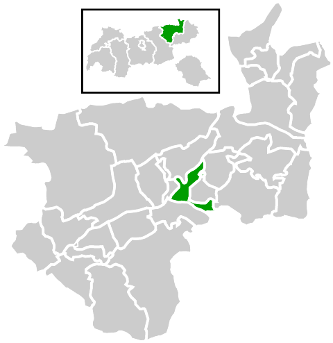
Itter (Itter)

- municipality in Austria
 Hiking in Itter
Itter is a picturesque village located in the Tyrol region of Austria, known for its stunning mountain views and outdoor activities, making it an ideal destination for hiking enthusiasts. Here are some highlights and tips for hiking in Itter:
Scenic Trails
-
Beginn der Wandermöglichkeiten (Beginning of Hiking Opportunities):
- Itter provides access to various marked hiking trails leading through magnificent alpine landscapes. Trails often offer panoramic views of the surrounding mountains, such as the Wilder Kaiser range.
-
Family-Friendly Tracks:
- There are several easy and moderate trails suitable for families and beginners. Look for paths that are well-marked and have gentle slopes, making them accessible for all ages.
-
Challenging Hikes:
- For more experienced hikers, there are steeper trails and routes that lead to higher elevations. These trails may present more challenging terrain but reward hikers with breathtaking views.
Points of Interest
- Wartegg Alm: A great spot to stop for a meal or a drink, perfect for taking in the mountain ambiance.
- Local Flora and Fauna: Keep an eye out for wildlife and diverse alpine plants. The region is rich in biodiversity.
Practical Tips
- Weather Conditions: Always check the weather before heading out, as conditions can change rapidly in the mountains.
- Hiking Gear: Wear appropriate hiking gear, including sturdy boots, and consider bringing trekking poles for stability on uneven terrain.
- Hydration and Snacks: Bring enough water and snacks, especially for longer hikes.
- Navigation: Having a map or GPS device is essential, as some trails may not be well-marked. Local tourist offices can provide maps and advice on the best routes.
Guided Tours
If you're unfamiliar with the area or want to learn more about local geology or ecology, consider joining a guided hike. Local guides can enhance your experience with knowledge about the region’s history and environment.
Accessibility
- Getting There: Itter is well-connected by public transport, and many trails can be easily accessed from the village center.
- Seasonal Considerations: The hiking season typically runs from late spring to early autumn, with some trails being accessible year-round depending on snow conditions.
Exploring the hiking trails around Itter can be a fulfilling experience, blending physical activity with the natural beauty of the Austrian Alps. Enjoy your hike!
- Country:

- Postal Code: 6305
- Local Dialing Code: 05335
- Licence Plate Code: KB
- Coordinates: 47° 28' 14" N, 12° 8' 38" E


- GPS tracks (wikiloc): [Link]
- AboveSeaLevel: 703 м m
- Area: 10.44 sq km
- Population: 1150
- Web site: http://www2.riskommunal.net/itter/
- Wikipedia en: wiki(en)
- Wikipedia: wiki(de)
- Wikidata storage: Wikidata: Q681724
- Wikipedia Commons Category: [Link]
- Freebase ID: [/m/02vr1hp]
- GeoNames ID: Alt: [2775168]
- archINFORM location ID: [10220]
- WOEID: [550767]
- Austrian municipality key: [70407]
Shares border with regions:

Kirchbichl
- municipality in Austria
Hiking in Kirchbichl
Kirchbichl is a charming village located in the Tyrol region of Austria, surrounded by stunning alpine landscapes and offering numerous hiking opportunities. Here are some highlights and tips for hiking in and around Kirchbichl:...
- Country:
- Postal Code: 6322
- Local Dialing Code: 05332
- Licence Plate Code: KU
- Coordinates: 47° 31' 0" N, 12° 4' 0" E
- GPS tracks (wikiloc): [Link]
- AboveSeaLevel: 515 м m
- Area: 15.0 sq km
- Population: 5855
- Web site: [Link]