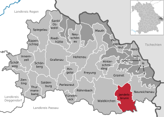
Jandelsbrunn (Jandelsbrunn)
- municipality of Germany
Jandelsbrunn is a small community in Bavaria, Germany, known for its beautiful natural landscape, making it a great destination for hikers. Nestled in the foothills of the Bavarian Forest, Jandelsbrunn offers a variety of trails that cater to hikers of different skill levels, from leisurely walks to more challenging hikes.
Hiking Highlights in Jandelsbrunn:
-
Scenic Trails: The region features well-marked hiking trails that allow you to explore the stunning Bavarian countryside. You can trek through lush forests, along rivers, and enjoy panoramic views of the rolling hills.
-
Bavarian Forest National Park: Located nearby, this national park offers a plethora of hiking opportunities. The park is one of the last remaining primeval forests in Central Europe and has a range of trails suitable for all levels.
-
Flora and Fauna: As you hike, you may encounter diverse wildlife and plant species. Keep an eye out for deer, various bird species, and unique flora native to the region.
-
Historical Sites: Some trails may lead you to historical landmarks, including old farms and ruins that reflect the rich history of the area.
-
Family-Friendly Options: Many trails in and around Jandelsbrunn are suitable for families, with shorter routes and educational signage about the local environment.
-
Local Amenities: After a day of hiking, you can enjoy local Bavarian cuisine at nearby restaurants or relax in accommodations that welcome hikers.
Tips for Hiking in Jandelsbrunn:
- Trail Maps: It's useful to have a trail map or a hiking app to navigate the area easily.
- Weather Check: Always check the weather conditions before heading out, as they can change rapidly, especially in mountainous areas.
- Stay Hydrated: Carry enough water and snacks, as some trails may be isolated without access to amenities.
- Footwear: Proper hiking boots are essential for navigating varied terrain.
Whether you're looking for a peaceful nature walk or a more vigorous hike, Jandelsbrunn and the surrounding Bavarian Forest provide an excellent backdrop for your outdoor adventures.
- Country:

- Postal Code: 94118
- Local Dialing Code: 08583
- Licence Plate Code: FRG
- Coordinates: 48° 44' 0" N, 13° 42' 0" E


- GPS tracks (wikiloc): [Link]
- AboveSeaLevel: 657 м m
- Area: 42.38 sq km
- Population: 3118
- Web site: http://www.jandelsbrunn.de
- Wikipedia en: wiki(en)
- Wikipedia: wiki(de)
- Wikidata storage: Wikidata: Q503445
- Wikipedia Commons Category: [Link]
- Freebase ID: [/m/02q36mz]
- GeoNames ID: Alt: [2895213]
- VIAF ID: Alt: [244711336]
- OSM relation ID: [958978]
- GND ID: Alt: [4337519-4]
- Historical Gazetteer (GOV) ID: [JANUN1JN68UR]
- Bavarikon ID: [ODB_A00001468]
- German municipality key: 09272129
Shares border with regions:


Hauzenberg
- municipality of Germany
Hauzenberg, located in Bavaria, Germany, offers a variety of beautiful hiking trails that showcase the stunning natural landscapes of the region. Nestled in the foothills of the Bavarian Forest, Hauzenberg is known for its lush forests, rolling hills, and picturesque views. Here are some key points about hiking in Hauzenberg:...
- Country:

- Postal Code: 94051; W-8395; 8391; 8395
- Local Dialing Code: 08586
- Licence Plate Code: PA
- Coordinates: 48° 39' 6" N, 13° 37' 25" E


- GPS tracks (wikiloc): [Link]
- AboveSeaLevel: 546 м m
- Area: 82.80 sq km
- Population: 11857
- Web site: [Link]

Sonnen
- municipality of Germany
Hiking in Sonnen, a small municipality in the Bavaria region of Germany, offers a variety of beautiful trails and scenic views. The area around Sonnen is characterized by rolling hills, lush forests, and picturesque countryside, making it an ideal destination for hikers of all experience levels....
- Country:

- Postal Code: 94164; W-8391; 8391
- Local Dialing Code: 08584
- Licence Plate Code: PA
- Coordinates: 48° 41' 5" N, 13° 43' 25" E


- GPS tracks (wikiloc): [Link]
- AboveSeaLevel: 836 м m
- Area: 16.50 sq km
- Population: 1367
- Web site: [Link]


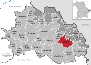
Grainet
- municipality of Germany
Grainet is a picturesque village located in Bavaria, Germany, known for its stunning natural landscapes and opportunities for outdoor activities, particularly hiking. Here are some highlights and tips for hiking in the Grainet area:...
- Country:

- Postal Code: 94143
- Local Dialing Code: 08585
- Licence Plate Code: FRG
- Coordinates: 48° 48' 0" N, 13° 39' 0" E


- GPS tracks (wikiloc): [Link]
- AboveSeaLevel: 694 м m
- Area: 36.12 sq km
- Population: 2112
- Web site: [Link]


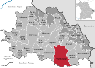
Waldkirchen
- municipality of Germany
Waldkirchen, located in the Bavarian region of Germany, is a beautiful destination for hiking enthusiasts. Known for its stunning landscapes, lush forests, and scenic views, the area offers various trails suitable for different skill levels....
- Country:

- Postal Code: 94065
- Local Dialing Code: 08581
- Licence Plate Code: FRG
- Coordinates: 48° 43' 50" N, 13° 36' 4" E


- GPS tracks (wikiloc): [Link]
- AboveSeaLevel: 532 м m
- Area: 80.01 sq km
- Population: 9448
- Web site: [Link]


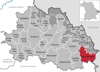
Neureichenau
- municipality of Germany
Neureichenau is a beautiful area in Bavaria, Germany, located near the borders of the Czech Republic and Austria. It's characterized by its stunning landscapes, rolling hills, and diverse flora and fauna, making it an excellent destination for hiking enthusiasts....
- Country:

- Postal Code: 94089
- Local Dialing Code: 08583
- Licence Plate Code: FRG
- Coordinates: 48° 45' 0" N, 13° 45' 0" E


- GPS tracks (wikiloc): [Link]
- AboveSeaLevel: 669 м m
- Area: 46.37 sq km
- Population: 4182
- Web site: [Link]


Breitenberg
- municipality of Germany
Breitenberg, located in Lower Bavaria, is a fantastic destination for hiking enthusiasts. The region features a mix of scenic landscapes, charming villages, and diverse flora and fauna, making it ideal for both casual hikers and experienced trekkers....
- Country:

- Postal Code: 94139
- Local Dialing Code: 08584
- Licence Plate Code: PA
- Coordinates: 48° 42' 14" N, 13° 47' 39" E


- GPS tracks (wikiloc): [Link]
- AboveSeaLevel: 689 м m
- Area: 29.87 sq km
- Population: 2109
- Web site: [Link]

