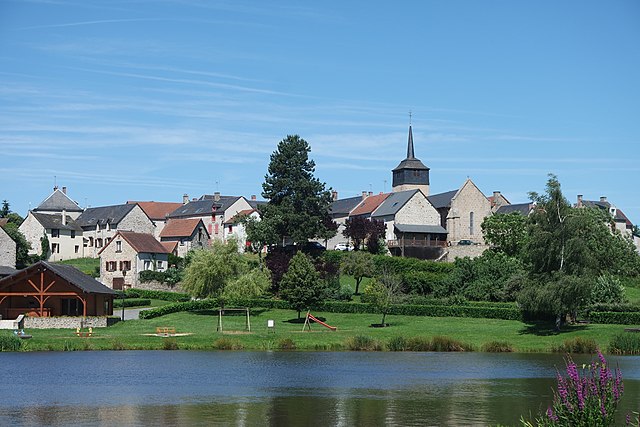
Jarnages (Jarnages)

- commune in Creuse, France
- Country:

- Postal Code: 23140
- Coordinates: 46° 10' 52" N, 2° 5' 5" E


- GPS tracks (wikiloc): [Link]
- Area: 9.17 sq km
- Population: 488
- Wikipedia en: wiki(en)
- Wikipedia: wiki(fr)
- Wikidata storage: Wikidata: Q1141387
- Wikipedia Commons Category: [Link]
- Freebase ID: [/m/03mfjh6]
- Freebase ID: [/m/03mfjh6]
- GeoNames ID: Alt: [6429201]
- GeoNames ID: Alt: [6429201]
- SIREN number: [212310007]
- SIREN number: [212310007]
- BnF ID: [15251488t]
- BnF ID: [15251488t]
- VIAF ID: Alt: [234309528]
- VIAF ID: Alt: [234309528]
- INSEE municipality code: 23100
- INSEE municipality code: 23100
Shares border with regions:


Pionnat
- commune in Creuse, France
- Country:
- Postal Code: 23140
- Coordinates: 46° 10' 15" N, 2° 1' 31" E
- GPS tracks (wikiloc): [Link]
- Area: 41.77 sq km
- Population: 766


Vigeville
- commune in Creuse, France
- Country:
- Postal Code: 23140
- Coordinates: 46° 9' 38" N, 2° 4' 29" E
- GPS tracks (wikiloc): [Link]
- Area: 7.27 sq km
- Population: 169

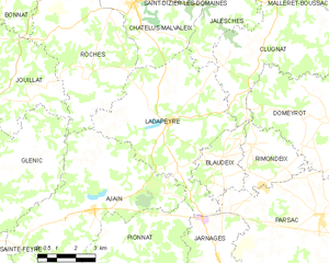
Ladapeyre
- commune in Creuse, France
- Country:
- Postal Code: 23270
- Coordinates: 46° 14' 54" N, 2° 2' 54" E
- GPS tracks (wikiloc): [Link]
- Area: 30.63 sq km
- Population: 355

Cressat
- commune in Creuse, France
- Country:
- Postal Code: 23140
- Coordinates: 46° 8' 23" N, 2° 6' 30" E
- GPS tracks (wikiloc): [Link]
- Area: 33.41 sq km
- Population: 554