
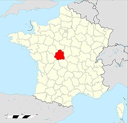
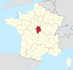
Creuse (Creuse)


- French department
- Country:

- Capital: Guéret
- Coordinates: 46° 35' 0" N, 2° 3' 0" E


- GPS tracks (wikiloc): [Link]
- Area: 5565 sq km
- Population: 120365
- Web site: http://www.creuse.pref.gouv.fr/
- Wikipedia en: wiki(en)
- Wikipedia: wiki(fr)
- Wikidata storage: Wikidata: Q3353
- Wikipedia Commons Gallery: [Link]
- Wikipedia Commons Category: [Link]
- Freebase ID: [/m/0mh1l]
- GeoNames ID: Alt: [3022516]
- SIREN number: [222309627]
- BnF ID: [119629420]
- VIAF ID: Alt: [128144648579166540683]
- OSM relation ID: [7459]
- GND ID: Alt: [4085359-7]
- archINFORM location ID: [72]
- Library of Congress authority ID: Alt: [n82158276]
- MusicBrainz area ID: [ed11a153-aa06-44fc-bf8d-b58029996611]
- Encyclopædia Britannica Online ID: [place/Creuse]
- National Library of Israel ID: [000996144]
- NUTS code: [FR632]
- BabelNet ID: [03797778n]
- INSEE department code: [23]
- ISO 3166-2 code: FR-23
Includes regions:


Saint-Silvain-sous-Toulx
- commune in Creuse, France
- Country:
- Postal Code: 23140
- Coordinates: 46° 15' 44" N, 2° 10' 42" E
- GPS tracks (wikiloc): [Link]
- Area: 14.57 sq km
- Population: 160


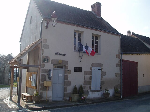
Noth
- commune in Creuse, France
- Country:
- Postal Code: 23300
- Coordinates: 46° 14' 5" N, 1° 35' 9" E
- GPS tracks (wikiloc): [Link]
- Area: 22.89 sq km
- Population: 515

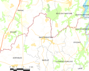
Saint-Sébastien
- commune in Creuse, France
- Country:
- Postal Code: 23160
- Coordinates: 46° 23' 28" N, 1° 31' 53" E
- GPS tracks (wikiloc): [Link]
- Area: 24.98 sq km
- Population: 657


Saint-Priest
- commune in Creuse, France
- Country:
- Postal Code: 23110
- Coordinates: 46° 5' 17" N, 2° 20' 36" E
- GPS tracks (wikiloc): [Link]
- Area: 22.34 sq km
- Population: 160


Pionnat
- commune in Creuse, France
- Country:
- Postal Code: 23140
- Coordinates: 46° 10' 15" N, 2° 1' 31" E
- GPS tracks (wikiloc): [Link]
- Area: 41.77 sq km
- Population: 766


Saint-Goussaud
- commune in Creuse, France
- Country:
- Postal Code: 23430
- Coordinates: 46° 2' 26" N, 1° 34' 41" E
- GPS tracks (wikiloc): [Link]
- Area: 24.3 sq km
- Population: 163

Saint-Marc-à-Loubaud
- commune in Creuse, France
- Country:
- Postal Code: 23460
- Coordinates: 45° 50' 56" N, 1° 59' 47" E
- GPS tracks (wikiloc): [Link]
- Area: 18.42 sq km
- Population: 140
- Web site: [Link]
Nouzerolles
- commune in Creuse, France
- Country:
- Postal Code: 23360
- Coordinates: 46° 22' 54" N, 1° 44' 30" E
- GPS tracks (wikiloc): [Link]
- Area: 8.17 sq km
- Population: 103

Saint-Hilaire-la-Plaine
- commune in Creuse, France
- Country:
- Postal Code: 23150
- Coordinates: 46° 7' 31" N, 1° 58' 35" E
- GPS tracks (wikiloc): [Link]
- Area: 11.06 sq km
- Population: 212
Saint-Chabrais
- commune in Creuse, France
- Country:
- Postal Code: 23130
- Coordinates: 46° 7' 56" N, 2° 12' 16" E
- GPS tracks (wikiloc): [Link]
- Area: 24.94 sq km
- Population: 309


Saint-Oradoux-de-Chirouze
- commune in Creuse, France
- Country:
- Postal Code: 23100
- Coordinates: 45° 44' 0" N, 2° 19' 59" E
- GPS tracks (wikiloc): [Link]
- Area: 28.58 sq km
- Population: 69


Saint-Christophe
- commune in Creuse, France
- Country:
- Postal Code: 23000
- Coordinates: 46° 6' 9" N, 1° 51' 44" E
- GPS tracks (wikiloc): [Link]
- Area: 7.79 sq km
- Population: 144
Saint-Dizier-Leyrenne
- commune in Creuse, France
- Country:
- Postal Code: 23400
- Coordinates: 46° 1' 46" N, 1° 42' 44" E
- GPS tracks (wikiloc): [Link]
- Area: 46.63 sq km
- Population: 779


Lioux-les-Monges
- commune in Creuse, France
- Country:
- Postal Code: 23700
- Coordinates: 45° 57' 6" N, 2° 27' 19" E
- GPS tracks (wikiloc): [Link]
- Area: 7.32 sq km
- Population: 54


Sainte-Feyre-la-Montagne
- commune in Creuse, France
- Country:
- Postal Code: 23500
- Coordinates: 45° 53' 55" N, 2° 13' 57" E
- GPS tracks (wikiloc): [Link]
- Area: 6.84 sq km
- Population: 133


Fontanières
- commune in Creuse, France
- Country:
- Postal Code: 23110
- Coordinates: 46° 6' 31" N, 2° 30' 2" E
- GPS tracks (wikiloc): [Link]
- Area: 15.91 sq km
- Population: 256


Le Donzeil
- commune in Creuse, France
- Country:
- Postal Code: 23480
- Coordinates: 46° 1' 40" N, 1° 59' 11" E
- GPS tracks (wikiloc): [Link]
- Area: 13.54 sq km
- Population: 188
Le Chauchet
- commune in Creuse, France
- Country:
- Postal Code: 23130
- Coordinates: 46° 6' 27" N, 2° 20' 1" E
- GPS tracks (wikiloc): [Link]
- AboveSeaLevel: 480 м m
- Area: 10.62 sq km
- Population: 111

La Cellette
- commune in Creuse, France
- Country:
- Postal Code: 23350
- Coordinates: 46° 24' 14" N, 2° 0' 51" E
- GPS tracks (wikiloc): [Link]
- Area: 21.48 sq km
- Population: 270
Saint-Silvain-Bellegarde
- commune in Creuse, France
- Country:
- Postal Code: 23190
- Coordinates: 45° 58' 21" N, 2° 18' 11" E
- GPS tracks (wikiloc): [Link]
- AboveSeaLevel: 550 м m
- Area: 20.85 sq km
- Population: 203

Tercillat
- commune in Creuse, France
- Country:
- Postal Code: 23350
- Coordinates: 46° 24' 29" N, 2° 3' 15" E
- GPS tracks (wikiloc): [Link]
- Area: 13.64 sq km
- Population: 159


Mourioux-Vieilleville
- commune in Creuse, France
- Country:
- Postal Code: 23210
- Coordinates: 46° 4' 38" N, 1° 38' 43" E
- GPS tracks (wikiloc): [Link]
- AboveSeaLevel: 456 м m
- Area: 25.2 sq km
- Population: 505
Saint-Fiel
- commune in Creuse, France
- Country:
- Postal Code: 23000
- Coordinates: 46° 12' 48" N, 1° 53' 43" E
- GPS tracks (wikiloc): [Link]
- Area: 16.72 sq km
- Population: 1037


Chambon-sur-Voueize
- commune in Creuse, France
- Country:
- Postal Code: 23170
- Coordinates: 46° 11' 21" N, 2° 25' 30" E
- GPS tracks (wikiloc): [Link]
- Area: 33.58 sq km
- Population: 931


Poussanges
- commune in Creuse, France
- Country:
- Postal Code: 23500
- Coordinates: 45° 49' 34" N, 2° 12' 56" E
- GPS tracks (wikiloc): [Link]
- Area: 23.35 sq km
- Population: 147


Roches
- commune in Creuse, France
- Country:
- Postal Code: 23270
- Coordinates: 46° 16' 59" N, 1° 59' 59" E
- GPS tracks (wikiloc): [Link]
- Area: 25.55 sq km
- Population: 368


Saint-Michel-de-Veisse
- commune in Creuse, France
- Country:
- Postal Code: 23480
- Coordinates: 45° 57' 6" N, 2° 3' 14" E
- GPS tracks (wikiloc): [Link]
- Area: 15.57 sq km
- Population: 166

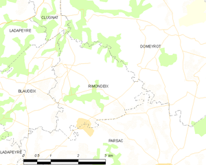
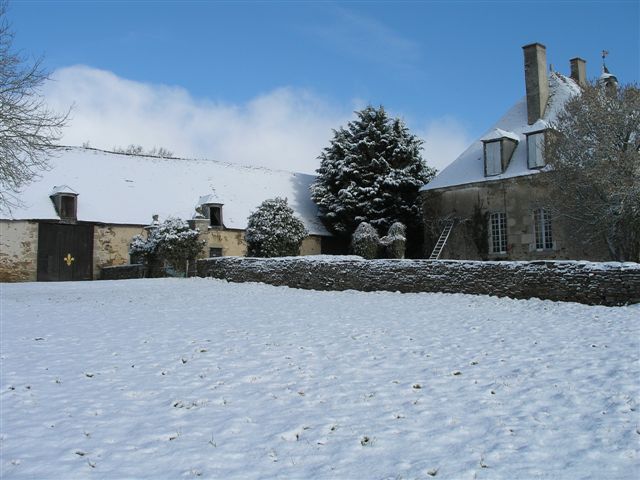
Rimondeix
- former commune in Creuse, France
- Country:
- Postal Code: 23140
- Coordinates: 46° 13' 44" N, 2° 6' 8" E
- GPS tracks (wikiloc): [Link]
- Area: 8.03 sq km
- Population: 83
Pierrefitte
- commune in Creuse, France
- Country:
- Postal Code: 23130
- Coordinates: 46° 8' 46" N, 2° 13' 58" E
- GPS tracks (wikiloc): [Link]
- Area: 6.4 sq km
- Population: 69


Saint-Pardoux-le-Neuf
- commune in Creuse, France
- Country:
- Postal Code: 23200
- Coordinates: 45° 55' 46" N, 2° 13' 58" E
- GPS tracks (wikiloc): [Link]
- Area: 7.51 sq km
- Population: 185


Saint-Léger-le-Guérétois
- commune in Creuse, France
- Country:
- Postal Code: 23000
- Coordinates: 46° 9' 4" N, 1° 48' 50" E
- GPS tracks (wikiloc): [Link]
- Area: 13.98 sq km
- Population: 434


Saint-Quentin-la-Chabanne
- commune in Creuse, France
- Country:
- Postal Code: 23500
- Coordinates: 45° 51' 52" N, 2° 9' 19" E
- GPS tracks (wikiloc): [Link]
- Area: 29.59 sq km
- Population: 399

Saint-Pardoux-les-Cards
- commune in Creuse, France
- Country:
- Postal Code: 23150
- Coordinates: 46° 4' 57" N, 2° 7' 13" E
- GPS tracks (wikiloc): [Link]
- Area: 24.76 sq km
- Population: 295

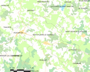
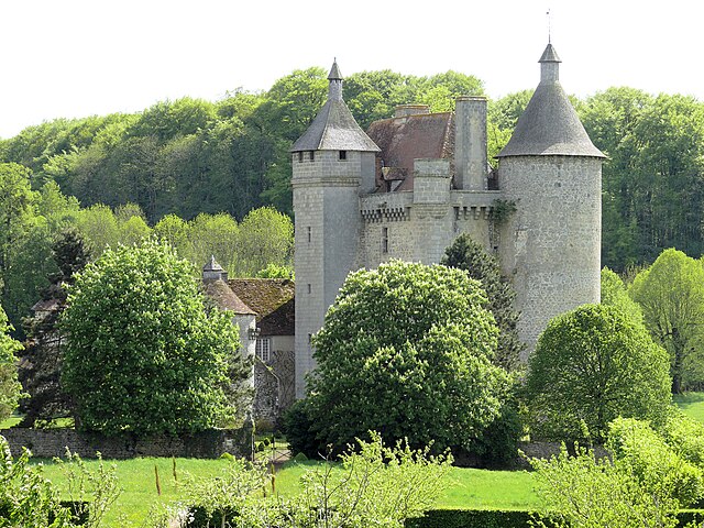
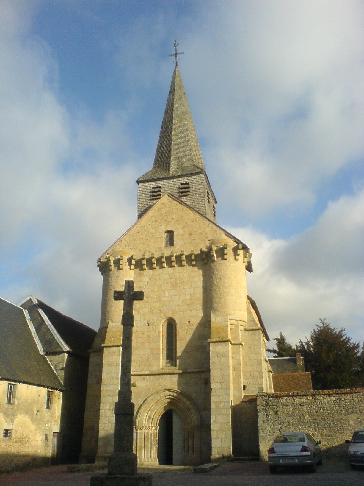
Saint-Hilaire-le-Château
- commune in Creuse, France
- Country:
- Postal Code: 23250
- Coordinates: 45° 58' 58" N, 1° 53' 49" E
- GPS tracks (wikiloc): [Link]
- Area: 19.59 sq km
- Population: 236


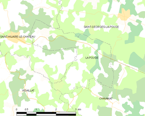
Saint-Georges-la-Pouge
- commune in Creuse, France
- Country:
- Postal Code: 23250
- Coordinates: 45° 59' 35" N, 1° 58' 13" E
- GPS tracks (wikiloc): [Link]
- Area: 24.09 sq km
- Population: 372
Saint-Loup
- commune in Creuse, France
- Country:
- Postal Code: 23130
- Coordinates: 46° 8' 12" N, 2° 16' 13" E
- GPS tracks (wikiloc): [Link]
- Area: 18.82 sq km
- Population: 181


Chénérailles
- commune in Creuse, France
- Country:
- Postal Code: 23130
- Coordinates: 46° 6' 43" N, 2° 10' 31" E
- GPS tracks (wikiloc): [Link]
- Area: 7.77 sq km
- Population: 765


Leyrat
- commune in Creuse, France
- Country:
- Postal Code: 23600
- Coordinates: 46° 21' 43" N, 2° 17' 33" E
- GPS tracks (wikiloc): [Link]
- Area: 18.32 sq km
- Population: 153
Mautes
- commune in Creuse, France
- Country:
- Postal Code: 23190
- Coordinates: 45° 56' 38" N, 2° 23' 4" E
- GPS tracks (wikiloc): [Link]
- Area: 22.67 sq km
- Population: 218


Saint-Pardoux-Morterolles
- commune in Creuse, France
- Country:
- Postal Code: 23400
- Coordinates: 45° 53' 51" N, 1° 49' 16" E
- GPS tracks (wikiloc): [Link]
- Area: 36.5 sq km
- Population: 207


Saint-Pardoux-d'Arnet
- commune in Creuse, France
- Country:
- Postal Code: 23260
- Coordinates: 45° 52' 37" N, 2° 19' 50" E
- GPS tracks (wikiloc): [Link]
- Area: 16.44 sq km
- Population: 168
Montaigut-le-Blanc
- commune in Creuse, France
- Country:
- Postal Code: 23320
- Coordinates: 46° 7' 16" N, 1° 44' 6" E
- GPS tracks (wikiloc): [Link]
- Area: 17.23 sq km
- Population: 400
Thauron
- commune in Creuse, France
- Country:
- Postal Code: 23250
- Coordinates: 46° 0' 0" N, 1° 49' 4" E
- GPS tracks (wikiloc): [Link]
- Area: 22.34 sq km
- Population: 177


Naillat
- commune in Creuse, France
- Country:
- Postal Code: 23800
- Coordinates: 46° 15' 52" N, 1° 38' 14" E
- GPS tracks (wikiloc): [Link]
- Area: 36.23 sq km
- Population: 668


Sermur
- commune in Creuse, France
- Country:
- Postal Code: 23700
- Coordinates: 45° 58' 31" N, 2° 25' 52" E
- GPS tracks (wikiloc): [Link]
- Area: 19.5 sq km
- Population: 131
La Chapelle-Saint-Martial
- commune in Creuse, France
- Country:
- Postal Code: 23250
- Coordinates: 46° 1' 34" N, 1° 55' 30" E
- GPS tracks (wikiloc): [Link]
- Area: 10.12 sq km
- Population: 96


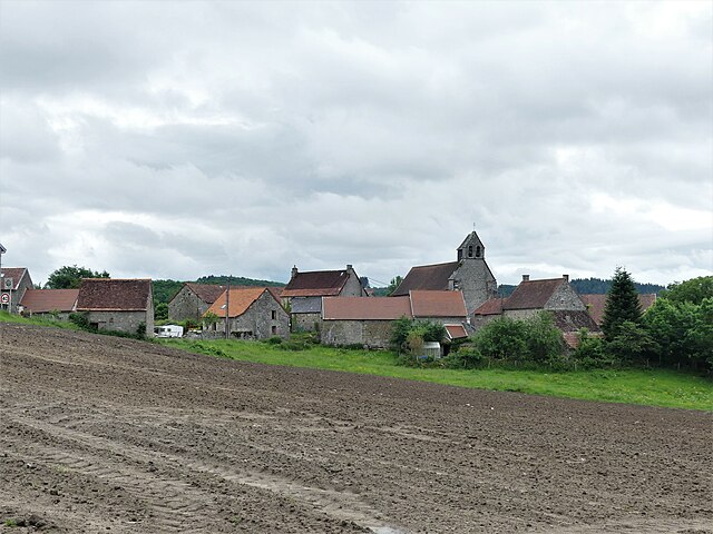
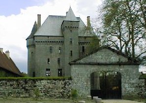
Moutier-d'Ahun
- commune in Creuse, France
- Country:
- Postal Code: 23150
- Coordinates: 46° 5' 30" N, 2° 3' 18" E
- GPS tracks (wikiloc): [Link]
- Area: 9.91 sq km
- Population: 176
- Web site: [Link]

Toulx-Sainte-Croix
- commune in Creuse, France
- Country:
- Postal Code: 23600
- Coordinates: 46° 17' 5" N, 2° 12' 49" E
- GPS tracks (wikiloc): [Link]
- Area: 35.05 sq km
- Population: 266


Saint-Martial-le-Vieux
- commune in Creuse, France
- Country:
- Postal Code: 23100
- Coordinates: 45° 41' 18" N, 2° 18' 42" E
- GPS tracks (wikiloc): [Link]
- Area: 22.22 sq km
- Population: 134


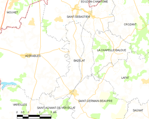
La Chapelle-Baloue
- commune in Creuse, France
- Country:
- Postal Code: 23160
- Coordinates: 46° 21' 35" N, 1° 34' 36" E
- GPS tracks (wikiloc): [Link]
- Area: 8.68 sq km
- Population: 135


La Chapelle-Taillefert
- commune in Creuse, France
- Country:
- Postal Code: 23000
- Coordinates: 46° 6' 2" N, 1° 50' 22" E
- GPS tracks (wikiloc): [Link]
- Area: 14.11 sq km
- Population: 415


La Celle-Dunoise
- commune in Creuse, France
- Country:
- Postal Code: 23800
- Coordinates: 46° 18' 35" N, 1° 46' 12" E
- GPS tracks (wikiloc): [Link]
- AboveSeaLevel: 235 м m
- Area: 29.11 sq km
- Population: 542
- Web site: [Link]
Masbaraud-Mérignat
- commune in Creuse, France
- Country:
- Postal Code: 23400
- Coordinates: 45° 58' 33" N, 1° 44' 44" E
- GPS tracks (wikiloc): [Link]
- Area: 20.39 sq km
- Population: 342

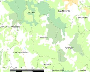
Savennes
- commune in Creuse, France
- Country:
- Postal Code: 23000
- Coordinates: 46° 6' 21" N, 1° 53' 17" E
- GPS tracks (wikiloc): [Link]
- Area: 6.93 sq km
- Population: 216


Saint-Yrieix-les-Bois
- commune in Creuse, France
- Country:
- Postal Code: 23150
- Coordinates: 46° 5' 59" N, 1° 56' 18" E
- GPS tracks (wikiloc): [Link]
- Area: 15.7 sq km
- Population: 288


Sainte-Feyre
- commune in Creuse, France
- Country:
- Postal Code: 23000
- Coordinates: 46° 8' 18" N, 1° 54' 54" E
- GPS tracks (wikiloc): [Link]
- Area: 29.99 sq km
- Population: 2488
- Web site: [Link]
Saint-Léger-Bridereix
- commune in Creuse, France
- Country:
- Postal Code: 23300
- Coordinates: 46° 17' 11" N, 1° 35' 16" E
- GPS tracks (wikiloc): [Link]
- Area: 8.1 sq km
- Population: 204


Saint-Priest-la-Feuille
- commune in Creuse, France
- Country:
- Postal Code: 23300
- Coordinates: 46° 12' 6" N, 1° 32' 7" E
- GPS tracks (wikiloc): [Link]
- Area: 27.44 sq km
- Population: 783
- Web site: [Link]


Saint-Agnant-près-Crocq
- commune in Creuse, France
- Country:
- Postal Code: 23260
- Coordinates: 45° 48' 13" N, 2° 21' 0" E
- GPS tracks (wikiloc): [Link]
- Area: 25.51 sq km
- Population: 197
Parsac
- former commune in Creuse, France
- Country:
- Postal Code: 23140
- Coordinates: 46° 12' 9" N, 2° 9' 8" E
- GPS tracks (wikiloc): [Link]
- Area: 38.99 sq km
- Population: 607


Bénévent-l'Abbaye
- commune in Creuse, France
- Country:
- Postal Code: 23210
- Coordinates: 46° 7' 4" N, 1° 37' 44" E
- GPS tracks (wikiloc): [Link]
- Area: 11.56 sq km
- Population: 819


Bellegarde-en-Marche
- commune in Creuse, France
- Country:
- Postal Code: 23190
- Coordinates: 45° 58' 55" N, 2° 17' 40" E
- GPS tracks (wikiloc): [Link]
- Area: 3.14 sq km
- Population: 403
- Web site: [Link]


Auge
- commune in Creuse, France
- Country:
- Postal Code: 23170
- Coordinates: 46° 14' 31" N, 2° 19' 25" E
- GPS tracks (wikiloc): [Link]
- Area: 9.97 sq km
- Population: 103


La Villedieu
- commune in Creuse, France
- Country:
- Postal Code: 23340
- Coordinates: 45° 44' 1" N, 1° 53' 12" E
- GPS tracks (wikiloc): [Link]
- Area: 5.63 sq km
- Population: 49


La Villetelle
- commune in Creuse, France
- Country:
- Postal Code: 23260
- Coordinates: 45° 55' 8" N, 2° 20' 28" E
- GPS tracks (wikiloc): [Link]
- Area: 16.14 sq km
- Population: 169


Le Mas-d'Artige
- commune in Creuse, France
- Country:
- Postal Code: 23100
- Coordinates: 45° 44' 3" N, 2° 12' 8" E
- GPS tracks (wikiloc): [Link]
- Area: 16.21 sq km
- Population: 104


La Nouaille
- commune in Creuse, France
- Country:
- Postal Code: 23500
- Coordinates: 45° 50' 48" N, 2° 3' 53" E
- GPS tracks (wikiloc): [Link]
- Area: 48.12 sq km
- Population: 247


La Serre-Bussière-Vieille
- commune in Creuse, France
- Country:
- Postal Code: 23190
- Coordinates: 46° 3' 23" N, 2° 19' 14" E
- GPS tracks (wikiloc): [Link]
- Area: 14.41 sq km
- Population: 123
Trois-Fonds
- commune in Creuse, France
- Country:
- Postal Code: 23230
- Coordinates: 46° 15' 2" N, 2° 13' 41" E
- GPS tracks (wikiloc): [Link]
- AboveSeaLevel: 470 м m
- Area: 9.53 sq km
- Population: 122
Verneiges
- commune in Creuse, France
- Country:
- Postal Code: 23170
- Coordinates: 46° 16' 6" N, 2° 20' 16" E
- GPS tracks (wikiloc): [Link]
- Area: 7.59 sq km
- Population: 111


Vigeville
- commune in Creuse, France
- Country:
- Postal Code: 23140
- Coordinates: 46° 9' 38" N, 2° 4' 29" E
- GPS tracks (wikiloc): [Link]
- Area: 7.27 sq km
- Population: 169


Jouillat
- commune in Creuse, France
- Country:
- Postal Code: 23220
- Coordinates: 46° 15' 26" N, 1° 56' 10" E
- GPS tracks (wikiloc): [Link]
- Area: 22.44 sq km
- Population: 422

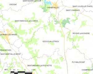
Issoudun-Létrieix
- commune in Creuse, France
- Country:
- Postal Code: 23130
- Coordinates: 46° 3' 37" N, 2° 8' 35" E
- GPS tracks (wikiloc): [Link]
- Area: 26.43 sq km
- Population: 302

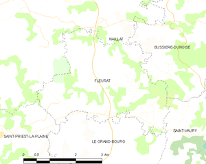
Fleurat
- commune in Creuse, France
- Country:
- Postal Code: 23320
- Coordinates: 46° 14' 26" N, 1° 40' 44" E
- GPS tracks (wikiloc): [Link]
- AboveSeaLevel: 500 м m
- Area: 12.3 sq km
- Population: 297
- Web site: [Link]


Lavaufranche
- commune in Creuse, France
- Country:
- Postal Code: 23600
- Coordinates: 46° 19' 14" N, 2° 16' 17" E
- GPS tracks (wikiloc): [Link]
- Area: 16.34 sq km
- Population: 249
Malleret-Boussac
- commune in Creuse, France
- Country:
- Postal Code: 23600
- Coordinates: 46° 20' 34" N, 2° 8' 35" E
- GPS tracks (wikiloc): [Link]
- Area: 25.43 sq km
- Population: 203


Malleret
- commune in Creuse, France
- Country:
- Postal Code: 23260
- Coordinates: 45° 45' 58" N, 2° 19' 7" E
- GPS tracks (wikiloc): [Link]
- Area: 11.8 sq km
- Population: 43


Jalesches
- commune in Creuse, France
- Country:
- Postal Code: 23270
- Coordinates: 46° 18' 4" N, 2° 5' 45" E
- GPS tracks (wikiloc): [Link]
- AboveSeaLevel: 450 м m
- Area: 8.45 sq km
- Population: 89
Lépinas
- commune in Creuse, France
- Country:
- Postal Code: 23150
- Coordinates: 46° 4' 35" N, 1° 55' 42" E
- GPS tracks (wikiloc): [Link]
- Area: 14.8 sq km
- Population: 154


Azerables
- commune in Creuse, France
- Country:
- Postal Code: 23160
- Coordinates: 46° 21' 14" N, 1° 28' 37" E
- GPS tracks (wikiloc): [Link]
- Area: 39.44 sq km
- Population: 826
- Web site: [Link]


Gentioux-Pigerolles
- commune in Creuse, France
- Country:
- Postal Code: 23340
- Coordinates: 45° 47' 4" N, 1° 59' 39" E
- GPS tracks (wikiloc): [Link]
- AboveSeaLevel: 800 м m
- Area: 79.29 sq km
- Population: 418


Pontarion
- commune in Creuse, France
- Country:
- Postal Code: 23250
- Coordinates: 45° 59' 50" N, 1° 50' 59" E
- GPS tracks (wikiloc): [Link]
- Area: 5.25 sq km
- Population: 366


Lavaveix-les-Mines
- commune in Creuse, France
- Country:
- Postal Code: 23150
- Coordinates: 46° 4' 16" N, 2° 5' 20" E
- GPS tracks (wikiloc): [Link]
- Area: 4.71 sq km
- Population: 683


Le Grand-Bourg
- commune in Creuse, France
- Country:
- Postal Code: 23240
- Coordinates: 46° 9' 36" N, 1° 38' 40" E
- GPS tracks (wikiloc): [Link]
- Area: 78.91 sq km
- Population: 1219


Sous-Parsat
- commune in Creuse, France
- Country:
- Postal Code: 23150
- Coordinates: 46° 3' 20" N, 1° 58' 47" E
- GPS tracks (wikiloc): [Link]
- Area: 9.14 sq km
- Population: 120
Reterre
- commune in Creuse, France
- Country:
- Postal Code: 23110
- Coordinates: 46° 6' 11" N, 2° 28' 25" E
- GPS tracks (wikiloc): [Link]
- Area: 17.54 sq km
- Population: 286


Saint-Pierre-de-Fursac
- former commune in Creuse, France
- Country:
- Postal Code: 23290
- Coordinates: 46° 8' 53" N, 1° 30' 45" E
- GPS tracks (wikiloc): [Link]
- Area: 27.33 sq km
- Population: 753


Gartempe
- commune in Creuse, France
- Country:
- Postal Code: 23320
- Coordinates: 46° 9' 0" N, 1° 44' 16" E
- GPS tracks (wikiloc): [Link]
- Area: 9.49 sq km
- Population: 124


Saint-Yrieix-la-Montagne
- commune in Creuse, France
- Country:
- Postal Code: 23460
- Coordinates: 45° 53' 0" N, 2° 1' 18" E
- GPS tracks (wikiloc): [Link]
- Area: 24.04 sq km
- Population: 221


Peyrat-la-Nonière
- commune in Creuse, France
- Country:
- Postal Code: 23130
- Coordinates: 46° 5' 15" N, 2° 15' 23" E
- GPS tracks (wikiloc): [Link]
- Area: 41.4 sq km
- Population: 425
- Web site: [Link]


Saint-Vaury
- commune in Creuse, France
- Country:
- Postal Code: 23320
- Coordinates: 46° 12' 14" N, 1° 45' 22" E
- GPS tracks (wikiloc): [Link]
- Area: 46.5 sq km
- Population: 1778
- Web site: [Link]


Jarnages
- commune in Creuse, France
- Country:
- Postal Code: 23140
- Coordinates: 46° 10' 52" N, 2° 5' 5" E
- GPS tracks (wikiloc): [Link]
- Area: 9.17 sq km
- Population: 488


Saint-Sulpice-les-Champs
- commune in Creuse, France
- Country:
- Postal Code: 23480
- Coordinates: 45° 59' 44" N, 2° 1' 18" E
- GPS tracks (wikiloc): [Link]
- Area: 21.7 sq km
- Population: 358
Sannat
- commune in Creuse, France
- Country:
- Postal Code: 23110
- Coordinates: 46° 7' 10" N, 2° 24' 28" E
- GPS tracks (wikiloc): [Link]
- Area: 34 sq km
- Population: 368


Tardes
- commune in Creuse, France
- Country:
- Postal Code: 23170
- Coordinates: 46° 8' 23" N, 2° 20' 42" E
- GPS tracks (wikiloc): [Link]
- Area: 21.4 sq km
- Population: 138


Lourdoueix-Saint-Pierre
- commune in Creuse, France
- Country:
- Postal Code: 23360
- Coordinates: 46° 24' 35" N, 1° 49' 20" E
- GPS tracks (wikiloc): [Link]
- Area: 44.73 sq km
- Population: 779

Basville
- commune in Creuse, France
- Country:
- Postal Code: 23260
- Coordinates: 45° 52' 16" N, 2° 23' 49" E
- GPS tracks (wikiloc): [Link]
- Area: 22.57 sq km
- Population: 162

Crozant
- commune in Creuse, France
- Country:
- Postal Code: 23160
- Coordinates: 46° 23' 30" N, 1° 37' 16" E
- GPS tracks (wikiloc): [Link]
- Area: 30.52 sq km
- Population: 459


Bosmoreau-les-Mines
- commune in Creuse, France
- Country:
- Postal Code: 23400
- Coordinates: 46° 0' 3" N, 1° 45' 20" E
- GPS tracks (wikiloc): [Link]
- Area: 9.01 sq km
- Population: 254

Champagnat
- commune in Creuse, France
- Country:
- Postal Code: 23190
- Coordinates: 46° 1' 6" N, 2° 17' 0" E
- GPS tracks (wikiloc): [Link]
- Area: 28.82 sq km
- Population: 463
Brousse
- commune in Creuse, France
- Country:
- Postal Code: 23700
- Coordinates: 45° 58' 19" N, 2° 27' 21" E
- GPS tracks (wikiloc): [Link]
- Area: 3.63 sq km
- Population: 26
Saint-Oradoux-près-Crocq
- commune in Creuse, France
- Country:
- Postal Code: 23260
- Coordinates: 45° 52' 42" N, 2° 23' 17" E
- GPS tracks (wikiloc): [Link]
- Area: 13.36 sq km
- Population: 100
Vidaillat
- commune in Creuse, France
- Country:
- Postal Code: 23250
- Coordinates: 45° 57' 28" N, 1° 54' 25" E
- GPS tracks (wikiloc): [Link]
- Area: 23.59 sq km
- Population: 154


Mansat-la-Courrière
- commune in Creuse, France
- Country:
- Postal Code: 23400
- Coordinates: 45° 57' 44" N, 1° 48' 24" E
- GPS tracks (wikiloc): [Link]
- Area: 9.42 sq km
- Population: 103

Bussière-Dunoise
- commune in Creuse, France
- Country:
- Postal Code: 23320
- Coordinates: 46° 15' 32" N, 1° 45' 46" E
- GPS tracks (wikiloc): [Link]
- Area: 41.13 sq km
- Population: 1032


Saint-Germain-Beaupré
- commune in Creuse, France
- Country:
- Postal Code: 23160
- Coordinates: 46° 18' 28" N, 1° 32' 42" E
- GPS tracks (wikiloc): [Link]
- Area: 17.06 sq km
- Population: 440
Soumans
- commune in Creuse, France
- Country:
- Postal Code: 23600
- Coordinates: 46° 18' 4" N, 2° 18' 24" E
- GPS tracks (wikiloc): [Link]
- Area: 36.68 sq km
- Population: 624
Saint-Pierre-le-Bost
- commune in Creuse, France
- Country:
- Postal Code: 23600
- Coordinates: 46° 24' 2" N, 2° 15' 37" E
- GPS tracks (wikiloc): [Link]
- Area: 17.24 sq km
- Population: 135
Saint-Sulpice-le-Guérétois
- commune in Creuse, France
- Country:
- Postal Code: 23000
- Coordinates: 46° 12' 2" N, 1° 49' 43" E
- GPS tracks (wikiloc): [Link]
- Area: 36.18 sq km
- Population: 1989
- Web site: [Link]
Augères
- commune in Creuse, France
- Country:
- Postal Code: 23210
- Coordinates: 46° 4' 58" N, 1° 44' 5" E
- GPS tracks (wikiloc): [Link]
- Area: 12.43 sq km
- Population: 122

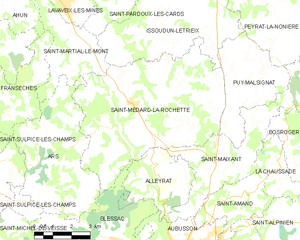
Saint-Médard-la-Rochette
- commune in Creuse, France
- Country:
- Postal Code: 23200
- Coordinates: 46° 2' 38" N, 2° 8' 46" E
- GPS tracks (wikiloc): [Link]
- AboveSeaLevel: 570 м m
- Area: 38.92 sq km
- Population: 589
Saint-Martin-Sainte-Catherine
- commune in Creuse, France
- Country:
- Postal Code: 23430
- Coordinates: 45° 56' 55" N, 1° 33' 55" E
- GPS tracks (wikiloc): [Link]
- Area: 27.27 sq km
- Population: 330

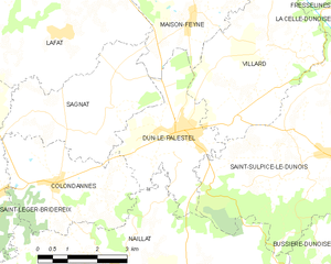
Dun-le-Palestel
- commune in Creuse, France
- Country:
- Postal Code: 23800
- Coordinates: 46° 18' 19" N, 1° 39' 58" E
- GPS tracks (wikiloc): [Link]
- Area: 9.81 sq km
- Population: 1127

Fransèches
- commune in Creuse, France
- Country:
- Postal Code: 23480
- Coordinates: 46° 1' 7" N, 2° 2' 59" E
- GPS tracks (wikiloc): [Link]
- Area: 18.29 sq km
- Population: 242

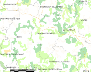
Saint-Avit-de-Tardes
- commune in Creuse, France
- Country:
- Postal Code: 23200
- Coordinates: 45° 55' 5" N, 2° 17' 7" E
- GPS tracks (wikiloc): [Link]
- Area: 14.42 sq km
- Population: 177

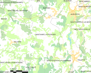
Saint-Marc-à-Frongier
- commune in Creuse, France
- Country:
- Postal Code: 23200
- Coordinates: 45° 55' 47" N, 2° 7' 14" E
- GPS tracks (wikiloc): [Link]
- Area: 25.45 sq km
- Population: 416


Saint-Pierre-Bellevue
- commune in Creuse, France
- Country:
- Postal Code: 23460
- Coordinates: 45° 54' 57" N, 1° 53' 18" E
- GPS tracks (wikiloc): [Link]
- Area: 32.78 sq km
- Population: 218

Saint-Amand
- commune in Creuse, France
- Country:
- Postal Code: 23200
- Coordinates: 45° 58' 54" N, 2° 12' 30" E
- GPS tracks (wikiloc): [Link]
- Area: 8.05 sq km
- Population: 501
Saint-Julien-le-Châtel
- commune in Creuse, France
- Country:
- Postal Code: 23130
- Coordinates: 46° 7' 5" N, 2° 16' 9" E
- GPS tracks (wikiloc): [Link]
- Area: 15.3 sq km
- Population: 147

Le Monteil-au-Vicomte
- commune in Creuse, France
- Country:
- Postal Code: 23460
- Coordinates: 45° 55' 49" N, 1° 56' 14" E
- GPS tracks (wikiloc): [Link]
- Area: 14.4 sq km
- Population: 204


La Chaussade
- commune in Creuse, France
- Country:
- Postal Code: 23200
- Coordinates: 45° 59' 20" N, 2° 14' 6" E
- GPS tracks (wikiloc): [Link]
- Area: 7.19 sq km
- Population: 114


Saint-Frion
- commune in Creuse, France
- Country:
- Postal Code: 23500
- Coordinates: 45° 51' 50" N, 2° 13' 42" E
- GPS tracks (wikiloc): [Link]
- Area: 18.76 sq km
- Population: 260


Royère-de-Vassivière
- commune in Creuse, France
- Country:
- Postal Code: 23460
- Coordinates: 45° 50' 28" N, 1° 54' 41" E
- GPS tracks (wikiloc): [Link]
- Area: 74.14 sq km
- Population: 569
Saint-Junien-la-Bregère
- commune in Creuse, France
- Country:
- Postal Code: 23400
- Coordinates: 45° 53' 2" N, 1° 45' 20" E
- GPS tracks (wikiloc): [Link]
- Area: 25.66 sq km
- Population: 137

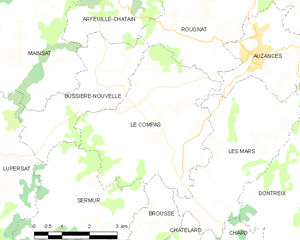
Le Compas
- commune in Creuse, France
- Country:
- Postal Code: 23700
- Coordinates: 45° 59' 46" N, 2° 27' 43" E
- GPS tracks (wikiloc): [Link]
- Area: 16.54 sq km
- Population: 219

Fresselines
- commune in Creuse, France
- Country:
- Postal Code: 23450
- Coordinates: 46° 22' 58" N, 1° 40' 55" E
- GPS tracks (wikiloc): [Link]
- Area: 30.78 sq km
- Population: 531
Saint-Dizier-la-Tour
- commune in Creuse, France
- Country:
- Postal Code: 23130
- Coordinates: 46° 8' 46" N, 2° 9' 12" E
- GPS tracks (wikiloc): [Link]
- Area: 16.99 sq km
- Population: 217
Montboucher
- commune in Creuse, France
- Country:
- Postal Code: 23400
- Coordinates: 45° 57' 12" N, 1° 40' 51" E
- GPS tracks (wikiloc): [Link]
- Area: 27.68 sq km
- Population: 352
Lafat
- commune in Creuse, France
- Country:
- Postal Code: 23800
- Coordinates: 46° 20' 5" N, 1° 36' 50" E
- GPS tracks (wikiloc): [Link]
- Area: 21.28 sq km
- Population: 362


Genouillac
- commune in Creuse, France
- Country:
- Postal Code: 23350
- Coordinates: 46° 21' 9" N, 1° 59' 32" E
- GPS tracks (wikiloc): [Link]
- Area: 35.76 sq km
- Population: 752


Guéret
- commune in Creuse, France
- Country:
- Postal Code: 23000
- Coordinates: 46° 10' 14" N, 1° 52' 6" E
- GPS tracks (wikiloc): [Link]
- AboveSeaLevel: 436 м m
- Area: 26.21 sq km
- Population: 13492
- Web site: [Link]


Charron
- commune in Creuse, France
- Country:
- Postal Code: 23700
- Coordinates: 46° 3' 35" N, 2° 33' 46" E
- GPS tracks (wikiloc): [Link]
- Area: 30.11 sq km
- Population: 224
Auriat
- commune in Creuse, France
- Country:
- Postal Code: 23400
- Coordinates: 45° 52' 24" N, 1° 38' 40" E
- GPS tracks (wikiloc): [Link]
- Area: 21.66 sq km
- Population: 110


Banize
- commune in Creuse, France
- Country:
- Postal Code: 23120
- Coordinates: 45° 55' 51" N, 1° 59' 51" E
- GPS tracks (wikiloc): [Link]
- AboveSeaLevel: 540 м m
- Area: 15.24 sq km
- Population: 186
Mainsat
- commune in Creuse, France
- Country:
- Postal Code: 23700
- Coordinates: 46° 3' 9" N, 2° 23' 12" E
- GPS tracks (wikiloc): [Link]
- Area: 34.81 sq km
- Population: 577
Saint-Éloi
- commune in Creuse, France
- Country:
- Postal Code: 23000
- Coordinates: 46° 4' 25" N, 1° 49' 58" E
- GPS tracks (wikiloc): [Link]
- Area: 15.6 sq km
- Population: 224


Magnat-l'Étrange
- commune in Creuse, France
- Country:
- Postal Code: 23260
- Coordinates: 45° 47' 38" N, 2° 16' 42" E
- GPS tracks (wikiloc): [Link]
- Area: 25.87 sq km
- Population: 228

Ahun
- commune in Creuse, France
- Country:
- Postal Code: 23150
- Coordinates: 46° 5' 11" N, 2° 2' 42" E
- GPS tracks (wikiloc): [Link]
- Area: 33.74 sq km
- Population: 1448


Les Mars
- commune in Creuse, France
- Country:
- Postal Code: 23700
- Coordinates: 45° 58' 53" N, 2° 28' 43" E
- GPS tracks (wikiloc): [Link]
- Area: 12.9 sq km
- Population: 197


Saint-Domet
- commune in Creuse, France
- Country:
- Postal Code: 23190
- Coordinates: 46° 2' 36" N, 2° 18' 0" E
- GPS tracks (wikiloc): [Link]
- Area: 15.33 sq km
- Population: 176


Lussat
- commune in Creuse, France
- Country:
- Postal Code: 23170
- Coordinates: 46° 10' 58" N, 2° 20' 30" E
- GPS tracks (wikiloc): [Link]
- Area: 46.86 sq km
- Population: 447


La Villeneuve
- commune in Creuse, France
- Country:
- Postal Code: 23260
- Coordinates: 45° 53' 55" N, 2° 24' 34" E
- GPS tracks (wikiloc): [Link]
- AboveSeaLevel: 705 м m
- Area: 4.45 sq km
- Population: 68


Moutier-Rozeille
- commune in Creuse, France
- Country:
- Postal Code: 23200
- Coordinates: 45° 55' 0" N, 2° 11' 50" E
- GPS tracks (wikiloc): [Link]
- Area: 19.66 sq km
- Population: 432
- Web site: [Link]


La Souterraine
- commune in Creuse, France
- Country:
- Postal Code: 23300
- Coordinates: 46° 14' 17" N, 1° 29' 8" E
- GPS tracks (wikiloc): [Link]
- Area: 37.07 sq km
- Population: 5315
- Web site: [Link]
Saint-Amand-Jartoudeix
- commune in Creuse, France
- Country:
- Postal Code: 23400
- Coordinates: 45° 54' 51" N, 1° 39' 31" E
- GPS tracks (wikiloc): [Link]
- Area: 18.74 sq km
- Population: 172

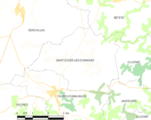
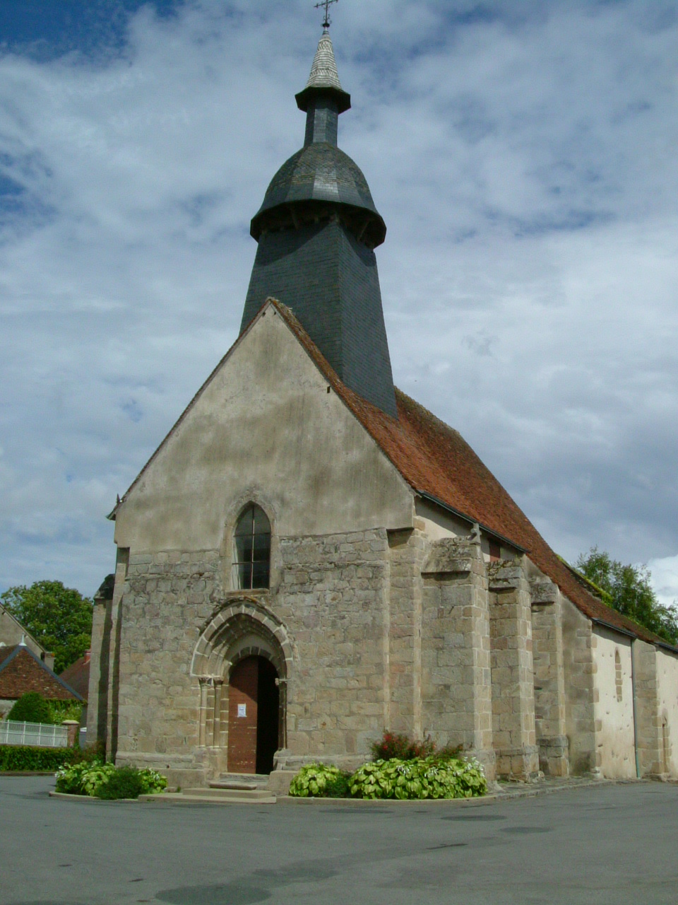
Saint-Dizier-les-Domaines
- commune in Creuse, France
- Country:
- Postal Code: 23270
- Coordinates: 46° 19' 8" N, 2° 2' 4" E
- GPS tracks (wikiloc): [Link]
- Area: 15.89 sq km
- Population: 185


Boussac-Bourg
- commune in Creuse, France
- Country:
- Postal Code: 23600
- Coordinates: 46° 21' 40" N, 2° 14' 4" E
- GPS tracks (wikiloc): [Link]
- Area: 38.69 sq km
- Population: 748


Soubrebost
- commune in Creuse, France
- Country:
- Postal Code: 23250
- Coordinates: 45° 57' 28" N, 1° 50' 35" E
- GPS tracks (wikiloc): [Link]
- Area: 20.76 sq km
- Population: 136

Azat-Châtenet
- commune in Creuse, France
- Country:
- Postal Code: 23210
- Coordinates: 46° 4' 35" N, 1° 45' 34" E
- GPS tracks (wikiloc): [Link]
- Area: 9.51 sq km
- Population: 106


Auzances
- commune in Creuse, France
- Country:
- Postal Code: 23700
- Coordinates: 46° 1' 36" N, 2° 30' 3" E
- GPS tracks (wikiloc): [Link]
- Area: 7.08 sq km
- Population: 1263
Saint-Julien-la-Genête
- commune in Creuse, France
- Country:
- Postal Code: 23110
- Coordinates: 46° 9' 9" N, 2° 28' 25" E
- GPS tracks (wikiloc): [Link]
- Area: 11.91 sq km
- Population: 232


Saint-Maurice-la-Souterraine
- commune in Creuse, France
- Country:
- Postal Code: 23300
- Coordinates: 46° 12' 51" N, 1° 25' 52" E
- GPS tracks (wikiloc): [Link]
- Area: 39.72 sq km
- Population: 1233
- Web site: [Link]


Clairavaux
- commune in Creuse, France
- Country:
- Postal Code: 23500
- Coordinates: 45° 46' 59" N, 2° 10' 1" E
- GPS tracks (wikiloc): [Link]
- Area: 27.55 sq km
- Population: 154


Saint-Marien
- commune in Creuse, France
- Country:
- Postal Code: 23600
- Coordinates: 46° 25' 13" N, 2° 13' 30" E
- GPS tracks (wikiloc): [Link]
- Area: 12.78 sq km
- Population: 191
Domeyrot
- commune in Creuse, France
- Country:
- Postal Code: 23140
- Coordinates: 46° 15' 0" N, 2° 9' 22" E
- GPS tracks (wikiloc): [Link]
- Area: 24.59 sq km
- Population: 216


Dontreix
- commune in Creuse, France
- Country:
- Postal Code: 23700
- Coordinates: 45° 59' 13" N, 2° 33' 34" E
- GPS tracks (wikiloc): [Link]
- Area: 47.45 sq km
- Population: 402

La Celle-sous-Gouzon
- commune in Creuse, France
- Country:
- Postal Code: 23230
- Coordinates: 46° 12' 53" N, 2° 12' 36" E
- GPS tracks (wikiloc): [Link]
- Area: 14.07 sq km
- Population: 148

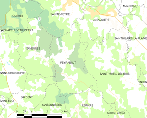
Peyrabout
- commune in Creuse, France
- Country:
- Postal Code: 23000
- Coordinates: 46° 6' 26" N, 1° 54' 43" E
- GPS tracks (wikiloc): [Link]
- Area: 8.91 sq km
- Population: 147


Féniers
- commune in Creuse, France
- Country:
- Postal Code: 23100
- Coordinates: 45° 45' 2" N, 2° 7' 36" E
- GPS tracks (wikiloc): [Link]
- Area: 14.33 sq km
- Population: 93

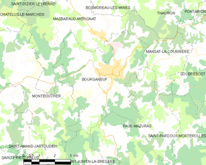
Bourganeuf
- commune in Creuse, France
- Country:
- Postal Code: 23400
- Coordinates: 45° 57' 13" N, 1° 45' 20" E
- GPS tracks (wikiloc): [Link]
- Area: 22.54 sq km
- Population: 2732
Linard
- commune in Creuse, France
- Country:
- Postal Code: 23220
- Coordinates: 46° 21' 30" N, 1° 52' 23" E
- GPS tracks (wikiloc): [Link]
- Area: 12.6 sq km
- Population: 166


Saint-Moreil
- commune in Creuse, France
- Country:
- Postal Code: 23400
- Coordinates: 45° 51' 14" N, 1° 41' 17" E
- GPS tracks (wikiloc): [Link]
- Area: 23.94 sq km
- Population: 221
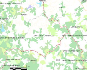
Saint-Merd-la-Breuille
- commune in Creuse, France
- Country:
- Postal Code: 23100
- Coordinates: 45° 44' 35" N, 2° 25' 50" E
- GPS tracks (wikiloc): [Link]
- AboveSeaLevel: 781 м m
- Area: 40.19 sq km
- Population: 187
Saint-Laurent
- commune in Creuse, France
- Country:
- Postal Code: 23000
- Coordinates: 46° 9' 59" N, 1° 57' 45" E
- GPS tracks (wikiloc): [Link]
- Area: 12.93 sq km
- Population: 686

Bazelat
- commune in Creuse, France
- Country:
- Postal Code: 23160
- Coordinates: 46° 21' 8" N, 1° 32' 18" E
- GPS tracks (wikiloc): [Link]
- Area: 13.43 sq km
- Population: 274
Saint-Maurice-près-Crocq
- commune in Creuse, France
- Country:
- Postal Code: 23260
- Coordinates: 45° 52' 25" N, 2° 19' 36" E
- GPS tracks (wikiloc): [Link]
- Area: 14.1 sq km
- Population: 100

Crocq
- commune in Creuse, France
- Country:
- Postal Code: 23260
- Coordinates: 45° 52' 5" N, 2° 22' 2" E
- GPS tracks (wikiloc): [Link]
- Area: 14.16 sq km
- Population: 391
Chambon-Sainte-Croix
- commune in Creuse, France
- Country:
- Postal Code: 23220
- Coordinates: 46° 21' 20" N, 1° 46' 29" E
- GPS tracks (wikiloc): [Link]
- Area: 6.66 sq km
- Population: 78


La Courtine
- commune in Creuse, France
- Country:
- Postal Code: 23100
- Coordinates: 45° 42' 4" N, 2° 15' 49" E
- GPS tracks (wikiloc): [Link]
- Area: 41.42 sq km
- Population: 710


Boussac
- commune in Creuse, France
- Country:
- Postal Code: 23600
- Coordinates: 46° 20' 56" N, 2° 12' 54" E
- GPS tracks (wikiloc): [Link]
- Area: 1.48 sq km
- Population: 1276
- Web site: [Link]


Felletin
- commune in Creuse, France
- Country:
- Postal Code: 23500
- Coordinates: 45° 53' 1" N, 2° 10' 23" E
- GPS tracks (wikiloc): [Link]
- Area: 13.74 sq km
- Population: 1691
- Web site: [Link]


Bonnat
- commune in Creuse, France
- Country:
- Postal Code: 23220
- Coordinates: 46° 19' 40" N, 1° 54' 17" E
- GPS tracks (wikiloc): [Link]
- Area: 45.79 sq km
- Population: 1307

Saint-Étienne-de-Fursac
- former commune in Creuse, France
- Country:
- Postal Code: 23290
- Coordinates: 46° 8' 39" N, 1° 30' 51" E
- GPS tracks (wikiloc): [Link]
- Area: 31.7 sq km
- Population: 781
La Brionne
- commune in Creuse, France
- Country:
- Postal Code: 23000
- Coordinates: 46° 10' 6" N, 1° 47' 13" E
- GPS tracks (wikiloc): [Link]
- Area: 7.08 sq km
- Population: 435


Saint-Georges-Nigremont
- commune in Creuse, France
- Country:
- Postal Code: 23500
- Coordinates: 45° 50' 13" N, 2° 15' 48" E
- GPS tracks (wikiloc): [Link]
- Area: 18.59 sq km
- Population: 126
Lizières
- commune in Creuse, France
- Country:
- Postal Code: 23240
- Coordinates: 46° 12' 39" N, 1° 34' 26" E
- GPS tracks (wikiloc): [Link]
- Area: 14.67 sq km
- Population: 272


Le Bourg-d'Hem
- commune in Creuse, France
- Country:
- Postal Code: 23220
- Coordinates: 46° 17' 47" N, 1° 49' 41" E
- GPS tracks (wikiloc): [Link]
- Area: 15.39 sq km
- Population: 212


Saint-Alpinien
- commune in Creuse, France
- Country:
- Postal Code: 23200
- Coordinates: 45° 58' 40" N, 2° 14' 17" E
- GPS tracks (wikiloc): [Link]
- Area: 15.21 sq km
- Population: 276
Saint-Silvain-Montaigut
- commune in Creuse, France
- Country:
- Postal Code: 23320
- Coordinates: 46° 8' 33" N, 1° 45' 7" E
- GPS tracks (wikiloc): [Link]
- Area: 9.55 sq km
- Population: 197
Janaillat
- commune in Creuse, France
- Country:
- Postal Code: 23250
- Coordinates: 46° 3' 24" N, 1° 44' 44" E
- GPS tracks (wikiloc): [Link]
- Area: 28.29 sq km
- Population: 337

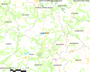
Ladapeyre
- commune in Creuse, France
- Country:
- Postal Code: 23270
- Coordinates: 46° 14' 54" N, 2° 2' 54" E
- GPS tracks (wikiloc): [Link]
- Area: 30.63 sq km
- Population: 355


Vallière
- commune in Creuse, France
- Country:
- Postal Code: 23120
- Coordinates: 45° 54' 21" N, 2° 2' 2" E
- GPS tracks (wikiloc): [Link]
- Area: 48.42 sq km
- Population: 743
- Web site: [Link]


Vareilles
- commune in Creuse, France
- Country:
- Postal Code: 23300
- Coordinates: 46° 18' 1" N, 1° 28' 38" E
- GPS tracks (wikiloc): [Link]
- Area: 17.68 sq km
- Population: 312
Faux-Mazuras
- commune in Creuse, France
- Country:
- Postal Code: 23400
- Coordinates: 45° 55' 25" N, 1° 47' 0" E
- GPS tracks (wikiloc): [Link]
- Area: 19.96 sq km
- Population: 177

Malval
- commune in Creuse, France
- Country:
- Postal Code: 23220
- Coordinates: 46° 21' 1" N, 1° 53' 7" E
- GPS tracks (wikiloc): [Link]
- Area: 4.03 sq km
- Population: 40
Lupersat
- commune in Creuse, France
- Country:
- Postal Code: 23190
- Coordinates: 45° 59' 7" N, 2° 21' 21" E
- GPS tracks (wikiloc): [Link]
- Area: 32.64 sq km
- Population: 321

Chavanat
- commune in Creuse, France
- Country:
- Postal Code: 23250
- Coordinates: 45° 57' 11" N, 1° 57' 51" E
- GPS tracks (wikiloc): [Link]
- Area: 12.73 sq km
- Population: 138


Saint-Agnant-de-Versillat
- commune in Creuse, France
- Country:
- Postal Code: 23300
- Coordinates: 46° 16' 44" N, 1° 30' 40" E
- GPS tracks (wikiloc): [Link]
- Area: 50.46 sq km
- Population: 1104

Faux-la-Montagne
- commune in Creuse, France
- Country:
- Postal Code: 23340
- Coordinates: 45° 45' 3" N, 1° 56' 5" E
- GPS tracks (wikiloc): [Link]
- Area: 47.89 sq km
- Population: 389
- Web site: [Link]


Aubusson
- commune in Creuse, France
- Country:
- Postal Code: 23200
- Coordinates: 45° 57' 22" N, 2° 10' 3" E
- GPS tracks (wikiloc): [Link]
- Area: 19.21 sq km
- Population: 3496
- Web site: [Link]


Évaux-les-Bains
- commune in Creuse, France
- Country:
- Postal Code: 23110
- Coordinates: 46° 10' 30" N, 2° 29' 10" E
- GPS tracks (wikiloc): [Link]
- Area: 45.55 sq km
- Population: 1383
- Web site: [Link]


Châtelus-Malvaleix
- commune in Creuse, France
- Country:
- Postal Code: 23270
- Coordinates: 46° 18' 16" N, 2° 1' 24" E
- GPS tracks (wikiloc): [Link]
- Area: 14.97 sq km
- Population: 581

Arrènes
- commune in Creuse, France
- Country:
- Postal Code: 23210
- Coordinates: 46° 4' 17" N, 1° 34' 12" E
- GPS tracks (wikiloc): [Link]
- Area: 22.56 sq km
- Population: 225


Chambonchard
- commune in Creuse, France
- Country:
- Postal Code: 23110
- Coordinates: 46° 9' 57" N, 2° 32' 9" E
- GPS tracks (wikiloc): [Link]
- Area: 12.86 sq km
- Population: 82


Chamborand
- commune in Creuse, France
- Country:
- Postal Code: 23240
- Coordinates: 46° 9' 21" N, 1° 34' 20" E
- GPS tracks (wikiloc): [Link]
- Area: 11.18 sq km
- Population: 248
Ceyroux
- commune in Creuse, France
- Country:
- Postal Code: 23210
- Coordinates: 46° 4' 16" N, 1° 39' 57" E
- GPS tracks (wikiloc): [Link]
- Area: 12.13 sq km
- Population: 129


Nouziers
- commune in Creuse, France
- Country:
- Postal Code: 23350
- Coordinates: 46° 25' 18" N, 1° 57' 28" E
- GPS tracks (wikiloc): [Link]
- Area: 14.33 sq km
- Population: 232

Cressat
- commune in Creuse, France
- Country:
- Postal Code: 23140
- Coordinates: 46° 8' 23" N, 2° 6' 30" E
- GPS tracks (wikiloc): [Link]
- Area: 33.41 sq km
- Population: 554

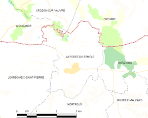
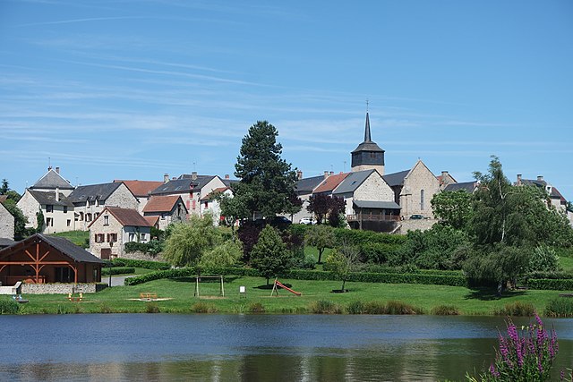
La Forêt-du-Temple
- commune in Creuse, France
- Country:
- Postal Code: 23360
- Coordinates: 46° 25' 15" N, 1° 54' 10" E
- GPS tracks (wikiloc): [Link]
- Area: 7.72 sq km
- Population: 141
Méasnes
- commune in Creuse, France
- Country:
- Postal Code: 23360
- Coordinates: 46° 24' 59" N, 1° 46' 40" E
- GPS tracks (wikiloc): [Link]
- Area: 27.63 sq km
- Population: 552


arrondissement of Guéret
- arrondissement of France
- Country:
- Capital: Guéret
- Coordinates: 46° 10' 0" N, 1° 50' 0" E
- GPS tracks (wikiloc): [Link]
- Area: 3027 sq km
- Population: 83464


Pontcharraud
- commune in Creuse, France
- Country:
- Postal Code: 23260
- Coordinates: 45° 51' 51" N, 2° 16' 16" E
- GPS tracks (wikiloc): [Link]
- Area: 9.56 sq km
- Population: 75


Gouzon
- commune in Creuse, France
- Country:
- Postal Code: 23230
- Coordinates: 46° 11' 30" N, 2° 14' 19" E
- GPS tracks (wikiloc): [Link]
- Area: 50.03 sq km
- Population: 1583
- Web site: [Link]


Gioux
- commune in Creuse, France
- Country:
- Postal Code: 23500
- Coordinates: 45° 48' 37" N, 2° 7' 18" E
- GPS tracks (wikiloc): [Link]
- Area: 37.42 sq km
- Population: 172


Lépaud
- commune in Creuse, France
- Country:
- Postal Code: 23170
- Coordinates: 46° 14' 22" N, 2° 23' 14" E
- GPS tracks (wikiloc): [Link]
- Area: 24.12 sq km
- Population: 366
Saint-Priest-Palus
- commune in Creuse, France
- Country:
- Postal Code: 23400
- Coordinates: 45° 53' 53" N, 1° 39' 29" E
- GPS tracks (wikiloc): [Link]
- Area: 10.64 sq km
- Population: 54


Saint-Bard
- commune in Creuse, France
- Country:
- Postal Code: 23260
- Coordinates: 45° 54' 52" N, 2° 24' 1" E
- GPS tracks (wikiloc): [Link]
- Area: 9.36 sq km
- Population: 109

La Pouge
- commune in Creuse, France
- Country:
- Postal Code: 23250
- Coordinates: 45° 58' 50" N, 1° 56' 42" E
- GPS tracks (wikiloc): [Link]
- Area: 7.58 sq km
- Population: 86


Châtelus-le-Marcheix
- commune in Creuse, France
- Country:
- Postal Code: 23430
- Coordinates: 45° 59' 58" N, 1° 36' 28" E
- GPS tracks (wikiloc): [Link]
- Area: 43.2 sq km
- Population: 342

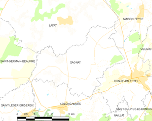
Sagnat
- commune in Creuse, France
- Country:
- Postal Code: 23800
- Coordinates: 46° 18' 15" N, 1° 37' 42" E
- GPS tracks (wikiloc): [Link]
- Area: 11.81 sq km
- Population: 196


La Saunière
- commune in Creuse, France
- Country:
- Postal Code: 23000
- Coordinates: 46° 7' 49" N, 1° 56' 13" E
- GPS tracks (wikiloc): [Link]
- Area: 7.5 sq km
- Population: 616


Flayat
- commune in Creuse, France
- Country:
- Postal Code: 23260
- Coordinates: 45° 46' 36" N, 2° 22' 56" E
- GPS tracks (wikiloc): [Link]
- Area: 43.53 sq km
- Population: 321


Saint-Sulpice-le-Dunois
- commune in Creuse, France
- Country:
- Postal Code: 23800
- Coordinates: 46° 17' 56" N, 1° 43' 52" E
- GPS tracks (wikiloc): [Link]
- Area: 30.85 sq km
- Population: 620

Saint-Maixant
- commune in Creuse, France
- Country:
- Postal Code: 23200
- Coordinates: 45° 59' 37" N, 2° 12' 26" E
- GPS tracks (wikiloc): [Link]
- Area: 13.86 sq km
- Population: 234


Mérinchal
- commune in Creuse, France
- Country:
- Postal Code: 23420
- Coordinates: 45° 55' 0" N, 2° 29' 19" E
- GPS tracks (wikiloc): [Link]
- Area: 45.45 sq km
- Population: 755

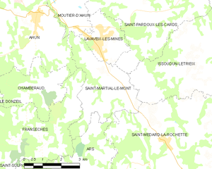
Saint-Martial-le-Mont
- commune in Creuse, France
- Country:
- Postal Code: 23150
- Coordinates: 46° 2' 58" N, 2° 5' 36" E
- GPS tracks (wikiloc): [Link]
- Area: 10.25 sq km
- Population: 244


Maisonnisses
- commune in Creuse, France
- Country:
- Postal Code: 23150
- Coordinates: 46° 3' 47" N, 1° 53' 56" E
- GPS tracks (wikiloc): [Link]
- Area: 11.12 sq km
- Population: 204


Chard
- commune in Creuse, France
- Country:
- Postal Code: 23700
- Coordinates: 45° 56' 40" N, 2° 28' 38" E
- GPS tracks (wikiloc): [Link]
- Area: 14.12 sq km
- Population: 201


Budelière
- commune in Creuse, France
- Country:
- Postal Code: 23170
- Coordinates: 46° 13' 12" N, 2° 28' 6" E
- GPS tracks (wikiloc): [Link]
- Area: 25.07 sq km
- Population: 748
- Web site: [Link]
Mortroux
- commune in Creuse, France
- Country:
- Postal Code: 23220
- Coordinates: 46° 23' 51" N, 1° 54' 55" E
- GPS tracks (wikiloc): [Link]
- Area: 13.28 sq km
- Population: 291


Saint-Avit-le-Pauvre
- commune in Creuse, France
- Country:
- Postal Code: 23480
- Coordinates: 45° 59' 45" N, 2° 2' 40" E
- GPS tracks (wikiloc): [Link]
- Area: 4.99 sq km
- Population: 78

La Mazière-aux-Bons-Hommes
- commune in Creuse, France
- Country:
- Postal Code: 23260
- Coordinates: 45° 53' 2" N, 2° 26' 27" E
- GPS tracks (wikiloc): [Link]
- Area: 10.24 sq km
- Population: 68
- Web site: [Link]
Viersat
- commune in Creuse, France
- Country:
- Postal Code: 23170
- Coordinates: 46° 16' 14" N, 2° 25' 52" E
- GPS tracks (wikiloc): [Link]
- Area: 29.09 sq km
- Population: 302


Sardent
- commune in Creuse, France
- Country:
- Postal Code: 23250
- Coordinates: 46° 3' 2" N, 1° 51' 20" E
- GPS tracks (wikiloc): [Link]
- Area: 41.11 sq km
- Population: 783
- Web site: [Link]
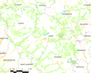
Ajain
- commune in Creuse, France
- Country:
- Postal Code: 23380
- Coordinates: 46° 12' 27" N, 1° 59' 55" E
- GPS tracks (wikiloc): [Link]
- Area: 33.14 sq km
- Population: 1130
Saint-Priest-la-Plaine
- commune in Creuse, France
- Country:
- Postal Code: 23240
- Coordinates: 46° 11' 28" N, 1° 37' 41" E
- GPS tracks (wikiloc): [Link]
- Area: 21.9 sq km
- Population: 263

arrondissement of Aubusson
- arrondissement of France
- Country:
- Capital: Aubusson
- Coordinates: 46° 0' 0" N, 2° 0' 0" E
- GPS tracks (wikiloc): [Link]
- Area: 2539 sq km
- Population: 36901
Saint-Victor-en-Marche
- commune in Creuse, France
- Country:
- Postal Code: 23000
- Coordinates: 46° 7' 6" N, 1° 48' 50" E
- GPS tracks (wikiloc): [Link]
- AboveSeaLevel: 479 м m
- Area: 16.62 sq km
- Population: 381


Glénic
- commune in Creuse, France
- Country:
- Postal Code: 23380
- Coordinates: 46° 13' 24" N, 1° 55' 22" E
- GPS tracks (wikiloc): [Link]
- Area: 27.6 sq km
- Population: 657


Villard
- commune in Creuse, France
- Country:
- Postal Code: 23800
- Coordinates: 46° 19' 55" N, 1° 42' 3" E
- GPS tracks (wikiloc): [Link]
- Area: 16.37 sq km
- Population: 368

Néoux
- commune in Creuse, France
- Country:
- Postal Code: 23200
- Coordinates: 45° 54' 54" N, 2° 15' 38" E
- GPS tracks (wikiloc): [Link]
- Area: 23.81 sq km
- Population: 290

Croze
- commune in Creuse, France
- Country:
- Postal Code: 23500
- Coordinates: 45° 49' 8" N, 2° 9' 39" E
- GPS tracks (wikiloc): [Link]
- Area: 22.16 sq km
- Population: 209
Bord-Saint-Georges
- commune in Creuse, France
- Country:
- Postal Code: 23230
- Coordinates: 46° 15' 37" N, 2° 17' 56" E
- GPS tracks (wikiloc): [Link]
- Area: 32.5 sq km
- Population: 355


Chéniers
- commune in Creuse, France
- Country:
- Postal Code: 23220
- Coordinates: 46° 21' 3" N, 1° 49' 39" E
- GPS tracks (wikiloc): [Link]
- Area: 34.9 sq km
- Population: 577


Bussière-Saint-Georges
- commune in Creuse, France
- Country:
- Postal Code: 23600
- Coordinates: 46° 24' 0" N, 2° 8' 38" E
- GPS tracks (wikiloc): [Link]
- Area: 22.45 sq km
- Population: 255
Aulon
- commune in Creuse, France
- Country:
- Postal Code: 23210
- Coordinates: 46° 4' 55" N, 1° 41' 26" E
- GPS tracks (wikiloc): [Link]
- Area: 10.86 sq km
- Population: 157
Champsanglard
- commune in Creuse, France
- Country:
- Postal Code: 23220
- Coordinates: 46° 16' 28" N, 1° 52' 52" E
- GPS tracks (wikiloc): [Link]
- Area: 13.64 sq km
- Population: 239
Arfeuille-Châtain
- commune in Creuse, France
- Country:
- Postal Code: 23700
- Coordinates: 46° 3' 55" N, 2° 26' 12" E
- GPS tracks (wikiloc): [Link]
- Area: 20.5 sq km
- Population: 182


Ars
- commune in Creuse, France
- Country:
- Postal Code: 23480
- Coordinates: 46° 0' 15" N, 2° 4' 42" E
- GPS tracks (wikiloc): [Link]
- Area: 21.69 sq km
- Population: 257
Bussière-Nouvelle
- commune in Creuse, France
- Country:
- Postal Code: 23700
- Coordinates: 46° 1' 9" N, 2° 25' 36" E
- GPS tracks (wikiloc): [Link]
- Area: 8.52 sq km
- Population: 96

Alleyrat
- commune in Creuse, France
- Country:
- Postal Code: 23200
- Coordinates: 45° 59' 18" N, 2° 9' 13" E
- GPS tracks (wikiloc): [Link]
- Area: 9.54 sq km
- Population: 146

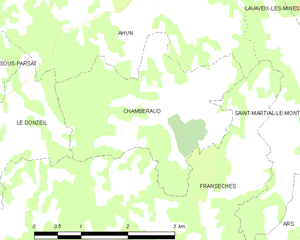
Chamberaud
- commune in Creuse, France
- Country:
- Postal Code: 23480
- Coordinates: 46° 2' 56" N, 2° 2' 44" E
- GPS tracks (wikiloc): [Link]
- Area: 7.44 sq km
- Population: 101


Blessac
- commune in Creuse, France
- Country:
- Postal Code: 23200
- Coordinates: 45° 57' 31" N, 2° 7' 36" E
- GPS tracks (wikiloc): [Link]
- Area: 17.75 sq km
- Population: 537
- Web site: [Link]


Colondannes
- commune in Creuse, France
- Country:
- Postal Code: 23800
- Coordinates: 46° 17' 21" N, 1° 36' 41" E
- GPS tracks (wikiloc): [Link]
- Area: 10.7 sq km
- Population: 269

Anzême
- commune in Creuse, France
- Country:
- Postal Code: 23000
- Coordinates: 46° 15' 57" N, 1° 51' 49" E
- GPS tracks (wikiloc): [Link]
- Area: 29.5 sq km
- Population: 575

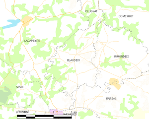
Blaudeix
- commune in Creuse, France
- Country:
- Postal Code: 23140
- Coordinates: 46° 13' 51" N, 2° 5' 3" E
- GPS tracks (wikiloc): [Link]
- Area: 6.9 sq km
- Population: 99
Châtelard
- commune in Creuse, France
- Country:
- Postal Code: 23700
- Coordinates: 45° 57' 51" N, 2° 28' 5" E
- GPS tracks (wikiloc): [Link]
- Area: 2.42 sq km
- Population: 31


Clugnat
- commune in Creuse, France
- Country:
- Postal Code: 23270
- Coordinates: 46° 18' 31" N, 2° 7' 5" E
- GPS tracks (wikiloc): [Link]
- Area: 42.42 sq km
- Population: 645


Bétête
- commune in Creuse, France
- Country:
- Postal Code: 23270
- Coordinates: 46° 21' 34" N, 2° 4' 40" E
- GPS tracks (wikiloc): [Link]
- Area: 28.24 sq km
- Population: 362


Beissat
- commune in Creuse, France
- Country:
- Postal Code: 23260
- Coordinates: 45° 46' 23" N, 2° 16' 34" E
- GPS tracks (wikiloc): [Link]
- Area: 14.49 sq km
- Population: 27


Puy-Malsignat
- commune in Creuse, France
- Country:
- Postal Code: 23130
- Coordinates: 46° 2' 17" N, 2° 13' 7" E
- GPS tracks (wikiloc): [Link]
- Area: 12.61 sq km
- Population: 172


Nouzerines
- commune in Creuse, France
- Country:
- Postal Code: 23600
- Coordinates: 46° 23' 18" N, 2° 6' 31" E
- GPS tracks (wikiloc): [Link]
- Area: 19.09 sq km
- Population: 250

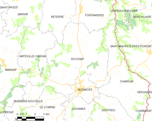
Rougnat
- commune in Creuse, France
- Country:
- Postal Code: 23700
- Coordinates: 46° 3' 14" N, 2° 30' 5" E
- GPS tracks (wikiloc): [Link]
- Area: 41.01 sq km
- Population: 498


Marsac
- commune in Creuse, France
- Country:
- Postal Code: 23210
- Coordinates: 46° 5' 52" N, 1° 35' 23" E
- GPS tracks (wikiloc): [Link]
- Area: 19.67 sq km
- Population: 673
Mazeirat
- commune in Creuse, France
- Country:
- Postal Code: 23150
- Coordinates: 46° 8' 32" N, 1° 58' 52" E
- GPS tracks (wikiloc): [Link]
- Area: 7.8 sq km
- Population: 139
Bosroger
- commune in Creuse, France
- Country:
- Postal Code: 23200
- Coordinates: 45° 59' 39" N, 2° 15' 1" E
- GPS tracks (wikiloc): [Link]
- AboveSeaLevel: 625 м m
- Area: 7.56 sq km
- Population: 116


Nouhant
- commune in Creuse, France
- Country:
- Postal Code: 23170
- Coordinates: 46° 17' 4" N, 2° 23' 26" E
- GPS tracks (wikiloc): [Link]
- Area: 25.75 sq km
- Population: 307

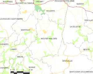
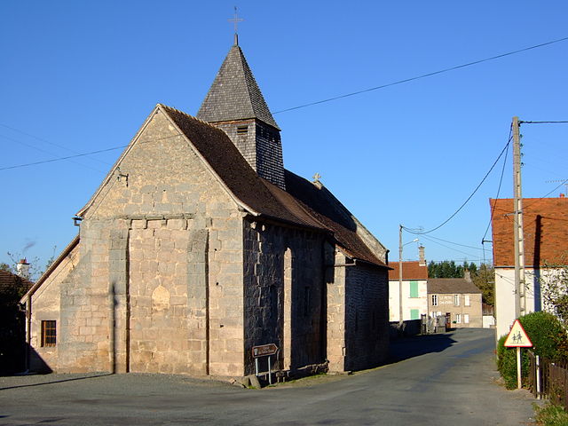
Moutier-Malcard
- commune in Creuse, France
- Country:
- Postal Code: 23220
- Coordinates: 46° 23' 37" N, 1° 56' 41" E
- GPS tracks (wikiloc): [Link]
- Area: 25.81 sq km
- Population: 519


Saint-Martin-Château
- commune in Creuse, France
- Country:
- Postal Code: 23460
- Coordinates: 45° 51' 26" N, 1° 47' 56" E
- GPS tracks (wikiloc): [Link]
- Area: 31.25 sq km
- Population: 147

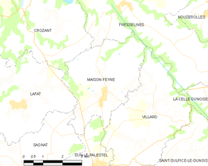
Maison-Feyne
- commune in Creuse, France
- Country:
- Postal Code: 23800
- Coordinates: 46° 20' 24" N, 1° 40' 12" E
- GPS tracks (wikiloc): [Link]
- Area: 13.27 sq km
- Population: 302

Saint-Silvain-Bas-le-Roc
- commune in Creuse, France
- Country:
- Postal Code: 23600
- Coordinates: 46° 19' 52" N, 2° 13' 39" E
- GPS tracks (wikiloc): [Link]
- Area: 15.32 sq km
- Population: 416
Saint-Pierre-Chérignat
- commune in Creuse, France
- Country:
- Postal Code: 23430
- Coordinates: 45° 58' 22" N, 1° 36' 51" E
- GPS tracks (wikiloc): [Link]
- AboveSeaLevel: 421 м m
- Area: 23.72 sq km
- Population: 173
Shares border with regions:

Indre
- French department
- Country:
- Capital: Châteauroux
- Coordinates: 46° 46' 0" N, 1° 36' 0" E
- GPS tracks (wikiloc): [Link]
- Area: 6791 sq km
- Population: 224200
- Web site: [Link]


Puy-de-Dôme
- French department
- Country:
- Capital: Clermont-Ferrand
- Coordinates: 45° 42' 0" N, 3° 13' 0" E
- GPS tracks (wikiloc): [Link]
- Area: 7970 sq km
- Population: 647501
- Web site: [Link]


Haute-Vienne
- French department
- Country:
- Capital: Limoges
- Coordinates: 45° 50' 0" N, 1° 16' 0" E
- GPS tracks (wikiloc): [Link]
- Area: 5520 sq km
- Population: 375795
- Web site: [Link]


Allier
- French department
- Country:
- Capital: Moulins
- Coordinates: 46° 20' 0" N, 3° 10' 0" E
- GPS tracks (wikiloc): [Link]
- Area: 7340 sq km
- Population: 341613
- Web site: [Link]

Cher
- French department
- Country:
- Capital: Bourges
- Coordinates: 47° 4' 52" N, 2° 26' 40" E
- GPS tracks (wikiloc): [Link]
- Area: 7235 sq km
- Population: 308992
- Web site: [Link]


Corrèze
- French department
- Country:
- Capital: Tulle
- Coordinates: 45° 20' 0" N, 1° 50' 0" E
- GPS tracks (wikiloc): [Link]
- Area: 5857 sq km
- Population: 241871
- Web site: [Link]