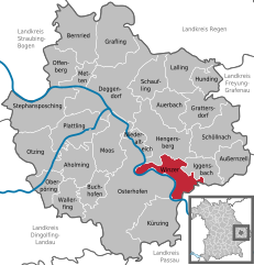
Künzing (Künzing)
- municipality of Germany
Künzing, located in Bavaria, Germany, is an excellent destination for hiking enthusiasts. The area features picturesque landscapes that include rolling hills, forests, and scenic views of the Danube River and surrounding countryside.
Here are some highlights and tips for hiking in Künzing:
-
Trails: There are several marked hiking trails around Künzing, ranging from easy walks to more challenging hikes. These trails often pass by historical landmarks, churches, and through charming villages.
-
Nature Experience: The region is rich in biodiversity and offers opportunities to see various wildlife. The trails typically traverse forests and meadows, providing a chance to enjoy the local flora and fauna.
-
Danube River: The proximity to the Danube means you can enjoy riverside hikes. Walking along the river offers lovely views, and there are numerous spots for resting and picnicking.
-
Locally Available Maps and Guides: Before hiking, it's a good idea to pick up local maps or guides from the town or local tourist information points to ensure you stay on marked paths and make the most of your experience.
-
Accommodation and Amenities: Künzing offers various accommodation options, from hotels to guesthouses, which can act as good bases for hiking excursions. Look for local restaurants to enjoy Bavarian cuisine after a long day of hiking.
-
Weather Considerations: Always check the weather forecast before heading out and dress in layers, as conditions can change quickly. Also, consider visiting in spring or fall for mild weather and beautiful scenery.
-
Safety: As with any hiking trip, make sure to carry enough water, snacks, and a basic first aid kit. Let someone know your plans, especially if you are heading out on a less-traveled path.
To fully enjoy your hiking experience in Künzing, it’s beneficial to take your time, appreciate the scenery, and explore the cultural heritage of the region. Happy hiking!
- Country:

- Postal Code: 94501; 94550
- Local Dialing Code: 08547; 08549
- Licence Plate Code: DEG
- Coordinates: 48° 40' 11" N, 13° 4' 49" E


- GPS tracks (wikiloc): [Link]
- AboveSeaLevel: 308 м m
- Area: 40.40 sq km
- Population: 3124
- Web site: https://www.kuenzing.de/
- Wikipedia en: wiki(en)
- Wikipedia: wiki(de)
- Wikidata storage: Wikidata: Q266785
- Wikipedia Commons Category: [Link]
- Freebase ID: [/m/02q0_yr]
- GeoNames ID: Alt: [6556461]
- VIAF ID: Alt: [248994042]
- OSM relation ID: [959819]
- GND ID: Alt: [4098786-3]
- Bavarikon ID: [ODB_A00001443]
- German municipality key: 09271128
Shares border with regions:


Vilshofen an der Donau
- municipality of Germany
 Hiking in Vilshofen an der Donau
Vilshofen an der Donau is a picturesque town located in Bavaria, Germany, along the banks of the Danube River. This area offers a variety of hiking opportunities suitable for different skill levels, enhanced by its stunning landscapes, lush forests, and charming riverside views....
- Country:

- Postal Code: 94474
- Local Dialing Code: 08549; 08548; 08541
- Licence Plate Code: PA
- Coordinates: 48° 37' 59" N, 13° 11' 18" E


- GPS tracks (wikiloc): [Link]
- AboveSeaLevel: 308 м m
- Area: 86.29 sq km
- Population: 15142
- Web site: [Link]


Aldersbach
- municipality of Germany
Aldersbach, located in Bavaria, Germany, is a picturesque area that offers a variety of hiking opportunities. Nestled in a scenic landscape, it is an ideal destination for nature lovers and outdoor enthusiasts. Here are some highlights of hiking in Aldersbach:...
- Country:

- Postal Code: 94501
- Local Dialing Code: 08543
- Licence Plate Code: PA
- Coordinates: 48° 35' 17" N, 13° 5' 8" E


- GPS tracks (wikiloc): [Link]
- AboveSeaLevel: 328 м m
- Area: 45.8 sq km
- Population: 3574
- Web site: [Link]


Osterhofen
- municipality of Germany
Osterhofen, located in Bavaria, Germany, is a charming area for hiking enthusiasts. Nestled in the picturesque landscape of Lower Bavaria, it offers various trails that can cater to both beginners and experienced hikers. Here are some key points to consider when hiking in and around Osterhofen:...
- Country:

- Postal Code: 94486
- Local Dialing Code: 09938; 08547; 09932
- Licence Plate Code: DEG
- Coordinates: 48° 42' 0" N, 13° 1' 0" E


- GPS tracks (wikiloc): [Link]
- AboveSeaLevel: 315 м m
- Area: 111.17 sq km
- Population: 11387
- Web site: [Link]

Winzer
- municipality in the Bavarian district of Deggendorf, Germany
Winzer, a charming area in Germany, offers a variety of hiking opportunities, especially for nature lovers and those who enjoy scenic landscapes. While it's not as widely known as some other hiking destinations in Germany, it has its own unique appeal, often characterized by vineyards, rolling hills, and picturesque views of the surrounding countryside....
- Country:

- Postal Code: 94577
- Local Dialing Code: 09901
- Licence Plate Code: DEG
- Coordinates: 48° 43' 0" N, 13° 4' 0" E


- GPS tracks (wikiloc): [Link]
- AboveSeaLevel: 311 м m
- Area: 27.61 sq km
- Population: 3812
- Web site: [Link]


Hofkirchen
- municipality of Germany
Hofkirchen, located in the Bavarian region of Germany, is a charming area surrounded by picturesque landscapes that make it a great destination for hiking enthusiasts. While it might not be as famous as some other Bavarian hiking spots, it offers a range of scenic trails suitable for different experience levels....
- Country:

- Postal Code: 94544
- Local Dialing Code: 08545
- Licence Plate Code: PA
- Coordinates: 48° 41' 0" N, 13° 7' 0" E


- GPS tracks (wikiloc): [Link]
- AboveSeaLevel: 309 м m
- Area: 32.7 sq km
- Population: 3122
- Web site: [Link]
