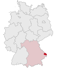
Deggendorf (Landkreis Deggendorf)

- district in Bavaria, Germany
 Hiking in Deggendorf
Deggendorf, located in Bavaria, Germany, is a fantastic region for hiking enthusiasts. Nestled at the edge of the Bavarian Forest National Park and alongside the Danube River, it boasts a variety of landscapes and trails suitable for all skill levels.
Hiking Highlights:
-
Danube River Trails: The trails along the Danube offer scenic views and are relatively flat, making them accessible for families and casual hikers. These paths wind through picturesque landscapes, charming villages, and lush vineyards.
-
Bavarian Forest National Park: Just a short drive from Deggendorf, this national park provides numerous hiking opportunities amid pristine wilderness. There are well-marked trails ranging from easy walks to more challenging hikes that take you through dense forests, over hills, and past stunning viewpoints.
-
Marking and Signage: Trails in and around Deggendorf are generally well-marked with signs and maps, making navigation straightforward. Look for the typical yellow or red markers indicating hiking routes.
-
Local Hiking Clubs: Deggendorf has active hiking clubs that organize group hikes, which can be a great way to meet fellow hiking enthusiasts and discover hidden gems in the area.
-
Scenic Lookouts: The region is home to several lookout points that provide panoramic views of the surrounding landscape, particularly over the Danube Valley and the Bavarian Forest.
-
Historical Trails: You can also explore trails that lead to historical sites, including old castles and traditional Bavarian villages, enriching your hiking experience with culture and history.
Preparation Tips:
-
Seasonal Considerations: Spring and fall are particularly beautiful times to hike in Deggendorf, thanks to mild weather and vibrant scenery. Summer can get warm, while winter may offer snow-covered trails suited for snowshoeing.
-
Gear: Ensure you have comfortable hiking boots, weather-appropriate clothing, and sufficient water and snacks. Having a trail map or a good GPS device can also be helpful.
-
Wildlife: Be aware of the local wildlife. While encounters are rare, it's always good to be prepared in the event of crossing paths with deer or other animals.
-
Safety: Always let someone know your plans before heading out, especially if you’re venturing into more remote areas. It’s wise to check the weather forecast before you go.
With its diverse landscapes, well-marked trails, and rich natural beauty, Deggendorf district is a wonderful area to explore on foot. Enjoy your hikes!
- Country:

- Capital: Deggendorf
- Licence Plate Code: DEG
- Coordinates: 48° 49' 48" N, 13° 0' 0" E


- GPS tracks (wikiloc): [Link]
- AboveSeaLevel: 309 м m
- Area: 861.00 sq km
- Population: 115005
- Web site: http://www.landkreis-deggendorf.de/
- Wikipedia en: wiki(en)
- Wikipedia: wiki(de)
- Wikidata storage: Wikidata: Q10485
- Wikipedia Commons Category: [Link]
- Freebase ID: [/m/01kqkk]
- GeoNames ID: Alt: [3220807]
- VIAF ID: Alt: [154877444]
- OSM relation ID: [62711]
- GND ID: Alt: [4011297-4]
- archINFORM location ID: [2378]
- Library of Congress authority ID: Alt: [n88155692]
- Quora topic ID: [Deggendorf]
- TGN ID: [7077311]
- Historical Gazetteer (GOV) ID: [adm_139271]
- Bavarikon ID: [ODB_A00002367]
- ISNI: Alt: [0000 0004 4910 5954]
- NUTS code: [DE224]
- BabelNet ID: [01814155n]
- German district key: 09271
- German regional key: 09271
Includes regions:

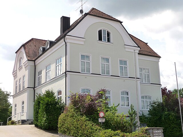
Otzing
- municipality of Germany
Hiking in Otzing
Otzing is a small village located in the beautiful surroundings of Bavaria, Germany. While the area itself may not be as famous as some major hiking destinations, it offers a variety of hiking opportunities suitable for different skill levels. Here’s what you might consider when hiking in and around Otzing:...
- Country:
- Postal Code: 94563
- Local Dialing Code: 09933; 09931
- Licence Plate Code: DEG
- Coordinates: 48° 46' 0" N, 12° 49' 0" E
- GPS tracks (wikiloc): [Link]
- AboveSeaLevel: 330 м m
- Area: 30.43 sq km
- Population: 1898
- Web site: [Link]

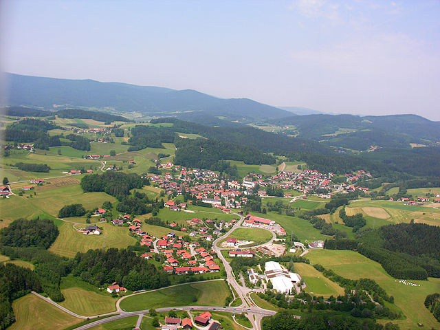
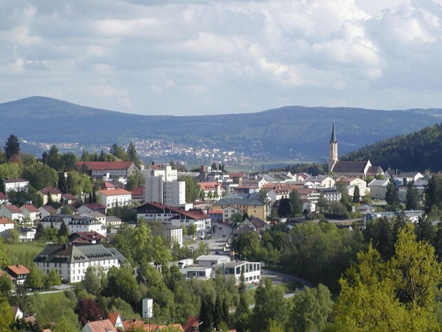
Deggendorf
- town in Bavaria, Germany
Hiking in Deggendorf
Deggendorf, located in the picturesque Bavaria region of Germany, offers a variety of hiking opportunities that are appealing to both novice and experienced hikers. The area is known for its scenic landscapes, including rolling hills, lush forests, and stunning views of the Danube River and the surrounding Bavarian countryside....
- Country:
- Postal Code: 94469
- Local Dialing Code: 0991
- Licence Plate Code: DEG
- Coordinates: 48° 50' 41" N, 12° 57' 30" E
- GPS tracks (wikiloc): [Link]
- AboveSeaLevel: 323 м m
- Area: 77.21 sq km
- Population: 31757
- Web site: [Link]

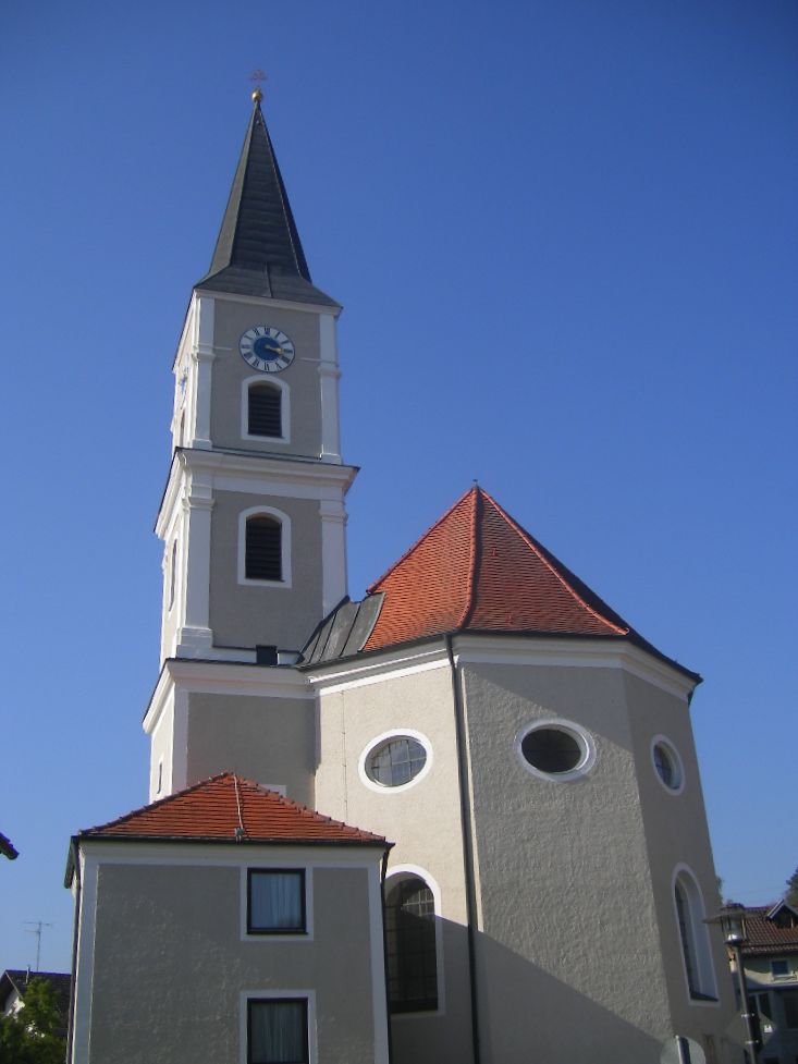
Auerbach
- municipality of Germany
Hiking in Auerbach
Auerbach in Lower Bavaria is a picturesque area that offers a variety of hiking opportunities in the beautiful Bavarian countryside. Here are some highlights and tips for hiking in Auerbach and the surrounding region:...
- Country:
- Postal Code: 94530
- Local Dialing Code: 09901
- Licence Plate Code: DEG
- Coordinates: 48° 48' 0" N, 13° 6' 0" E
- GPS tracks (wikiloc): [Link]
- AboveSeaLevel: 396 м m
- Area: 24.06 sq km
- Population: 2088
- Web site: [Link]
Aholming
- municipality in Deggendorf, Germany
Hiking in Aholming
Aholming is a charming village located in Bavaria, Germany, known for its scenic landscapes and opportunities for outdoor activities, including hiking. The region is characterized by its rolling hills, lush forests, and picturesque paths that make it a great spot for both casual walkers and more experienced hikers. Here are some highlights to consider if you plan to hike in Aholming:...
- Country:
- Postal Code: 94527; W–8351; 8351
- Local Dialing Code: 09938; 09931; 09936
- Licence Plate Code: DEG
- Coordinates: 48° 44' 0" N, 12° 55' 0" E
- GPS tracks (wikiloc): [Link]
- AboveSeaLevel: 327 м m
- Area: 29.35 sq km
- Population: 2361
- Web site: [Link]

Bernried
- municipality of Germany
Hiking in Bernried
Bernried, located in Bavaria, Germany, is an excellent destination for hiking enthusiasts. Nestled near the beautiful Starnberger See (Lake Starnberg), it offers a mix of picturesque landscapes, serene lakeshores, and forested hills. Here are some highlights to consider when hiking in Bernried:...
- Country:
- Postal Code: 94374; 94505
- Local Dialing Code: 09905
- Licence Plate Code: DEG
- Coordinates: 48° 55' 0" N, 12° 52' 0" E
- GPS tracks (wikiloc): [Link]
- AboveSeaLevel: 382 м m
- Area: 39.47 sq km
- Population: 4772
- Web site: [Link]

Stephansposching
- municipality of Germany
Hiking in Stephansposching
Stephansposching is a small village in Bavaria, Germany, located near the banks of the River Inn. While it may not be as well-known as some other hiking destinations in the region, its picturesque countryside, rolling hills, and proximity to nature trails make it a lovely spot for outdoor activities....
- Country:
- Postal Code: 94569
- Local Dialing Code: 09931; 09935
- Licence Plate Code: DEG
- Coordinates: 48° 49' 0" N, 12° 48' 0" E
- GPS tracks (wikiloc): [Link]
- AboveSeaLevel: 326 м m
- Area: 44.64 sq km
- Population: 3027
- Web site: [Link]

Künzing
- municipality of Germany
Hiking in Künzing
Künzing, located in Bavaria, Germany, is an excellent destination for hiking enthusiasts. The area features picturesque landscapes that include rolling hills, forests, and scenic views of the Danube River and surrounding countryside....
- Country:
- Postal Code: 94501; 94550
- Local Dialing Code: 08547; 08549
- Licence Plate Code: DEG
- Coordinates: 48° 40' 11" N, 13° 4' 49" E
- GPS tracks (wikiloc): [Link]
- AboveSeaLevel: 308 м m
- Area: 40.40 sq km
- Population: 3124
- Web site: [Link]

Moos
- municipality of Germany
Hiking in Moos
Moos, located in Bavaria, Germany, is a charming destination for hiking enthusiasts. The region is characterized by its scenic landscapes, including rolling hills, lush forests, and beautiful lakes. Here are some highlights and tips for hiking in Moos:...
- Country:
- Postal Code: 94554
- Local Dialing Code: 09938
- Licence Plate Code: DEG
- Coordinates: 48° 45' 0" N, 12° 58' 0" E
- GPS tracks (wikiloc): [Link]
- AboveSeaLevel: 316 м m
- Area: 32.23 sq km
- Population: 2181
- Web site: [Link]

Außernzell
- municipality of Germany
Hiking in Außernzell
Außernzell is a picturesque area located in Bavaria, Germany, known for its beautiful landscapes, rolling hills, and lush greenery. Hiking in this region can be quite rewarding for both beginners and experienced hikers. Here are some highlights and tips for hiking in Außernzell:...
- Country:
- Postal Code: 94532
- Local Dialing Code: 08544; 09903
- Licence Plate Code: DEG
- Coordinates: 48° 43' 0" N, 13° 12' 0" E
- GPS tracks (wikiloc): [Link]
- AboveSeaLevel: 372 м m
- Area: 24.11 sq km
- Population: 1377
- Web site: [Link]

Iggensbach
- municipality of Germany
Hiking in Iggensbach
Iggensbach is a beautiful village located in Bavaria, Germany, known for its picturesque landscapes and outdoor recreational opportunities, including hiking. Here's a brief overview of what you can expect when hiking in and around Iggensbach:...
- Country:
- Postal Code: 94547
- Local Dialing Code: 09903
- Licence Plate Code: DEG
- Coordinates: 48° 44' 0" N, 13° 8' 0" E
- GPS tracks (wikiloc): [Link]
- AboveSeaLevel: 382 м m
- Area: 19.08 sq km
- Population: 2014
- Web site: [Link]

Osterhofen
- municipality of Germany
Hiking in Osterhofen
Osterhofen, located in Bavaria, Germany, is a charming area for hiking enthusiasts. Nestled in the picturesque landscape of Lower Bavaria, it offers various trails that can cater to both beginners and experienced hikers. Here are some key points to consider when hiking in and around Osterhofen:...
- Country:
- Postal Code: 94486
- Local Dialing Code: 09938; 08547; 09932
- Licence Plate Code: DEG
- Coordinates: 48° 42' 0" N, 13° 1' 0" E
- GPS tracks (wikiloc): [Link]
- AboveSeaLevel: 315 м m
- Area: 111.17 sq km
- Population: 11387
- Web site: [Link]

Schöllnach
- municipality of Germany
Hiking in Schöllnach
Schöllnach is a beautiful region located in Bavaria, Germany, known for its lush landscapes and scenic hiking trails. Nestled in the heart of the Bavarian Forest, it offers a variety of hiking opportunities suitable for all levels, from beginners to experienced hikers....
- Country:
- Postal Code: 94508
- Local Dialing Code: 09903
- Licence Plate Code: DEG
- Coordinates: 48° 45' 0" N, 13° 10' 0" E
- GPS tracks (wikiloc): [Link]
- AboveSeaLevel: 371 м m
- Area: 39.9 sq km
- Population: 4772
- Web site: [Link]

Schaufling
- municipality of Germany
Hiking in Schaufling
Schaufling, located in the Lower Bavaria region of Germany, is a wonderful spot for hiking enthusiasts. Surrounded by picturesque landscapes, including rolling hills, dense forests, and tranquil rivers, it offers various trails suitable for all skill levels. Here are some highlights for hiking in Schaufling:...
- Country:
- Postal Code: 94571
- Local Dialing Code: 09904
- Licence Plate Code: DEG
- Coordinates: 48° 51' 0" N, 13° 4' 0" E
- GPS tracks (wikiloc): [Link]
- AboveSeaLevel: 443 м m
- Area: 25.39 sq km
- Population: 1471
- Web site: [Link]

Buchhofen
- municipality of Germany
Hiking in Buchhofen
Buchhofen, a charming village in Germany, is surrounded by beautiful landscapes that are perfect for hiking enthusiasts. When hiking in and around Buchhofen, you can expect to enjoy scenic views, lush forests, and a variety of trails suitable for different skill levels....
- Country:
- Postal Code: 94533
- Local Dialing Code: 09936
- Licence Plate Code: DEG
- Coordinates: 48° 42' 0" N, 12° 55' 0" E
- GPS tracks (wikiloc): [Link]
- AboveSeaLevel: 331 м m
- Area: 15.74 sq km
- Population: 886
- Web site: [Link]

Oberpöring
- municipality of Germany
Hiking in Oberpöring
Oberpöring is located in Bavaria, Germany, and is surrounded by beautiful landscapes that make it an excellent location for hiking enthusiasts. The region features a mix of gentle hills, forests, and agricultural fields, offering a variety of trails suitable for different skill levels....
- Country:
- Postal Code: 94562
- Local Dialing Code: 09937
- Licence Plate Code: DEG
- Coordinates: 48° 42' 0" N, 12° 50' 0" E
- GPS tracks (wikiloc): [Link]
- AboveSeaLevel: 349 м m
- Area: 17.39 sq km
- Population: 1151
- Web site: [Link]
Winzer
- municipality in the Bavarian district of Deggendorf, Germany
Hiking in Winzer
Winzer, a charming area in Germany, offers a variety of hiking opportunities, especially for nature lovers and those who enjoy scenic landscapes. While it's not as widely known as some other hiking destinations in Germany, it has its own unique appeal, often characterized by vineyards, rolling hills, and picturesque views of the surrounding countryside....
- Country:
- Postal Code: 94577
- Local Dialing Code: 09901
- Licence Plate Code: DEG
- Coordinates: 48° 43' 0" N, 13° 4' 0" E
- GPS tracks (wikiloc): [Link]
- AboveSeaLevel: 311 м m
- Area: 27.61 sq km
- Population: 3812
- Web site: [Link]

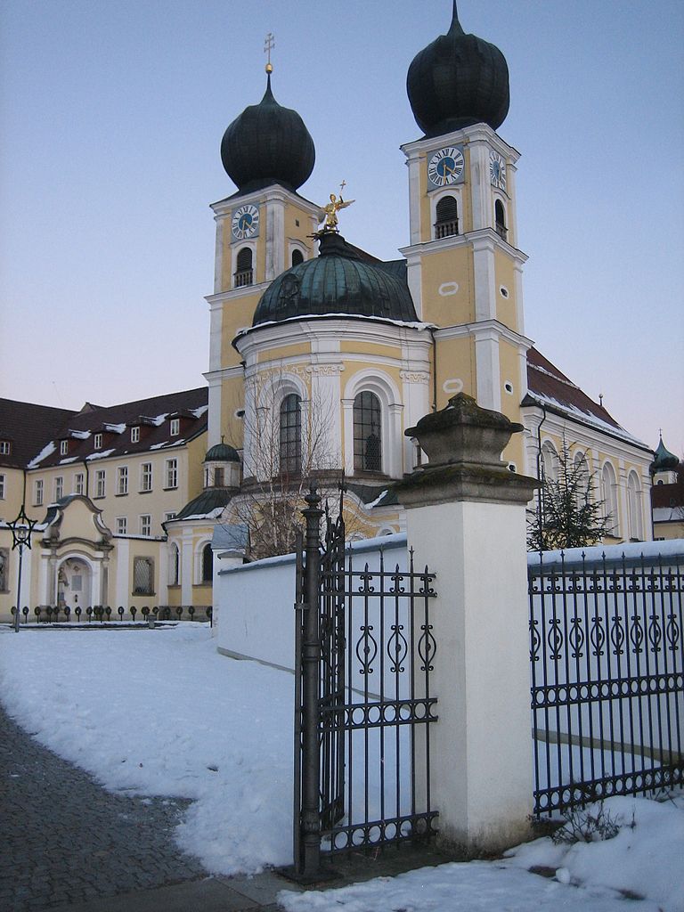
Niederalteich
- municipality of Germany
Hiking in Niederalteich
Niederalteich is a picturesque village in Bavaria, Germany, located in the scenic region of the Danube Valley. It offers a serene environment ideal for hiking enthusiasts who appreciate both nature and culture....
- Country:
- Postal Code: 94557
- Local Dialing Code: 09901
- Licence Plate Code: DEG
- Coordinates: 48° 46' 0" N, 13° 1' 0" E
- GPS tracks (wikiloc): [Link]
- AboveSeaLevel: 312 м m
- Area: 9.97 sq km
- Population: 1802
- Web site: [Link]
Metten
- human settlement in Germany
Hiking in Metten
Metten is a charming town in Bavaria, Germany, known for its beautiful landscapes and outdoor activities, including hiking. The town is surrounded by lush forests, rolling hills, and the Danube River, making it an ideal location for nature lovers and hikers of all skill levels....
- Country:
- Postal Code: 94526
- Local Dialing Code: 0991
- Licence Plate Code: DEG
- Coordinates: 48° 52' 0" N, 12° 55' 0" E
- GPS tracks (wikiloc): [Link]
- AboveSeaLevel: 318 м m
- Area: 11.95 sq km
- Population: 4191
- Web site: [Link]

Grattersdorf
- municipality of Germany
Hiking in Grattersdorf
Grattersdorf, a small village in Bavaria, Germany, is situated in a scenic area ideal for hiking enthusiasts. Here are some features to consider if you're planning a hike in this picturesque region:...
- Country:
- Postal Code: 94551; 94541
- Local Dialing Code: 09904
- Licence Plate Code: DEG
- Coordinates: 48° 48' 0" N, 13° 9' 0" E
- GPS tracks (wikiloc): [Link]
- AboveSeaLevel: 476 м m
- Area: 25.98 sq km
- Population: 1258
- Web site: [Link]

Offenberg
- municipality of Germany
Hiking in Offenberg
Offenberg is a small town located in Bavaria, Germany, known for its beautiful landscapes and outdoor activities, including hiking. Here are some highlights about hiking in that area:...
- Country:
- Postal Code: 94560
- Local Dialing Code: 09906; 09962; 09905; 0991
- Licence Plate Code: DEG
- Coordinates: 48° 52' 0" N, 12° 52' 0" E
- GPS tracks (wikiloc): [Link]
- AboveSeaLevel: 346 м m
- Area: 23.76 sq km
- Population: 3258
- Web site: [Link]

Plattling
- human settlement in Germany
Hiking in Plattling
Plattling, located in Bavaria, Germany, is a charming town that serves as an excellent base for hikers looking to explore the beautiful landscapes of the surrounding region. Nestled along the banks of the Danube River, it offers access to diverse trails suitable for various skill levels. Here are some key points about hiking in and around Plattling:...
- Country:
- Postal Code: 94447
- Local Dialing Code: 09931
- Licence Plate Code: DEG
- Coordinates: 48° 46' 36" N, 12° 52' 25" E
- GPS tracks (wikiloc): [Link]
- AboveSeaLevel: 318 м m
- Area: 35.9 sq km
- Population: 12428
- Web site: [Link]
Lalling
- municipality of Germany
Hiking in Lalling
Lalling, located in Bavaria, Germany, offers a variety of beautiful hiking opportunities, characterized by its stunning landscapes, lush forests, and picturesque surroundings. Here are some highlights for hiking in Lalling:...
- Country:
- Postal Code: 94551
- Local Dialing Code: 09904
- Licence Plate Code: DEG
- Coordinates: 48° 51' 0" N, 13° 8' 0" E
- GPS tracks (wikiloc): [Link]
- AboveSeaLevel: 446 м m
- Area: 27.92 sq km
- Population: 1541
- Web site: [Link]

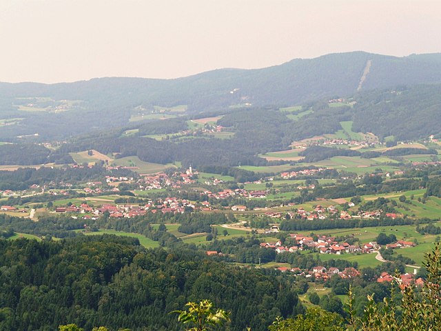
Grafling
- municipality of Germany
Hiking in Grafling
Hiking in Grafling, located in Bavaria, Germany, offers a variety of scenic trails and beautiful landscapes, making it an excellent destination for outdoor enthusiasts. Here are some highlights and tips for hiking in the area:...
- Country:
- Postal Code: 94539
- Local Dialing Code: 0991
- Licence Plate Code: DEG
- Coordinates: 48° 53' 40" N, 12° 58' 30" E
- GPS tracks (wikiloc): [Link]
- AboveSeaLevel: 433 м m
- Area: 46.32 sq km
- Population: 2738
- Web site: [Link]

Hengersberg
- human settlement in Germany
Hiking in Hengersberg
Hengersberg is located in the Bavarian Forest region of Germany, which offers a variety of hiking opportunities amid picturesque landscapes and diverse natural surroundings. Here are some highlights you might appreciate while hiking in Hengersberg:...
- Country:
- Postal Code: 94491
- Local Dialing Code: 09901
- Licence Plate Code: DEG
- Coordinates: 48° 47' 0" N, 13° 3' 0" E
- GPS tracks (wikiloc): [Link]
- AboveSeaLevel: 311 м m
- Area: 45.81 sq km
- Population: 7190
- Web site: [Link]
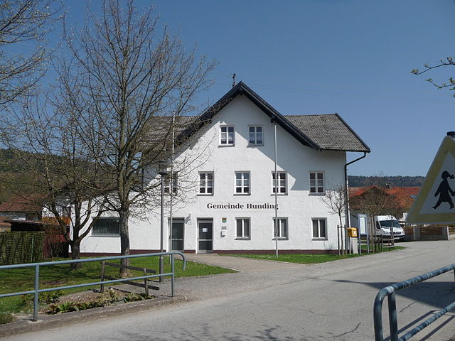
Hunding
- municipality of Germany
Hiking in Hunding
It appears that "Hunding" may refer to a specific location that isn't widely recognized or perhaps has a different name more commonly used. However, if you meant to ask about hiking in a general area known for its outdoor activities, I can provide you with some tips and recommendations based on popular hiking destinations....
- Country:
- Postal Code: 94551
- Local Dialing Code: 09904
- Licence Plate Code: DEG
- Coordinates: 48° 51' 0" N, 13° 11' 0" E
- GPS tracks (wikiloc): [Link]
- AboveSeaLevel: 468 м m
- Area: 14.67 sq km
- Population: 1171
- Web site: [Link]

Wallerfing
- municipality of Germany
Hiking in Wallerfing
Wallerfing is a small village located in Bavaria, Germany, known for its scenic countryside and natural beauty, making it a great destination for hiking enthusiasts. While it may not be as popular as other destinations, the area around Wallerfing offers a variety of hiking trails that allow you to experience the picturesque landscape, local flora and fauna, and quaint villages....
- Country:
- Postal Code: 94574
- Local Dialing Code: 09936
- Licence Plate Code: DEG
- Coordinates: 48° 41' 0" N, 12° 53' 0" E
- GPS tracks (wikiloc): [Link]
- AboveSeaLevel: 357 м m
- Area: 20.76 sq km
- Population: 1350
- Web site: [Link]
Shares border with regions:
Rottal-Inn
- district of Bavaria, Germany
Hiking in Rottal-Inn
Rottal-Inn, located in Bavaria, Germany, is a picturesque area known for its natural beauty and diverse landscapes, making it an excellent destination for hiking enthusiasts. The region is characterized by rolling hills, lush forests, and charming villages, providing a variety of hiking trails suitable for all skill levels. Here are some highlights to consider when hiking in Rottal-Inn:...
- Country:
- Capital: Pfarrkirchen
- Licence Plate Code: PAN; VIB; GRI; EG
- Coordinates: 48° 25' 12" N, 12° 55' 12" E
- GPS tracks (wikiloc): [Link]
- AboveSeaLevel: 461 м m
- Area: 1.28 sq km
- Population: 104013
- Web site: [Link]


Dingolfing-Landau
- district in Bavaria, Germany
Hiking in Dingolfing-Landau
Dingolfing-Landau, located in Bavaria, Germany, offers a variety of hiking opportunities for enthusiasts of all levels. The region is known for its picturesque landscapes, charming villages, and diverse flora and fauna. Here are some highlights of hiking in Dingolfing-Landau:...
- Country:
- Capital: Dingolfing
- Licence Plate Code: DGF
- Coordinates: 48° 40' 12" N, 12° 34' 48" E
- GPS tracks (wikiloc): [Link]
- AboveSeaLevel: 372 м m
- Area: 878.00 sq km
- Population: 75517
- Web site: [Link]
Straubing-Bogen
- district of Bavaria, Germany
Hiking in Straubing-Bogen
Straubing-Bogen is a beautiful district located in Bavaria, Germany, known for its picturesque landscapes and varied terrain, making it a great destination for hiking enthusiasts. Here are some highlights and tips for hiking in the region:...
- Country:
- Capital: Straubing
- Licence Plate Code: MAL; BOG; SR
- Coordinates: 48° 55' 12" N, 12° 34' 48" E
- GPS tracks (wikiloc): [Link]
- AboveSeaLevel: 337 м m
- Area: 1202.24 sq km
- Population: 81062
- Web site: [Link]
Regen district
- district in Bavaria, Germany
Hiking in Regen district
Hiking in the Regen district, located in Bavaria, Germany, offers a stunning blend of natural beauty, cultural attractions, and outdoor adventure. The region is known for its picturesque landscapes, featuring lush forests, rolling hills, and the scenic Danube and Regen rivers. Here are some highlights and tips for hiking in this area:...
- Country:
- Capital: Regen
- Licence Plate Code: REG
- Coordinates: 49° 0' 0" N, 13° 10' 12" E
- GPS tracks (wikiloc): [Link]
- AboveSeaLevel: 686 м m
- Area: 975.00 sq km
- Population: 76135
- Web site: [Link]
Freyung-Grafenau
- district in Bavaria, Germany
Hiking in Freyung-Grafenau
Freyung-Grafenau is a beautiful district located in Bavaria, Germany, known for its stunning landscapes, dense forests, and rugged terrain, making it a great destination for hiking enthusiasts. Here are some highlights and trails to consider when hiking in the area:...
- Country:
- Capital: Freyung
- Licence Plate Code: WOS; GRA; FRG
- Coordinates: 48° 49' 48" N, 13° 30' 0" E
- GPS tracks (wikiloc): [Link]
- AboveSeaLevel: 693 м m
- Area: 984.00 sq km
- Population: 75564
- Web site: [Link]

Passau
- district of Bavaria, Germany
Hiking in Passau
Hiking in the Passau district, located in the southeast of Bavaria, Germany, offers an array of scenic trails and beautiful landscapes characterized by hills, forests, rivers, and charming villages. The Passau area is known for its impressive natural beauty, making it a great destination for hikers of all experience levels. Below are some highlights of hiking in the region:...
- Country:
- Capital: Passau
- Licence Plate Code: PA
- Coordinates: 48° 30' 0" N, 13° 19' 48" E
- GPS tracks (wikiloc): [Link]
- AboveSeaLevel: 364 м m
- Area: 1530.04 sq km
- Population: 162355
- Web site: [Link]
Deggendorf
- town in Bavaria, Germany
Hiking in Deggendorf
Deggendorf, located in the picturesque Bavaria region of Germany, offers a variety of hiking opportunities that are appealing to both novice and experienced hikers. The area is known for its scenic landscapes, including rolling hills, lush forests, and stunning views of the Danube River and the surrounding Bavarian countryside....
- Country:
- Postal Code: 94469
- Local Dialing Code: 0991
- Licence Plate Code: DEG
- Coordinates: 48° 50' 41" N, 12° 57' 30" E
- GPS tracks (wikiloc): [Link]
- AboveSeaLevel: 323 м m
- Area: 77.21 sq km
- Population: 31757
- Web site: [Link]