Kervignac (Kervignac)

- commune in Morbihan, France
- Country:

- Postal Code: 56700
- Coordinates: 47° 45' 48" N, 3° 14' 20" E


- GPS tracks (wikiloc): [Link]
- Area: 39.56 sq km
- Population: 6559
- Web site: http://www.kervignac.fr
- Wikipedia en: wiki(en)
- Wikipedia: wiki(fr)
- Wikidata storage: Wikidata: Q71679
- Wikipedia Commons Category: [Link]
- Freebase ID: [/m/03c5nk_]
- GeoNames ID: Alt: [3011506]
- SIREN number: [215600941]
- BnF ID: [152653443]
- VIAF ID: Alt: [243218228]
- PACTOLS thesaurus ID: [pcrtSqcJgg14Mi]
- INSEE municipality code: 56094
Shares border with regions:


Brandérion
- commune in Morbihan, France
- Country:
- Postal Code: 56700
- Coordinates: 47° 47' 37" N, 3° 11' 41" E
- GPS tracks (wikiloc): [Link]
- Area: 6.03 sq km
- Population: 1419
- Web site: [Link]


Nostang
- commune in Morbihan, France
- Country:
- Postal Code: 56690
- Coordinates: 47° 44' 59" N, 3° 11' 16" E
- GPS tracks (wikiloc): [Link]
- Area: 15.71 sq km
- Population: 1512
- Web site: [Link]


Locmiquélic
- commune in Morbihan, France
- Country:
- Postal Code: 56570
- Coordinates: 47° 43' 31" N, 3° 20' 27" E
- GPS tracks (wikiloc): [Link]
- Area: 3.58 sq km
- Population: 4098
- Web site: [Link]

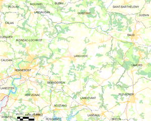
Languidic
- commune in Morbihan, France
- Country:
- Postal Code: 56440
- Coordinates: 47° 50' 0" N, 3° 9' 28" E
- GPS tracks (wikiloc): [Link]
- Area: 109.08 sq km
- Population: 7772
- Web site: [Link]

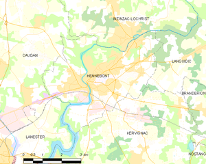
Hennebont
- commune in Morbihan, France
- Country:
- Postal Code: 56700
- Coordinates: 47° 48' 15" N, 3° 16' 44" E
- GPS tracks (wikiloc): [Link]
- AboveSeaLevel: 5 м m
- Area: 18.57 sq km
- Population: 15489
- Web site: [Link]


Lanester
- commune in Morbihan, France
- Country:
- Postal Code: 56600
- Coordinates: 47° 45' 48" N, 3° 20' 20" E
- GPS tracks (wikiloc): [Link]
- AboveSeaLevel: 5 м m
- Area: 18.37 sq km
- Population: 22095
- Web site: [Link]

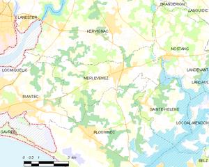
Merlevenez
- commune in Morbihan, France
- Country:
- Postal Code: 56700
- Coordinates: 47° 44' 12" N, 3° 14' 1" E
- GPS tracks (wikiloc): [Link]
- Area: 17.67 sq km
- Population: 3193
- Web site: [Link]