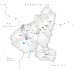
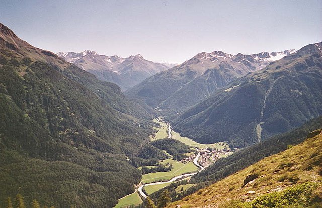
Klosters (Klosters-Serneus)
- municipality in Switzerland
Klosters, located in the Swiss Alps near the popular ski resort of Davos, is a beautiful destination for hiking enthusiasts. Here’s an overview of what you can expect while hiking in this wonderful area:
Scenic Trails
Klosters offers a variety of hiking trails catering to all levels of experience, from easy walks suitable for families to challenging alpine hikes. Some popular trails include:
- Prättigauer Höhenweg: A panoramic trail that provides stunning views of the surrounding mountains and valleys.
- Schwarzsee and Gotschnagrat: This trail takes you to the breathtaking vistas over Klosters and beyond, perfect for photography enthusiasts.
- Zucchelliweg: A relatively easy and family-friendly trail that features beautiful wildflower meadows during the summer months.
Natural Beauty
The region around Klosters is known for its stunning landscapes, including lush forests, glistening lakes, and soaring peaks. Wildlife sightings are also common, with opportunities to see chamois, marmots, and a variety of bird species.
Seasonal Hiking
While summer is the prime hiking season, Klosters is also accessible in autumn when the foliage provides a colorful backdrop. In winter, certain trails are accessible for snowshoeing or winter hiking, along with skiing opportunities.
Accessibility
Klosters is easily accessible by public transport, with a train station connecting it to major cities like Zurich and Davos. Additionally, the local cable cars make reaching higher altitudes easier, allowing hikers to enjoy more elevated views without a strenuous ascent.
Safety and Preparedness
Always check the weather before heading out, as alpine conditions can change rapidly. Ensure you have the right gear, including sturdy hiking boots, appropriate clothing, and sufficient water and food supplies. It’s also wise to carry a map or have a reliable GPS device.
Local Amenities
Klosters offers various accommodations, from charming hotels to mountain lodges. After a day of hiking, you can enjoy local Swiss cuisine in one of the town's restaurants or relax in a cozy cafe.
Guided Tours
If you're new to the area or prefer a more structured experience, consider joining guided hikes offered by local companies. These can provide valuable insights into the region's flora, fauna, and culture.
Conclusion
Hiking in Klosters can be an unforgettable experience, combining breathtaking natural beauty with a range of trails for everyone. Whether you’re looking for a leisurely stroll or a challenging trek, Klosters has something to offer for all hiking enthusiasts. Always ensure to follow local trail guidelines and respect the natural environment. Enjoy your hike!
- Country:

- Postal Code: 7250
- Local Dialing Code: 081
- Licence Plate Code: GR
- Coordinates: 46° 53' 0" N, 9° 53' 0" E


- GPS tracks (wikiloc): [Link]
- AboveSeaLevel: 1342 м m
- Area: 193.10 sq km
- Population: 4437
- Web site: http://www.klosters-serneus.ch
- Wikipedia en: wiki(en)
- Wikipedia: wiki(de)
- Wikidata storage: Wikidata: Q68236
- Wikipedia Commons Category: [Link]
- Freebase ID: [/m/088mb_]
- GeoNames ID: Alt: [7286209]
- VIAF ID: Alt: [157205668]
- OSM relation ID: [5817235]
- archINFORM location ID: [3628]
- Library of Congress authority ID: Alt: [n88027447]
- MusicBrainz area ID: [b272351f-7e82-4330-9f09-433a989d476f]
- Quora topic ID: [Klosters]
- HDS ID: [1575]
- Facebook Places ID: [110447052318140]
- Swiss municipality code: [3871]
Shares border with regions:


Arosa
- resort in the canton of Graubünden, Switzerland
Arosa is a beautiful alpine resort located in Switzerland, renowned for its stunning landscapes, diverse trails, and welcoming atmosphere for hikers of all skill levels. Here’s an overview of hiking in Arosa:...
- Country:

- Postal Code: 7050
- Local Dialing Code: 081
- Licence Plate Code: GR
- Coordinates: 46° 46' 0" N, 9° 40' 1" E


- GPS tracks (wikiloc): [Link]
- AboveSeaLevel: 2003 м m
- Area: 42.53 sq km
- Population: 3185
- Web site: [Link]


Saas
- municipality in Switzerland
Saas im Prättigau is a fantastic destination for hiking enthusiasts, nestled in the stunning Prättigau region of the Swiss Alps. Here are some key points to consider about hiking in this area:...
- Country:

- Postal Code: 7247
- Local Dialing Code: 081
- Licence Plate Code: GR
- Coordinates: 46° 54' 59" N, 9° 47' 59" E


- GPS tracks (wikiloc): [Link]
- AboveSeaLevel: 988 м m
- Area: 26.71 sq km
- Web site: [Link]


Conters im Prättigau
- municipality in Switzerland
 Hiking in Conters im Prättigau
Conters im Prättigau is a charming village located in the Graubünden region of Switzerland, surrounded by stunning natural landscapes and offering various hiking opportunities. Here are some key points to consider when planning your hiking adventure in and around Conters:...
- Country:

- Postal Code: 7241
- Local Dialing Code: 081
- Licence Plate Code: GR
- Coordinates: 46° 53' 59" N, 9° 47' 0" E


- GPS tracks (wikiloc): [Link]
- AboveSeaLevel: 1110 м m
- Area: 18.40 sq km
- Population: 225
- Web site: [Link]


Lavin
- former municipality of Switzerland
Lavin, a picturesque village in the Lower Engadine region of Switzerland, offers a stunning backdrop for hikers. Nestled in the Swiss Alps, it provides access to a variety of trails that cater to all skill levels. The region is known for its breathtaking landscapes, including lush valleys, scenic mountain views, and charming alpine architecture....
- Country:

- Postal Code: 7543
- Local Dialing Code: 081
- Licence Plate Code: GR
- Coordinates: 46° 46' 3" N, 10° 6' 38" E


- GPS tracks (wikiloc): [Link]
- AboveSeaLevel: 2140 м m
- Area: 46.26 sq km
- Web site: [Link]


Susch
- former municipality of Switzerland
Susch, a picturesque village located in the Lower Engadine region of Switzerland, offers a range of hiking opportunities that showcase its stunning alpine scenery and cultural heritage. Here are some things to know about hiking in Susch:...
- Country:

- Postal Code: 7542
- Local Dialing Code: 081
- Licence Plate Code: GR
- Coordinates: 46° 45' 3" N, 10° 1' 20" E


- GPS tracks (wikiloc): [Link]
- AboveSeaLevel: 1856 м m
- Area: 93.93 sq km
- Web site: [Link]


Davos
- Swiss municipality in the Grisons
Davos, located in the Swiss Alps, is renowned for its stunning landscapes and extensive hiking trails, making it a popular destination for outdoor enthusiasts. Here are some key points to consider when hiking in Davos:...
- Country:

- Postal Code: 7272 Davos Clavadel; 7294 Davos Wiesen; 7278; 7277; 7276; 7270 Davos Platz; 7260 Davos Dorf; 7265 Davos Wolfgang
- Local Dialing Code: 081
- Licence Plate Code: GR
- Coordinates: 46° 48' 17" N, 9° 50' 14" E


- GPS tracks (wikiloc): [Link]
- AboveSeaLevel: 1563 м m
- Area: 284 sq km
- Population: 10937
- Web site: [Link]
