Alvaschein (Kreis Alvaschein)

- subdistrict in the canton of Graubünden, Switzerland
 Hiking in Alvaschein
Kreis Alvaschein, located in the canton of Graubünden in Switzerland, offers a stunning array of hiking opportunities for outdoor enthusiasts. The region is characterized by its beautiful landscapes, including picturesque valleys, rugged mountains, and lush forests. Here are some key highlights and tips for hiking in this area:
Trails and Landscapes
-
Variety of Trails: There are numerous marked trails ranging from easy walks suitable for families to challenging hikes for experienced adventurers. Always check local maps and signage for trail difficulty levels.
-
Natural Beauty: Hiking in Kreis Alvaschein allows you to experience the diverse flora and fauna of the Swiss Alps. Keep an eye out for local wildlife and unique alpine plants.
-
Scenic Views: Many trails offer breathtaking views of the surrounding mountains, valleys, and lakes. Notable viewpoints provide excellent opportunities for photography, especially during sunrise and sunset.
Popular Hiking Routes
-
Alvaschein to Bergün: A popular trail that connects the two villages, offering beautiful scenery along the way. It’s a fairly moderate hike with manageable elevation changes.
-
Valley of Arosa: A bit further afield, the Arosa region is easily accessible and provides numerous hiking options with well-marked trails.
-
Mount Piz Scalottas: For those looking for a challenge, consider a hike towards Piz Scalottas, where you can enjoy stunning panoramic views at the summit.
Tips for Hiking in Kreis Alvaschein
-
Seasonal Considerations: The best time to hike in this area is typically between late spring and early autumn. Be cautious of snow and ice conditions in early spring or late fall.
-
Prepare Accordingly: Bring plenty of water, snacks, weather-appropriate clothing, and a good pair of hiking shoes. Weather can change quickly in the mountains.
-
Respect Nature: Stay on marked trails to protect the local habitat and carry out whatever you bring in to keep the area clean.
-
Local Information: Check in with local tourism offices or hiking clubs for the latest trail updates, maps, and guided hiking options.
-
Navigation Tools: While many trails are well-marked, carrying a physical map or GPS device can be very helpful, especially in less trafficked areas.
Whether you are looking for a short day hike or a prolonged trek into the beautiful Swiss landscapes, Kreis Alvaschein has plenty to offer for all skill levels! Enjoy your adventure!
- Country:

- Wikidata storage: Wikidata: Q448577
- Wikipedia Commons Category: [Link]
Includes regions:
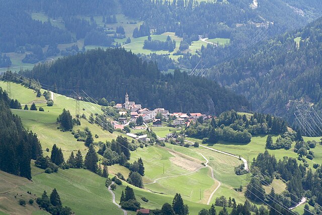

Alvaschein
- former municipality of Switzerland
Hiking in Alvaschein
Alvaschein is a picturesque village located in the canton of Graubünden in Switzerland, surrounded by stunning alpine landscapes. It serves as an excellent base for hiking enthusiasts looking to explore the natural beauty of the region....
- Country:
- Postal Code: 7451
- Local Dialing Code: 081
- Licence Plate Code: GR
- Coordinates: 46° 39' 59" N, 9° 32' 59" E


- GPS tracks (wikiloc): [Link]
- AboveSeaLevel: 1001 м m
- Area: 4.08 sq km
- Web site: [Link]


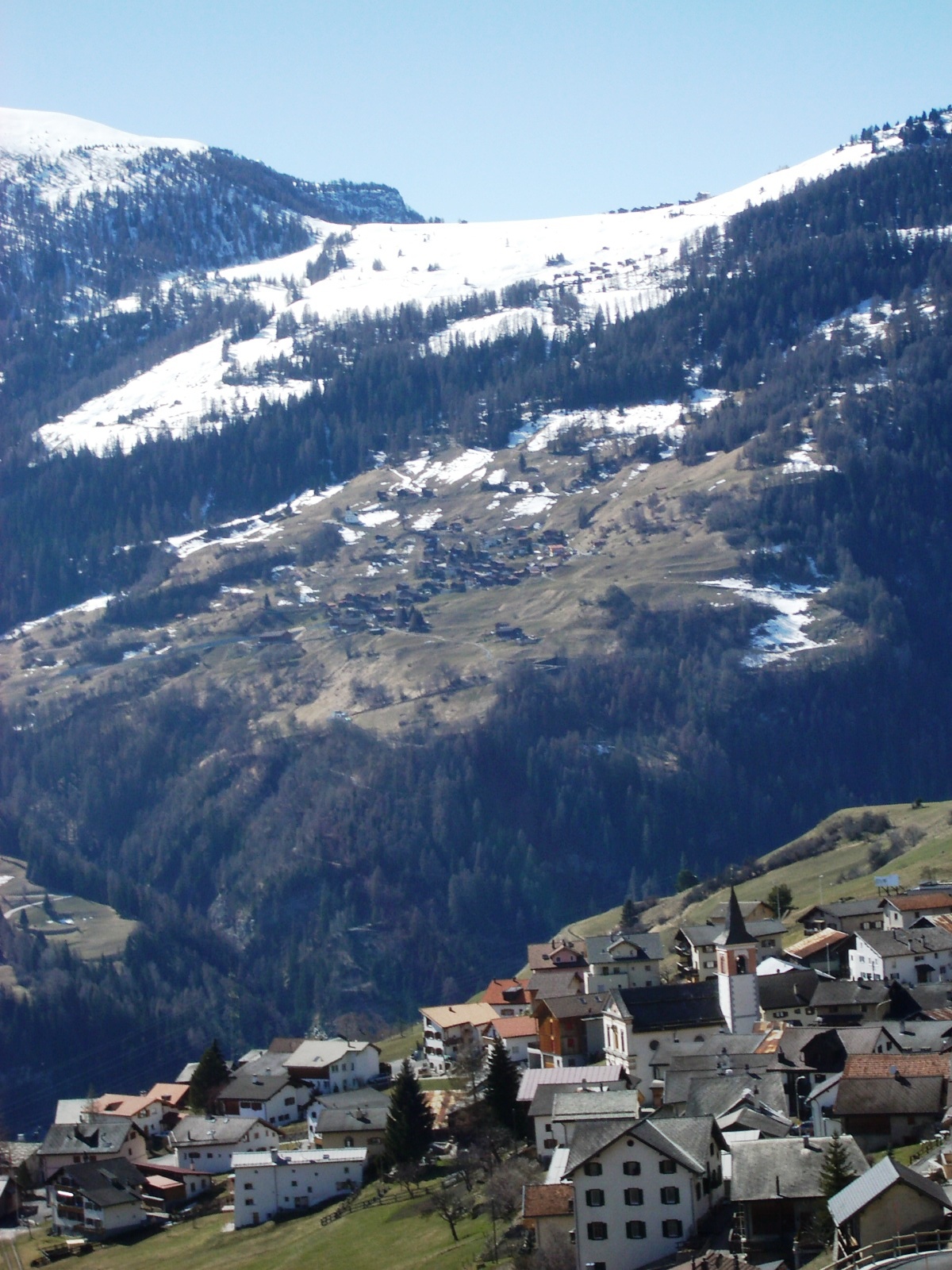
Tiefencastel
- former municipality of Switzerland
Hiking in Tiefencastel
Tiefencastel is a small village located in the beautiful region of Graubünden in Switzerland, known for its stunning landscapes and excellent hiking opportunities. Here’s an overview of what to expect when hiking in and around Tiefencastel:...
- Country:
- Postal Code: 7450
- Local Dialing Code: 081
- Licence Plate Code: GR
- Coordinates: 46° 38' 42" N, 9° 36' 47" E
- GPS tracks (wikiloc): [Link]
- AboveSeaLevel: 1716 м m
- Area: 14.85 sq km
- Web site: [Link]

Vaz/Obervaz
- municipality in Switzerland
Hiking in Vaz/Obervaz
Vaz Obervaz, also known simply as Vaz, is a charming municipality located in the Grisons (Graubünden) region of Switzerland. It's a great destination for hiking enthusiasts due to its stunning landscapes, diverse trails, and access to the surrounding mountains....
- Country:
- Postal Code: 7082
- Local Dialing Code: 081
- Licence Plate Code: GR
- Coordinates: 46° 42' 59" N, 9° 33' 0" E
- GPS tracks (wikiloc): [Link]
- AboveSeaLevel: 1300 м m
- Area: 42.51 sq km
- Population: 2630
- Web site: [Link]


Mutten
- municipality in Graubünden, Switzerland
Hiking in Mutten
Mutten is a small, picturesque village in the Swiss Graubünden region, renowned for its stunning natural beauty and peace. For hiking enthusiasts, it offers various trails that cater to different skill levels, showcasing breathtaking alpine landscapes, lush meadows, and stunning vistas....
- Country:
- Postal Code: 7431
- Local Dialing Code: 081
- Licence Plate Code: GR
- Coordinates: 46° 40' 16" N, 9° 29' 32" E
- GPS tracks (wikiloc): [Link]
- AboveSeaLevel: 1708 м m
- Area: 9.30 sq km
- Population: 61
- Web site: [Link]
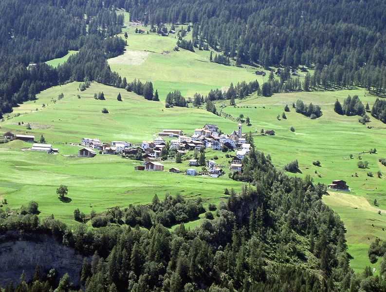

Stierva
- former municipality of Switzerland
Hiking in Stierva
Stierva, a picturesque village located in the heart of the Swiss Alps, offers a stunning array of hiking opportunities for outdoor enthusiasts. Nestled within the Graubünden region, Stierva is known for its breathtaking landscapes, diverse terrain, and rich natural beauty. Here are some key points to consider when hiking in and around Stierva:...
- Country:
- Postal Code: 7459
- Local Dialing Code: 081
- Licence Plate Code: GR
- Coordinates: 46° 38' 59" N, 9° 32' 0" E
- GPS tracks (wikiloc): [Link]
- AboveSeaLevel: 1375 м m
- Area: 10.56 sq km
- Web site: [Link]
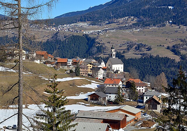

Mon
- municipality in Graubünden, Switzerland
Hiking in Mon
Hiking in Mon, Switzerland, offers a stunning experience amidst breathtaking alpine scenery. Mon is located in the Valais region, which is known for its majestic mountains, picturesque villages, and rich cultural heritage. Here are some key points to consider when planning a hike in this beautiful region:...
- Country:
- Postal Code: 7458
- Local Dialing Code: 081
- Licence Plate Code: GR
- Coordinates: 46° 39' 0" N, 9° 33' 0" E
- GPS tracks (wikiloc): [Link]
- AboveSeaLevel: 1231 м m
- Area: 8.46 sq km