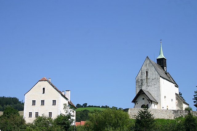
Krumbach (Krumbach)
- municipality in Lower Austria, Austria
Krumbach, located in Lower Austria, offers a picturesque setting for hiking enthusiasts. The region is characterized by its rolling hills, lush forests, and open spaces, making it ideal for various types of hikes, from leisurely walks to more challenging trails.
Hiking Trails in Krumbach
-
Local Trails: There are numerous well-marked hiking trails in and around Krumbach. These trails often showcase stunning natural landscapes and may pass by cultural landmarks such as quaint villages, farms, or historic sites.
-
Forest Trails: The forests surrounding Krumbach offer shaded paths that are perfect for warmer days. These trails can be explored by families and casual hikers.
-
Scenic Views: Many trails provide elevated viewpoints where you can admire the beautiful countryside, vineyards, and nearby hills. It's a great opportunity for photography and appreciating the natural beauty of Lower Austria.
-
Guided Tours: If you prefer a more structured experience, look for local hiking guides who offer organized hikes. They can provide insight into the flora, fauna, and history of the region.
Preparation and Safety
-
Trail Maps: Always carry a map or use a hiking app to help navigate the trails, as some paths may not be well-marked.
-
Equipment: Wear sturdy hiking boots and weather-appropriate clothing. Bringing trekking poles can also be advantageous, especially on uneven terrain.
-
Water and Snacks: Stay hydrated and bring some snacks to keep your energy up during your hike.
-
Weather Considerations: Check the weather forecast before heading out, as conditions can change rapidly in mountainous areas.
Additional Activities
While hiking is a primary attraction, Krumbach also offers opportunities for cycling, exploring local cuisine at nearby restaurants, and visiting local attractions if you want to take a break from hiking.
Overall, Krumbach is an excellent destination for nature lovers and those seeking outdoor adventures. Enjoy your time in the beautiful landscapes of Lower Austria!
- Country:

- Local Dialing Code: 02647
- Licence Plate Code: WB
- Coordinates: 47° 31' 27" N, 16° 11' 31" E


- GPS tracks (wikiloc): [Link]
- AboveSeaLevel: 533 м m
- Area: 43.91 sq km
- Population: 2316
- Web site: http://www.krumbach-noe.at/
- Wikipedia en: wiki(en)
- Wikipedia: wiki(de)
- Wikidata storage: Wikidata: Q695232
- Wikipedia Commons Category: [Link]
- Freebase ID: [/m/04d3zv]
- GeoNames ID: Alt: [7871935]
- Austrian municipality key: [32315]
Shares border with regions:

Zöbern
- municipality in Austria
Zöbern is a charming village located in the state of Lower Austria, surrounded by beautiful landscapes, rolling hills, and diverse natural habitats. Hiking in and around Zöbern offers a great opportunity to explore the scenic beauty and tranquility of the region....
- Country:

- Postal Code: 2851, 2852, 2870, 2871, 8244
- Local Dialing Code: 02642
- Licence Plate Code: NK
- Coordinates: 47° 30' 0" N, 16° 7' 0" E


- GPS tracks (wikiloc): [Link]
- AboveSeaLevel: 591 м m
- Area: 31.56 sq km
- Population: 1423
- Web site: [Link]

Kirchschlag in der Buckligen Welt
- municipality in Austria
 Hiking in Kirchschlag in der Buckligen Welt
Kirchschlag in der Buckligen Welt is a beautiful area located in Austria, known for its picturesque landscapes, rolling hills, and extensive hiking opportunities. This region is particularly appealing to outdoor enthusiasts and nature lovers....
- Country:

- Local Dialing Code: 02646
- Licence Plate Code: WB
- Coordinates: 47° 30' 0" N, 16° 17' 0" E


- GPS tracks (wikiloc): [Link]
- AboveSeaLevel: 417 м m
- Area: 57.97 sq km
- Population: 2889
- Web site: [Link]
Thomasberg
- municipality in Austria
Thomasberg is a beautiful area for hiking, particularly known for its scenic views, diverse terrain, and the opportunity to connect with nature. Here are some key highlights and tips for hiking in this region:...
- Country:

- Local Dialing Code: 02644
- Licence Plate Code: NK
- Coordinates: 47° 34' 0" N, 16° 8' 0" E


- GPS tracks (wikiloc): [Link]
- AboveSeaLevel: 541 м m
- Area: 28.99 sq km
- Population: 1284
- Web site: [Link]

Lichtenegg
- municipality in Austria
Lichtenegg, located in Austria, is a beautiful area that offers a variety of hiking trails suitable for different skill levels. Here are some key points to consider if you're planning a hiking trip in Lichtenegg:...
- Country:

- Local Dialing Code: 02643
- Licence Plate Code: WB
- Coordinates: 47° 36' 0" N, 16° 12' 0" E


- GPS tracks (wikiloc): [Link]
- AboveSeaLevel: 770 м m
- Area: 35.4 sq km
- Population: 1034
- Web site: [Link]

Bad Schönau
- municipality in Austria
Bad Schönau is a charming spa town located in the foothills of the eastern Alps in Austria, offering beautiful landscapes and a variety of hiking trails. The region is known for its lush forests, rolling hills, and scenic views, making it an excellent destination for outdoor enthusiasts. Here are some highlights for hiking in Bad Schönau:...
- Country:

- Postal Code: 2853
- Local Dialing Code: 02646
- Licence Plate Code: WB
- Coordinates: 47° 29' 0" N, 16° 14' 0" E


- GPS tracks (wikiloc): [Link]
- AboveSeaLevel: 490 м m
- Area: 13.58 sq km
- Population: 721
- Web site: [Link]
Hochneukirchen-Gschaidt
- municipality in Austria
 Hiking in Hochneukirchen-Gschaidt
Hochneukirchen-Gschaidt, located in Lower Austria, offers a beautiful setting for hiking enthusiasts with its picturesque landscapes, rolling hills, and diverse natural environments. Here are some highlights and tips for hiking in this area:...
- Country:

- Postal Code: 2852
- Local Dialing Code: 02648
- Licence Plate Code: WB
- Coordinates: 47° 27' 0" N, 16° 12' 0" E


- GPS tracks (wikiloc): [Link]
- AboveSeaLevel: 769 м m
- Area: 35.13 sq km
- Population: 1633
- Web site: [Link]