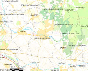
L'Isle-sur-la-Sorgue (L'Isle-sur-la-Sorgue)
- commune in Vaucluse, France
 Hiking in L'Isle-sur-la-Sorgue
L'Isle-sur-la-Sorgue is a picturesque town located in the Provence-Alpes-Côte d'Azur region of France, renowned for its beautiful canals, charming antique shops, and vibrant markets. While it is mostly known for its cultural and historical significance, it also offers various opportunities for hiking and enjoying the natural landscape.
Hiking Opportunities Around L'Isle-sur-la-Sorgue:
-
Local Trails: While L'Isle-sur-la-Sorgue itself is a small town, there are several trails that you can explore in the surrounding areas. The scenic paths along the Sorgue River provide a leisurely hiking experience, perfect for those looking to enjoy nature without straying too far from the town center.
-
Mont Ventoux: About an hour’s drive from L'Isle-sur-la-Sorgue, Mont Ventoux is a prominent hiking destination. It offers various trails with different difficulty levels. The views from the summit are spectacular, making it a rewarding hike for those looking for a more challenging adventure.
-
Vaucluse Regional Nature Park: This nearby park features a range of hiking opportunities through diverse landscapes, from cliffs to forests. The trails range from easy strolls to more strenuous hikes, accommodating various fitness levels.
-
Gorges de la Nesque: Located slightly further afield, this is another magnificent area for hiking, featuring dramatic cliffs and stunning views. The trails are well marked, with options for both short hikes and longer, more strenuous routes.
-
Historic and Cultural Walks: Some local trails incorporate cultural aspects, allowing hikers to appreciate the region's history, including old mills, historic bridges, and charming villages.
Tips for Hiking in the Area:
-
Best Time to Hike: Spring (April to June) and fall (September to October) are ideal seasons for hiking in the region, as the weather is pleasant and the landscapes are vibrant.
-
Preparation: Make sure to bring plenty of water, wear appropriate hiking shoes, and carry a map or GPS device. Some trails may not be well-signed, so having a reliable navigation tool is helpful.
-
Respect Nature: Follow Leave No Trace principles to preserve the natural beauty of the area. Stay on marked paths and respect wildlife.
Exploring the natural beauty surrounding L'Isle-sur-la-Sorgue can provide a lovely contrast to its cultural offerings, making it a great location for a mix of activities. Enjoy your hike!
- Country:

- Postal Code: 84800
- Coordinates: 43° 55' 10" N, 5° 3' 5" E


- GPS tracks (wikiloc): [Link]
- AboveSeaLevel: 246 м m
- Area: 44.57 sq km
- Population: 19483
- Web site: http://www.islesurlasorgue.fr
- Wikipedia en: wiki(en)
- Wikipedia: wiki(fr)
- Wikidata storage: Wikidata: Q504204
- Wikipedia Commons Gallery: [Link]
- Wikipedia Commons Category: [Link]
- Freebase ID: [/m/06rtk2]
- GeoNames ID: Alt: [2998127]
- SIREN number: [218400547]
- BnF ID: [15278034w]
- VIAF ID: Alt: [144321313]
- GND ID: Alt: [4192851-9]
- archINFORM location ID: [6844]
- Library of Congress authority ID: Alt: [n85307982]
- PACTOLS thesaurus ID: [pcrt4DgAUrOeA5]
- MusicBrainz area ID: [d06a5c2c-b968-4fe5-bedd-5fd3cca3befa]
- WOEID: [22756396]
- SUDOC authorities ID: [077154983]
- INSEE municipality code: 84054
Shares border with regions:


Cavaillon
- commune in Vaucluse, France
- Country:

- Postal Code: 84300
- Coordinates: 43° 50' 12" N, 5° 2' 14" E


- GPS tracks (wikiloc): [Link]
- Area: 45.96 sq km
- Population: 26707
- Web site: [Link]


Robion
- commune in Vaucluse, France
Robion, located in the Vaucluse department in southeastern France, is surrounded by the scenic landscapes of the Luberon Regional Natural Park, making it an excellent starting point for hiking enthusiasts. Here are a few key points about hiking in and around Robion:...
- Country:

- Postal Code: 84440
- Coordinates: 43° 50' 42" N, 5° 6' 46" E


- GPS tracks (wikiloc): [Link]
- Area: 17.7 sq km
- Population: 4393
- Web site: [Link]


La Roque-sur-Pernes
- commune in Vaucluse, France
La Roque-sur-Pernes is a picturesque village located in the Vaucluse department of the Provence-Alpes-Côte d'Azur region in France. The area is known for its stunning landscapes, rich history, and scenic hiking trails. Here are some key highlights and considerations for hiking in and around La Roque-sur-Pernes:...
- Country:

- Postal Code: 84210
- Coordinates: 43° 58' 44" N, 5° 6' 31" E


- GPS tracks (wikiloc): [Link]
- Area: 11.03 sq km
- Population: 417

Pernes-les-Fontaines
- commune in Vaucluse, France
 Hiking in Pernes-les-Fontaines
Pernes-les-Fontaines, located in the Vaucluse department in the Provence region of France, offers a variety of hiking opportunities. The area is characterized by its stunning natural landscapes, picturesque scenery, and rich cultural heritage. Here are some highlights for hiking in and around Pernes-les-Fontaines:...
- Country:

- Postal Code: 84210
- Coordinates: 43° 59' 52" N, 5° 3' 33" E


- GPS tracks (wikiloc): [Link]
- Area: 51.12 sq km
- Population: 9556
- Web site: [Link]
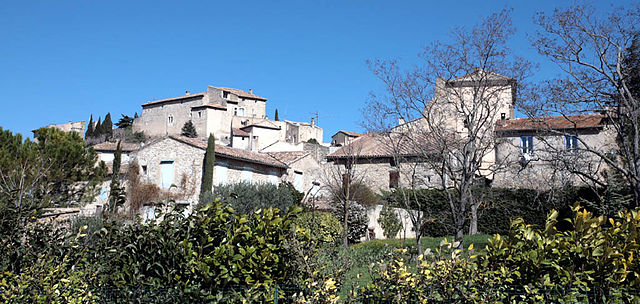
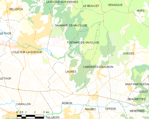
Lagnes
- commune in Vaucluse, France
Lagnes, located in the Vaucluse region of France, is a great destination for hiking enthusiasts. Nestled near the Luberon Mountains and close to the picturesque village of Gordes, Lagnes offers a variety of trails that showcase the natural beauty of the surrounding landscape....
- Country:

- Postal Code: 84800
- Coordinates: 43° 53' 36" N, 5° 6' 53" E


- GPS tracks (wikiloc): [Link]
- Area: 16.93 sq km
- Population: 1622
- Web site: [Link]

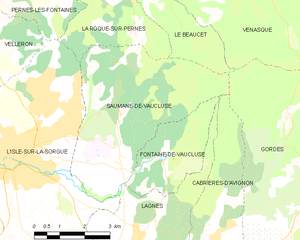
Saumane-de-Vaucluse
- commune in Vaucluse, France
Saumane-de-Vaucluse is a charming village located in the Vaucluse region of Provence, France. It's nestled in a picturesque landscape characterized by rolling hills, lavender fields, and impressive limestone cliffs, making it a fantastic spot for hiking enthusiasts....
- Country:

- Postal Code: 84800
- Coordinates: 43° 56' 11" N, 5° 6' 22" E


- GPS tracks (wikiloc): [Link]
- AboveSeaLevel: 140 м m
- Area: 20.81 sq km
- Population: 936

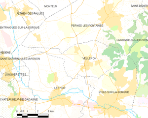
Velleron
- commune in Vaucluse, France
Velleron is a charming village located in the Provence region of France, not far from the picturesque town of L’Isle-sur-la-Sorgue. While Velleron itself may not be a major hiking destination, it offers beautiful landscapes and opportunities for outdoor activities in the surrounding areas....
- Country:

- Postal Code: 84740
- Coordinates: 43° 57' 27" N, 5° 1' 46" E


- GPS tracks (wikiloc): [Link]
- Area: 16.39 sq km
- Population: 2943
- Web site: [Link]


Le Thor
- commune in Vaucluse, France
- Country:

- Postal Code: 84250
- Coordinates: 43° 55' 45" N, 4° 59' 40" E


- GPS tracks (wikiloc): [Link]
- Area: 35.53 sq km
- Population: 8879
- Web site: [Link]
