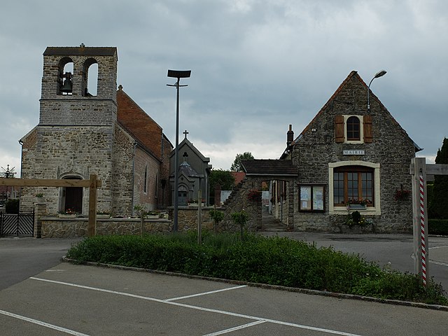
La Capelle-lès-Boulogne (La Capelle-lès-Boulogne)
- commune in Pas-de-Calais, France
- Country:

- Postal Code: 62360
- Coordinates: 50° 43' 52" N, 1° 42' 25" E


- GPS tracks (wikiloc): [Link]
- Area: 6.5 sq km
- Population: 1579
- Web site: http://www.capelle-les-boulogne.fr
- Wikipedia en: wiki(en)
- Wikipedia: wiki(fr)
- Wikidata storage: Wikidata: Q1031079
- Wikipedia Commons Category: [Link]
- Freebase ID: [/m/02z0c7_]
- GeoNames ID: Alt: [3010607]
- SIREN number: [216209080]
- BnF ID: [15269349s]
- OSM relation ID: [240366]
- INSEE municipality code: 62908
Shares border with regions:


Bellebrune
- commune in Pas-de-Calais, France
- Country:

- Postal Code: 62142
- Coordinates: 50° 43' 37" N, 1° 46' 28" E


- GPS tracks (wikiloc): [Link]
- Area: 5.32 sq km
- Population: 369


Belle-et-Houllefort
- commune in Pas-de-Calais, France
- Country:

- Postal Code: 62142
- Coordinates: 50° 44' 37" N, 1° 45' 31" E


- GPS tracks (wikiloc): [Link]
- Area: 9.14 sq km
- Population: 557


Conteville-lès-Boulogne
- commune in Pas-de-Calais, France
- Country:

- Postal Code: 62126
- Coordinates: 50° 44' 41" N, 1° 43' 54" E


- GPS tracks (wikiloc): [Link]
- Area: 2.1 sq km
- Population: 476
- Web site: [Link]


Baincthun
- commune in Pas-de-Calais, France
- Country:

- Postal Code: 62360
- Coordinates: 50° 42' 36" N, 1° 40' 49" E


- GPS tracks (wikiloc): [Link]
- Area: 26.69 sq km
- Population: 1293
- Web site: [Link]


Pernes-lès-Boulogne
- commune in Pas-de-Calais, France
- Country:

- Postal Code: 62126
- Coordinates: 50° 45' 7" N, 1° 42' 10" E


- GPS tracks (wikiloc): [Link]
- Area: 7.76 sq km
- Population: 448


Saint-Martin-Boulogne
- commune in Pas-de-Calais, France
- Country:

- Postal Code: 62280
- Coordinates: 50° 43' 33" N, 1° 37' 56" E


- GPS tracks (wikiloc): [Link]
- Area: 13.15 sq km
- Population: 11285
- Web site: [Link]
