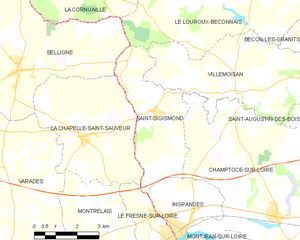
La Chapelle-Saint-Sauveur (La Chapelle-Saint-Sauveur)
- former commune in Loire-Atlantique, France
- Country:

- Postal Code: 44370
- Coordinates: 47° 26' 28" N, 0° 59' 11" E


- GPS tracks (wikiloc): [Link]
- Area: 18.7 sq km
- Population: 805
- Web site: http://www.lachapellesaintsauveur44.fr
- Wikipedia en: wiki(en)
- Wikipedia: wiki(fr)
- Wikidata storage: Wikidata: Q1115745
- Wikipedia Commons Category: [Link]
- Freebase ID: [/m/03nwcm3]
- Freebase ID: [/m/03nwcm3]
- GeoNames ID: Alt: [6456913]
- GeoNames ID: Alt: [6456913]
- BnF ID: [152602031]
- BnF ID: [152602031]
- VIAF ID: Alt: [247864703]
- VIAF ID: Alt: [247864703]
- Library of Congress authority ID: Alt: [no2018073179]
- Library of Congress authority ID: Alt: [no2018073179]
- INSEE municipality code: 44034
- INSEE municipality code: 44034
Shares border with regions:


Le Fresne-sur-Loire
- former commune in Loire-Atlantique, France
- Country:

- Postal Code: 49123
- Coordinates: 47° 24' 3" N, 0° 55' 42" E


- GPS tracks (wikiloc): [Link]
- Area: 6.29 sq km
- Population: 977
- Web site: [Link]


Saint-Sigismond
- commune in Maine-et-Loire, France
- Country:

- Postal Code: 49123
- Coordinates: 47° 27' 13" N, 0° 56' 34" E


- GPS tracks (wikiloc): [Link]
- AboveSeaLevel: 68 м m
- Area: 12.72 sq km
- Population: 369


Montrelais
- commune in Loire-Atlantique, France
- Country:

- Postal Code: 44370
- Coordinates: 47° 23' 20" N, 0° 57' 59" E


- GPS tracks (wikiloc): [Link]
- Area: 13.73 sq km
- Population: 867


Belligné
- former commune in Loire-Atlantique, France
- Country:

- Postal Code: 44370
- Coordinates: 47° 28' 3" N, 1° 1' 41" E


- GPS tracks (wikiloc): [Link]
- Area: 32.8 sq km
- Population: 1858
- Web site: [Link]
