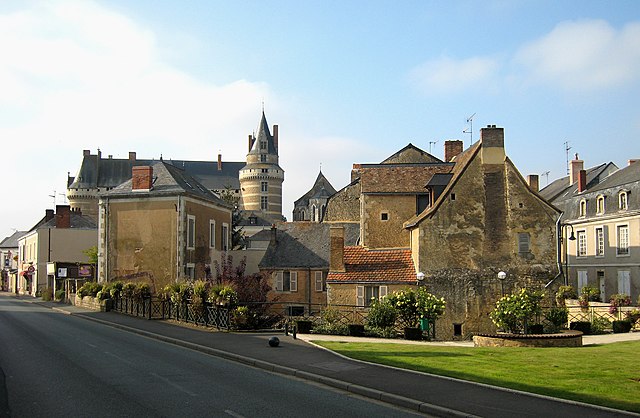
La Chapelle-d'Aligné (La Chapelle-d'Aligné)

- commune in Sarthe, France
- Country:

- Postal Code: 72300
- Coordinates: 47° 43' 58" N, 0° 14' 11" E


- GPS tracks (wikiloc): [Link]
- Area: 33.04 sq km
- Population: 1660
- Wikipedia en: wiki(en)
- Wikipedia: wiki(fr)
- Wikidata storage: Wikidata: Q1224064
- Wikipedia Commons Category: [Link]
- Freebase ID: [/m/03qkzdv]
- GeoNames ID: Alt: [6457051]
- SIREN number: [217200617]
- BnF ID: [152736183]
- INSEE municipality code: 72061
Shares border with regions:

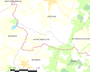
Notre-Dame-du-Pé
- commune in Sarthe, France
- Country:
- Postal Code: 72300
- Coordinates: 47° 43' 46" N, 0° 19' 32" E
- GPS tracks (wikiloc): [Link]
- Area: 7.75 sq km
- Population: 639
- Web site: [Link]


Crosmières
- commune in Sarthe, France
- Country:
- Postal Code: 72200
- Coordinates: 47° 44' 45" N, 0° 9' 5" E
- GPS tracks (wikiloc): [Link]
- AboveSeaLevel: 61 м m
- Area: 20.45 sq km
- Population: 1045
- Web site: [Link]


Précigné
- commune in Sarthe, France
- Country:
- Postal Code: 72300
- Coordinates: 47° 45' 58" N, 0° 19' 27" E
- GPS tracks (wikiloc): [Link]
- Area: 57.85 sq km
- Population: 2989

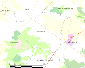
Louailles
- commune in Sarthe, France
- Country:
- Postal Code: 72300
- Coordinates: 47° 47' 31" N, 0° 15' 6" E
- GPS tracks (wikiloc): [Link]
- Area: 10.49 sq km
- Population: 737


Le Bailleul
- commune in Sarthe, France
- Country:
- Postal Code: 72200
- Coordinates: 47° 46' 7" N, 0° 9' 40" E
- GPS tracks (wikiloc): [Link]
- Area: 27.46 sq km
- Population: 1240
- Web site: [Link]

Durtal
- commune in Maine-et-Loire, France
- Country:
- Postal Code: 49430
- Coordinates: 47° 40' 19" N, 0° 14' 29" E
- GPS tracks (wikiloc): [Link]
- Area: 60.58 sq km
- Population: 3371
- Web site: [Link]