canton of La Flèche (canton de La Flèche)

- canton of France
- Country:

- Capital: La Flèche
- Coordinates: 47° 42' 41" N, 0° 6' 47" E


- GPS tracks (wikiloc): [Link]
- Population: 25401
- Wikipedia en: wiki(en)
- Wikipedia: wiki(fr)
- Wikidata storage: Wikidata: Q1725606
- Wikipedia Commons Category: [Link]
- Library of Congress authority ID: Alt: [nr2001047777]
- INSEE canton code: [7206]
Includes regions:


Cré-sur-Loir
- former commune in Sarthe, France
- Country:
- Postal Code: 72200
- Coordinates: 47° 40' 37" N, 0° 9' 32" E
- GPS tracks (wikiloc): [Link]
- Area: 17.19 sq km
- Population: 801


Bazouges-sur-le-Loir
- former commune in Sarthe, France
- Country:
- Postal Code: 72200
- Coordinates: 47° 41' 25" N, 0° 10' 7" E
- GPS tracks (wikiloc): [Link]
- Area: 29.9 sq km
- Population: 1269
- Web site: [Link]

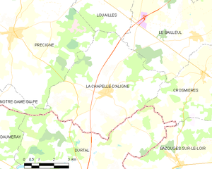
La Chapelle-d'Aligné
- commune in Sarthe, France
- Country:
- Postal Code: 72300
- Coordinates: 47° 43' 58" N, 0° 14' 11" E
- GPS tracks (wikiloc): [Link]
- Area: 33.04 sq km
- Population: 1660

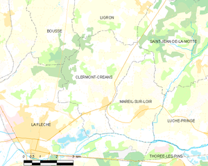
Clermont-Créans
- commune in Sarthe, France
- Country:
- Postal Code: 72200
- Coordinates: 47° 43' 5" N, 0° 0' 54" E
- GPS tracks (wikiloc): [Link]
- Area: 17.82 sq km
- Population: 1279
- Web site: [Link]


La Flèche
- commune in Sarthe, France
- Country:
- Postal Code: 72200
- Coordinates: 47° 41' 59" N, 0° 4' 34" E
- GPS tracks (wikiloc): [Link]
- Area: 74.21 sq km
- Population: 15185
- Web site: [Link]


Crosmières
- commune in Sarthe, France
- Country:
- Postal Code: 72200
- Coordinates: 47° 44' 45" N, 0° 9' 5" E
- GPS tracks (wikiloc): [Link]
- AboveSeaLevel: 61 м m
- Area: 20.45 sq km
- Population: 1045
- Web site: [Link]


Mareil-sur-Loir
- commune in Sarthe, France
- Country:
- Postal Code: 72200
- Coordinates: 47° 42' 53" N, 0° 0' 39" E
- GPS tracks (wikiloc): [Link]
- Area: 11.83 sq km
- Population: 657