La Chapelle-des-Pots (La Chapelle-des-Pots)

- commune in Charente-Maritime, France
- Country:

- Postal Code: 17100
- Coordinates: 45° 45' 35" N, 0° 32' 26" E


- GPS tracks (wikiloc): [Link]
- Area: 10.27 sq km
- Population: 988
- Web site: http://lachapelle-des-pots.fr/
- Wikipedia en: wiki(en)
- Wikipedia: wiki(fr)
- Wikidata storage: Wikidata: Q937599
- Wikipedia Commons Category: [Link]
- Freebase ID: [/m/03mcghp]
- GeoNames ID: Alt: [3010367]
- SIREN number: [211700893]
- BnF ID: [15248951b]
- INSEE municipality code: 17089
Shares border with regions:


Fontcouverte
- commune in Charente-Maritime, France
- Country:
- Postal Code: 17100
- Coordinates: 45° 46' 18" N, 0° 35' 29" E
- GPS tracks (wikiloc): [Link]
- Area: 11.58 sq km
- Population: 2404
- Web site: [Link]
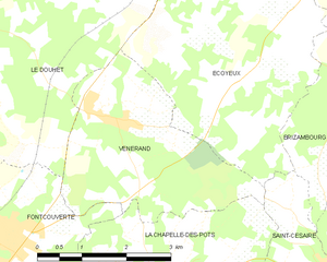
Vénérand
- commune in Charente-Maritime, France
- Country:
- Postal Code: 17100
- Coordinates: 45° 47' 37" N, 0° 33' 38" E
- GPS tracks (wikiloc): [Link]
- Area: 9.65 sq km
- Population: 761


Chaniers
- commune in Charente-Maritime, France
- Country:
- Postal Code: 17610
- Coordinates: 45° 43' 5" N, 0° 33' 26" E
- GPS tracks (wikiloc): [Link]
- Area: 26.53 sq km
- Population: 3567
- Web site: [Link]


Saint-Césaire
- commune in Charente-Maritime, France
- Country:
- Postal Code: 17770
- Coordinates: 45° 45' 11" N, 0° 30' 22" E
- GPS tracks (wikiloc): [Link]
- Area: 10.41 sq km
- Population: 881
- Web site: [Link]