La Clisse (La Clisse)

- commune in Charente-Maritime, France
- Country:

- Postal Code: 17600
- Coordinates: 45° 43' 59" N, 0° 45' 46" E


- GPS tracks (wikiloc): [Link]
- Area: 5.18 sq km
- Population: 650
- Wikipedia en: wiki(en)
- Wikipedia: wiki(fr)
- Wikidata storage: Wikidata: Q1147472
- Wikipedia Commons Category: [Link]
- Freebase ID: [/m/03mcgq6]
- GeoNames ID: Alt: [6455624]
- SIREN number: [211701123]
- BnF ID: [152489740]
- INSEE municipality code: 17112
Shares border with regions:


Luchat
- commune in Charente-Maritime, France
- Country:
- Postal Code: 17600
- Coordinates: 45° 43' 5" N, 0° 45' 47" E
- GPS tracks (wikiloc): [Link]
- Area: 4.67 sq km
- Population: 506


Pessines
- commune in Charente-Maritime, France
- Country:
- Postal Code: 17810
- Coordinates: 45° 43' 44" N, 0° 43' 5" E
- GPS tracks (wikiloc): [Link]
- Area: 9.05 sq km
- Population: 748


Corme-Royal
- commune in Charente-Maritime, France
- Country:
- Postal Code: 17600
- Coordinates: 45° 44' 45" N, 0° 48' 44" E
- GPS tracks (wikiloc): [Link]
- Area: 27.18 sq km
- Population: 1758
- Web site: [Link]

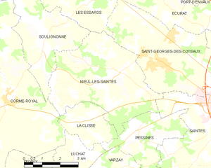
Nieul-lès-Saintes
- commune in Charente-Maritime, France
- Country:
- Postal Code: 17810
- Coordinates: 45° 45' 35" N, 0° 43' 56" E
- GPS tracks (wikiloc): [Link]
- Area: 20.41 sq km
- Population: 1190