
La Crau (La Crau)

- commune in Var, France
- Country:

- Postal Code: 83260
- Coordinates: 43° 8' 59" N, 6° 4' 27" E


- GPS tracks (wikiloc): [Link]
- Area: 37.87 sq km
- Population: 17292
- Web site: http://www.villedelacrau.fr
- Wikipedia en: wiki(en)
- Wikipedia: wiki(fr)
- Wikidata storage: Wikidata: Q636893
- Wikipedia Commons Category: [Link]
- Freebase ID: [/m/03qhff8]
- GeoNames ID: Alt: [3009791]
- SIREN number: [218300473]
- BnF ID: [152778743]
- VIAF ID: Alt: [135316012]
- Library of Congress authority ID: Alt: [nr95030546]
- INSEE municipality code: 83047
Shares border with regions:


Hyères
- commune in Var, France
- Country:
- Postal Code: 83400
- Coordinates: 43° 7' 8" N, 6° 7' 43" E
- GPS tracks (wikiloc): [Link]
- AboveSeaLevel: 40 м m
- Area: 132.38 sq km
- Population: 56478
- Web site: [Link]


La Garde
- commune in Var, France
- Country:
- Postal Code: 83130
- Coordinates: 43° 7' 29" N, 6° 0' 38" E
- GPS tracks (wikiloc): [Link]
- AboveSeaLevel: 1 м m
- Area: 15.54 sq km
- Population: 25047
- Web site: [Link]
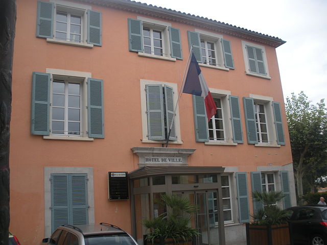
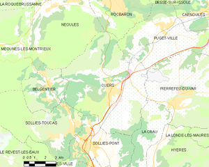
Cuers
- commune in Var, France
 Hiking in Cuers
Cuers, located in the Var department of the Provence-Alpes-Côte d'Azur region in France, offers a unique hiking experience that combines stunning landscapes with rich cultural heritage. Here are some highlights of hiking in Cuers:...
- Country:
- Postal Code: 83390
- Coordinates: 43° 14' 15" N, 6° 4' 15" E
- GPS tracks (wikiloc): [Link]
- Area: 50.53 sq km
- Population: 10832


Solliès-Ville
- commune in Var, France
- Country:
- Postal Code: 83210
- Coordinates: 43° 10' 56" N, 6° 2' 18" E
- GPS tracks (wikiloc): [Link]
- Area: 14.1 sq km
- Population: 2391


Solliès-Pont
- commune in Var, France
Hiking in Solliès-Pont
Solliès-Pont is a charming commune in the Var department of the Provence-Alpes-Côte d'Azur region in southeastern France. Nestled near the foothills of the Maures mountains, it offers a variety of hiking opportunities that allow you to explore the beautiful landscapes, vineyards, and olive groves characteristic of the region....
- Country:
- Postal Code: 83210
- Coordinates: 43° 11' 24" N, 6° 2' 28" E
- GPS tracks (wikiloc): [Link]
- Area: 17.73 sq km
- Population: 10951
La Farlède
- commune in Var, France
- Country:
- Postal Code: 83210
- Coordinates: 43° 10' 4" N, 6° 2' 35" E
- GPS tracks (wikiloc): [Link]
- Area: 8.31 sq km
- Population: 8748
- Web site: [Link]


Carqueiranne
- commune in Var, France
- Country:
- Postal Code: 83320
- Coordinates: 43° 5' 42" N, 6° 4' 25" E
- GPS tracks (wikiloc): [Link]
- Area: 14.48 sq km
- Population: 9990
- Web site: [Link]


Pierrefeu-du-Var
- commune in Var, France
Hiking in Pierrefeu-du-Var
Pierrefeu-du-Var is a charming village located in the Provence-Alpes-Côte d'Azur region of France. It offers a delightful setting for hiking enthusiasts, combining beautiful landscapes with a rich history and cultural appeal. Here’s an overview of what you can expect for hiking in and around Pierrefeu-du-Var:...
- Country:
- Postal Code: 83390
- Coordinates: 43° 13' 28" N, 6° 8' 43" E
- GPS tracks (wikiloc): [Link]
- Area: 58.36 sq km
- Population: 6074