
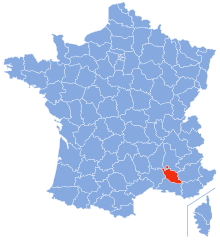
Var (Var)


- department in France
 Hiking in Var
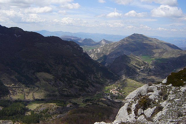
Hiking in the Var department, located in the Provence-Alpes-Côte d'Azur region of southeastern France, offers a diverse range of landscapes and trails suitable for hikers of varying skill levels. Here are some key highlights and tips for hiking in Var:
Landscape and Terrain:
- Diverse Scenery: Var features stunning landscapes, including the rugged hills of the Massif des Maures, the sandy beaches of the coastline, vineyards, and the picturesque Gorges du Verdon, often referred to as the "Grand Canyon of Europe."
- Natural Parks: The region is home to several natural parks, including the Port-Cros National Park and the Sainte-Baume Regional Natural Park, where you can explore lush forests, dramatic cliffs, and hidden coves.
Hiking Trails:
- GR Trails: The Var is intersected by several Grande Randonnée (GR) long-distance trails, such as the GR 51, which winds through the coastal areas and offers breathtaking views of the Mediterranean Sea.
- Local Paths: In addition to the GR routes, there are numerous local hiking paths that take you through charming villages, olive groves, and vineyards. Many trails are marked and maintained, making navigation straightforward.
Highlights and Popular Hikes:
- Gorges du Verdon: Known for its turquoise waters and steep cliffs, hiking around this area provides stunning views and various trails suitable for both casual walkers and experienced hikers.
- Massif des Maures: This mountain range offers shaded trails through forests and past charming old villages like Collobrières. The panoramic views from higher points are rewarding.
- Cap Sicié: Located near Toulon, this area offers coastal hikes with magnificent views of the sea and nearby islands.
Best Time to Hike:
- Spring (April to June): Mild temperatures and blooming wildflowers make this a great time for hiking.
- Autumn (September to November): Another ideal time when the weather is cooler and crowds are fewer.
Safety and Preparation:
- Gear: Wear sturdy hiking shoes, bring plenty of water, snacks, and sun protection. Depending on the trail, trekking poles can also be useful.
- Trail Maps: While many trails are well-marked, it's always a good idea to carry a map or GPS device, as some areas can be remote.
- Local Regulations: Be aware of any specific regulations in nature parks, such as seasonal restrictions or fire safety guidelines.
Hiking in Var immerses you in the beauty of Provence and offers an unforgettable experience for nature lovers and adventure seekers alike. Enjoy your hiking adventures!
- Country:

- Capital: Toulon
- Coordinates: 43° 24' 3" N, 6° 12' 36" E


- GPS tracks (wikiloc): [Link]
- Area: 5973 sq km
- Population: 1048652
- Web site: http://www.var.gouv.fr/
- Wikipedia en: wiki(en)
- Wikipedia: wiki(fr)
- Wikidata storage: Wikidata: Q12789
- Wikipedia Commons Gallery: [Link]
- Wikipedia Commons Category: [Link]
- Freebase ID: [/m/0j3kh]
- GeoNames ID: Alt: [2970749]
- SIREN number: [228300018]
- BnF ID: [119314464]
- VIAF ID: Alt: [87144648418653613332]
- OSM relation ID: [7390]
- GND ID: Alt: [4245258-2]
- archINFORM location ID: [2765]
- Library of Congress authority ID: Alt: [n81102547]
- PACTOLS thesaurus ID: [pcrtVacUtHvsRG]
- MusicBrainz area ID: [c5b787ff-7285-4a8e-8373-b6125ad275c7]
- TGN ID: [7003220]
- NUTS code: [FR825]
- NE.se ID: [var-(departement-frankrike)]
- INSEE department code: [83]
- ISO 3166-2 code: FR-83
Includes regions:


arrondissement of Draguignan
- arrondissement of France
Hiking in arrondissement of Draguignan
The Arrondissement of Draguignan, located in the Var department of the Provence-Alpes-Côte d'Azur region in southeastern France, offers a variety of stunning hiking opportunities. The area is characterized by beautiful landscapes that include rolling hills, forests, vineyards, and the rugged terrain of the nearby Verdon Gorge....
- Country:
- Capital: Draguignan
- Coordinates: 43° 30' 12" N, 6° 33' 10" E
- GPS tracks (wikiloc): [Link]
- Area: 2417 sq km
- Population: 305204


arrondissement of Toulon
- arrondissement of France
Hiking in arrondissement of Toulon
The Arrondissement of Toulon, located in the Var department of the Provence-Alpes-Côte d'Azur region in southeastern France, is a fantastic destination for hiking enthusiasts. The area boasts a rich combination of stunning coastal landscapes, rugged hills, and picturesque villages, providing a variety of trails for all skill levels. Here are some highlights and tips for hiking in this region:...
- Country:
- Capital: Toulon
- Coordinates: 43° 15' 0" N, 6° 0' 0" E
- GPS tracks (wikiloc): [Link]
- Area: 1296 sq km
- Population: 564106


arrondissement of Brignoles
- arrondissement of France
Hiking in arrondissement of Brignoles
The Arrondissement of Brignoles, located in the Var department in Provence-Alpes-Côte d'Azur, offers a variety of hiking opportunities that showcase the stunning natural beauty and diverse landscapes of the region. Here are some highlights:...
- Country:
- Capital: Brignoles
- Coordinates: 43° 24' 0" N, 6° 4' 0" E
- GPS tracks (wikiloc): [Link]
- Area: 2260 sq km
- Population: 179342


Saint-Maximin-la-Sainte-Baume
- commune in Var, France
Hiking in Saint-Maximin-la-Sainte-Baume
Saint-Maximin-la-Sainte-Baume, located in the Provence-Alpes-Côte d'Azur region of France, is an excellent destination for hiking enthusiasts. The town is beautifully situated near the Sainte-Baume mountain range, which offers a variety of trails and stunning natural landscapes, making it ideal for all levels of hikers....
- Country:
- Postal Code: 83470
- Coordinates: 43° 27' 12" N, 5° 51' 43" E
- GPS tracks (wikiloc): [Link]
- Area: 64.13 sq km
- Population: 16037
- Web site: [Link]
Shares border with regions:
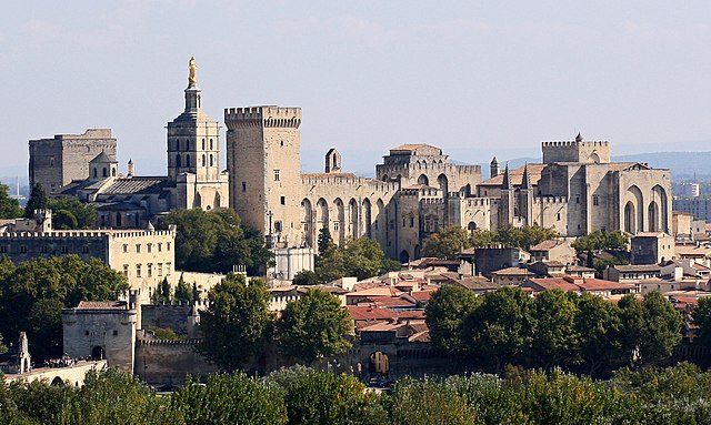
Vaucluse
- French department
Hiking in Vaucluse
Vaucluse, located in the Provence-Alpes-Côte d'Azur region of southeastern France, offers a diverse range of hiking opportunities, combining stunning landscapes, historical sites, and charming villages. Here are some highlights for hiking in Vaucluse:...
- Country:
- Capital: Avignon
- Licence Plate Code: 84
- Coordinates: 44° 0' 0" N, 5° 10' 0" E
- GPS tracks (wikiloc): [Link]
- Area: 3567 sq km
- Population: 557548
- Web site: [Link]
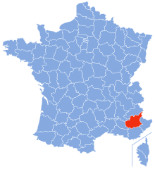
Alpes-de-Haute-Provence
- French department
Hiking in Alpes-de-Haute-Provence
Hiking in the Alpes-de-Haute-Provence region of southeastern France offers a unique blend of stunning landscapes, diverse ecosystems, and charming villages. Here are some key points to consider if you’re planning a hiking trip in this area:...
- Country:
- Capital: Digne-les-Bains
- Coordinates: 44° 5' 43" N, 6° 14' 24" E
- GPS tracks (wikiloc): [Link]
- Area: 6925 sq km
- Population: 161799
- Web site: [Link]
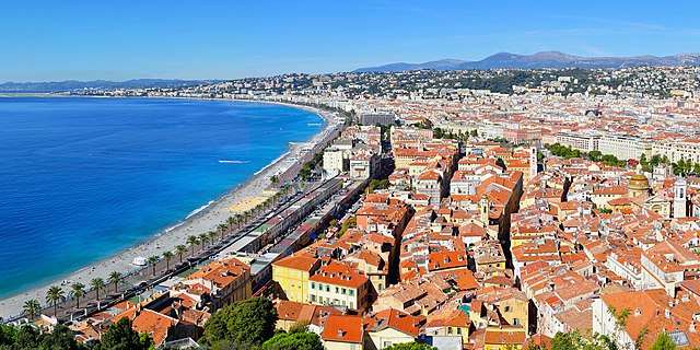

Alpes-Maritimes
- French department
Hiking in Alpes-Maritimes
Hiking in Alpes-Maritimes, located in the Provence-Alpes-Côte d'Azur region of France, offers a diverse range of trails and stunning landscapes. From coastal paths along the Mediterranean Sea to rocky mountain trails in the Mercantour National Park, the area caters to hikers of all levels....
- Country:
- Capital: Nice
- Coordinates: 43° 50' 0" N, 7° 10' 0" E
- GPS tracks (wikiloc): [Link]
- Area: 4299 sq km
- Population: 1082440
- Web site: [Link]


Bouches-du-Rhône
- French department in Provence-Alpes-Côte d'Azur
Hiking in Bouches-du-Rhône
Bouches-du-Rhône, located in the Provence-Alpes-Côte d'Azur region of southern France, offers diverse hiking opportunities amid stunning landscapes, rich history, and vibrant culture. Here are some key highlights for hiking in this beautiful area:...
- Country:
- Capital: Marseille
- Coordinates: 43° 30' 0" N, 5° 5' 0" E
- GPS tracks (wikiloc): [Link]
- Area: 5087 sq km
- Population: 2016622
- Web site: [Link]