La Grée-Saint-Laurent (La Grée-Saint-Laurent)

- commune in Morbihan, France
- Country:

- Postal Code: 56120
- Coordinates: 47° 59' 43" N, 2° 29' 56" E


- GPS tracks (wikiloc): [Link]
- Area: 7.9 sq km
- Population: 341
- Web site: http://lagreesaintlaurent.fr
- Wikipedia en: wiki(en)
- Wikipedia: wiki(fr)
- Wikidata storage: Wikidata: Q71300
- Wikipedia Commons Category: [Link]
- Freebase ID: [/m/03c4byl]
- GeoNames ID: Alt: [3008901]
- SIREN number: [215600685]
- BnF ID: [15265318j]
- INSEE municipality code: 56068
Shares border with regions:

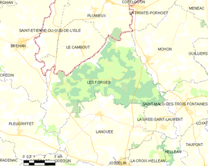
Les Forges
- former commune in Morbihan, France
- Country:
- Postal Code: 56120
- Coordinates: 48° 1' 5" N, 2° 38' 49" E
- GPS tracks (wikiloc): [Link]
- Area: 52.53 sq km
- Population: 461
- Web site: [Link]


Saint-Malo-des-Trois-Fontaines
- commune in Morbihan, France
- Country:
- Postal Code: 56490
- Coordinates: 48° 0' 47" N, 2° 28' 19" E
- GPS tracks (wikiloc): [Link]
- Area: 16.19 sq km
- Population: 556


Helléan
- commune in Morbihan, France
- Country:
- Postal Code: 56120
- Coordinates: 47° 58' 16" N, 2° 28' 26" E
- GPS tracks (wikiloc): [Link]
- Area: 7.87 sq km
- Population: 364


La Croix-Helléan
- commune in Morbihan, France
- Country:
- Postal Code: 56120
- Coordinates: 47° 57' 25" N, 2° 30' 3" E
- GPS tracks (wikiloc): [Link]
- Area: 14.4 sq km
- Population: 901


Lanouée
- former commune in Morbihan, France
- Country:
- Postal Code: 56120
- Coordinates: 48° 0' 7" N, 2° 34' 55" E
- GPS tracks (wikiloc): [Link]
- Area: 43.76 sq km
- Population: 1769