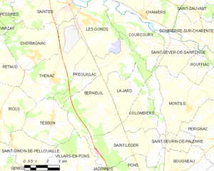
La Jard (La Jard)

- commune in Charente-Maritime, France
- Country:

- Postal Code: 17460
- Coordinates: 45° 39' 16" N, 0° 35' 10" E


- GPS tracks (wikiloc): [Link]
- Area: 8.48 sq km
- Population: 415
- Wikipedia en: wiki(en)
- Wikipedia: wiki(fr)
- Wikidata storage: Wikidata: Q1097095
- Wikipedia Commons Category: [Link]
- Freebase ID: [/m/03mchk0]
- GeoNames ID: Alt: [6455637]
- SIREN number: [211701917]
- BnF ID: [15249052f]
- INSEE municipality code: 17191
Shares border with regions:


Montils
- commune in Charente-Maritime, France
- Country:
- Postal Code: 17800
- Coordinates: 45° 38' 53" N, 0° 30' 12" E
- GPS tracks (wikiloc): [Link]
- Area: 23.64 sq km
- Population: 835
- Web site: [Link]


Colombiers
- commune in Charente-Maritime, France
- Country:
- Postal Code: 17460
- Coordinates: 45° 38' 38" N, 0° 33' 2" E
- GPS tracks (wikiloc): [Link]
- Area: 7.14 sq km
- Population: 320

Berneuil
- commune in Charente-Maritime, France
- Country:
- Postal Code: 17460
- Coordinates: 45° 38' 35" N, 0° 36' 1" E
- GPS tracks (wikiloc): [Link]
- Area: 25.45 sq km
- Population: 1141