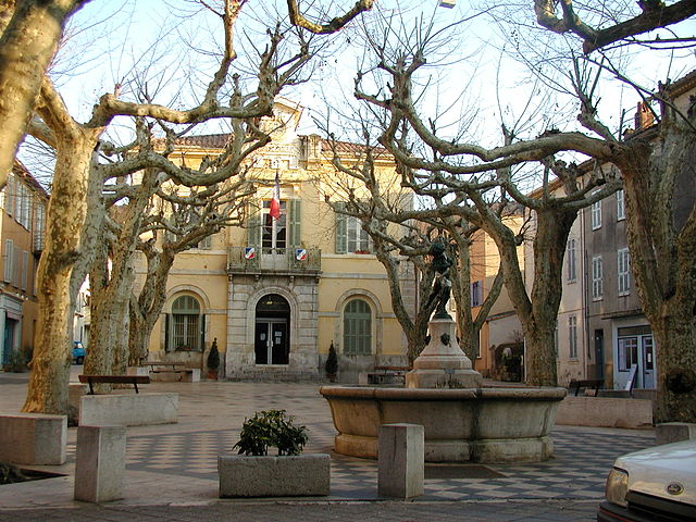
La Londe-les-Maures (La Londe-les-Maures)

- commune in Var, France
- Country:

- Postal Code: 83250
- Coordinates: 43° 8' 17" N, 6° 14' 4" E


- GPS tracks (wikiloc): [Link]
- Area: 79.29 sq km
- Population: 10173
- Wikipedia en: wiki(en)
- Wikipedia: wiki(fr)
- Wikidata storage: Wikidata: Q282326
- Wikipedia Commons Category: [Link]
- Freebase ID: [/m/03qhfg9]
- GeoNames ID: Alt: [3008432]
- SIREN number: [218300713]
- BnF ID: [152778983]
- VIAF ID: Alt: [148974697]
- GND ID: Alt: [4267602-2]
- Library of Congress authority ID: Alt: [n84126470]
- PACTOLS thesaurus ID: [pcrthyqaLu83a6]
- MusicBrainz area ID: [13b9a0e1-97a3-4334-a85d-a63aed35a75d]
- INSEE municipality code: 83071
Shares border with regions:


Hyères
- commune in Var, France
- Country:
- Postal Code: 83400
- Coordinates: 43° 7' 8" N, 6° 7' 43" E
- GPS tracks (wikiloc): [Link]
- AboveSeaLevel: 40 м m
- Area: 132.38 sq km
- Population: 56478
- Web site: [Link]

Collobrières
- commune in Var, France
- Country:
- Postal Code: 83610
- Coordinates: 43° 14' 14" N, 6° 18' 32" E
- GPS tracks (wikiloc): [Link]
- Area: 112.68 sq km
- Population: 1919
- Web site: [Link]

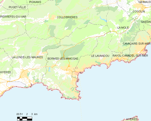
Bormes-les-Mimosas
- commune in Var, France
- Country:
- Postal Code: 83230
- Coordinates: 43° 9' 6" N, 6° 20' 35" E
- GPS tracks (wikiloc): [Link]
- Area: 97.32 sq km
- Population: 7862
- Web site: [Link]


Pierrefeu-du-Var
- commune in Var, France
 Hiking in Pierrefeu-du-Var
Pierrefeu-du-Var is a charming village located in the Provence-Alpes-Côte d'Azur region of France. It offers a delightful setting for hiking enthusiasts, combining beautiful landscapes with a rich history and cultural appeal. Here’s an overview of what you can expect for hiking in and around Pierrefeu-du-Var:...
- Country:
- Postal Code: 83390
- Coordinates: 43° 13' 28" N, 6° 8' 43" E
- GPS tracks (wikiloc): [Link]
- Area: 58.36 sq km
- Population: 6074