La Mothe-Saint-Héray (La Mothe-Saint-Héray)

- commune in Deux-Sèvres, France
- Country:

- Postal Code: 79800
- Coordinates: 46° 21' 18" N, 0° 6' 36" E


- GPS tracks (wikiloc): [Link]
- Area: 14.92 sq km
- Population: 1702
- Web site: http://www.la-mothe-saint-heray.fr/modules/fr/site/index.php
- Wikipedia en: wiki(en)
- Wikipedia: wiki(fr)
- Wikidata storage: Wikidata: Q919713
- Wikipedia Commons Category: [Link]
- Freebase ID: [/m/03m4yg6]
- GeoNames ID: Alt: [3008040]
- SIREN number: [217901842]
- BnF ID: [15276319b]
- VIAF ID: Alt: [142075541]
- Library of Congress authority ID: Alt: [n98062182]
- PACTOLS thesaurus ID: [pcrtfOfacEtdzS]
- INSEE municipality code: 79184
Shares border with regions:

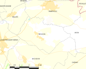
Bougon
- commune in Deux-Sèvres, France
- Country:
- Postal Code: 79800
- Coordinates: 46° 21' 52" N, 0° 3' 34" E
- GPS tracks (wikiloc): [Link]
- Area: 11.7 sq km
- Population: 180


Exoudun
- commune in Deux-Sèvres, France
- Country:
- Postal Code: 79800
- Coordinates: 46° 20' 40" N, 0° 4' 55" E
- GPS tracks (wikiloc): [Link]
- Area: 25.95 sq km
- Population: 611
Salles
- commune in Deux-Sèvres, France
- Country:
- Postal Code: 79800
- Coordinates: 46° 23' 7" N, 0° 5' 58" E
- GPS tracks (wikiloc): [Link]
- AboveSeaLevel: 100 м m
- Area: 7.77 sq km
- Population: 336
La Couarde
- commune in Deux-Sèvres, France
- Country:
- Postal Code: 79800
- Coordinates: 46° 19' 10" N, 0° 9' 33" E
- GPS tracks (wikiloc): [Link]
- Area: 16.36 sq km
- Population: 266
- Web site: [Link]
Sainte-Eanne
- commune in Deux-Sèvres, France
- Country:
- Postal Code: 79800
- Coordinates: 46° 23' 56" N, 0° 8' 10" E
- GPS tracks (wikiloc): [Link]
- Area: 13.83 sq km
- Population: 623

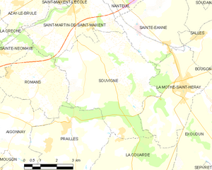
Souvigné
- commune in Deux-Sèvres, France
- Country:
- Postal Code: 79800
- Coordinates: 46° 22' 24" N, 0° 11' 14" E
- GPS tracks (wikiloc): [Link]
- Area: 26.41 sq km
- Population: 895