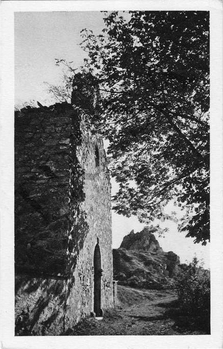
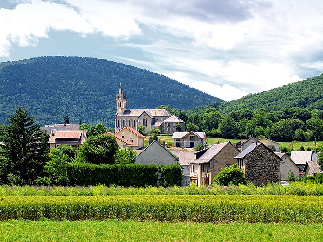
La Mure (La Mure)

- commune in Isère, France
 Hiking in La Mure
La Mure is a charming town situated in the French Alps, known for its breathtaking landscapes and excellent hiking opportunities. Located within the Isère department, it serves as a great starting point for outdoor enthusiasts looking to explore the surrounding mountains and natural parks.
Hiking Trails:
-
Sentier des Gorges de la Bourne: This is a stunning trail that follows the Bourne River through dramatic gorges. The pathways can vary from easy to moderate, making it suitable for families and more experienced hikers alike.
-
Grand Veymont: This hike leads you to the second-highest peak in the Vercors, offering panoramic views of the surrounding area. It's more challenging, so it's better suited for experienced hikers.
-
Lac du Sautet: A relatively easy hike that takes you to a beautiful lake, perfect for those looking for a shorter, scenic route. It's a great spot for a picnic or a rest.
Tips for Hiking in La Mure:
- Weather Conditions: Always check the weather forecast before heading out, as conditions in the mountains can change rapidly.
- Equipment: Wear appropriate hiking gear, including sturdy boots, weather-proof clothing, and a backpack with essentials like water, snacks, and a first aid kit.
- Local Regulations: Be mindful of local wildlife and stick to marked trails to preserve the natural environment.
- Guided Tours: If you're unfamiliar with the area, consider joining a guided hiking tour. Local guides can provide valuable insights and ensure your safety.
Nearby Attractions:
- Les Écrins National Park: A vast area that offers numerous hiking trails, breathtaking mountain scenery, and diverse wildlife.
- Local Culture: Take some time to explore the historic town of La Mure itself, with its quaint streets and local shops.
Whether you're looking for a relaxing stroll by the lake or a more strenuous mountain trek, La Mure and its surrounding areas have something to offer every hiker. Always plan your hike according to your skill level, and enjoy the stunning alpine scenery!
- Country:

- Postal Code: 38350
- Coordinates: 44° 54' 11" N, 5° 47' 15" E


- GPS tracks (wikiloc): [Link]
- AboveSeaLevel: 886 м m
- Area: 8.33 sq km
- Population: 4992
- Web site: http://www.lamure.fr
- Wikipedia en: wiki(en)
- Wikipedia: wiki(fr)
- Wikidata storage: Wikidata: Q631622
- Wikipedia Commons Category: [Link]
- Freebase ID: [/m/03cm957]
- GeoNames ID: Alt: [6616663]
- SIREN number: [213802697]
- BnF ID: [152580810]
- VIAF ID: Alt: [144156391]
- INSEE municipality code: 38269
Shares border with regions:

Cognet
- commune in Isère, France
Hiking in Cognet
Cognet is a small area in the Isère department of the Auvergne-Rhône-Alpes region in France, known for its natural beauty and outdoor activities, including hiking. Located at the foot of the Alps, Cognet offers a variety of hiking trails that cater to different skill levels, making it an excellent destination for both novice and experienced hikers....
- Country:
- Postal Code: 38350
- Coordinates: 44° 52' 52" N, 5° 46' 37" E
- GPS tracks (wikiloc): [Link]
- Area: 1.8 sq km
- Population: 44


Saint-Honoré
- commune in Isère, France
Hiking in Saint-Honoré
Saint-Honoré is a charming village located in the Isère department of the Auvergne-Rhône-Alpes region in southeastern France. It is surrounded by the beautiful Vercors and Chartreuse mountain ranges, making it an excellent base for hiking enthusiasts. Here are some highlights and tips for hiking in and around Saint-Honoré:...
- Country:
- Postal Code: 38350
- Coordinates: 44° 57' 16" N, 5° 48' 24" E
- GPS tracks (wikiloc): [Link]
- Area: 14.58 sq km
- Population: 806


Prunières
- commune in Isère, France
Hiking in Prunières
Prunières, located in the Isère department in the Auvergne-Rhône-Alpes region of France, offers a variety of hiking opportunities that allow hikers to enjoy beautiful landscapes, lush forests, and alpine vistas. Here are some highlights about hiking in and around Prunières:...
- Country:
- Postal Code: 38350
- Coordinates: 44° 53' 35" N, 5° 45' 47" E
- GPS tracks (wikiloc): [Link]
- Area: 8.2 sq km
- Population: 365


Susville
- commune in Isère, France
Hiking in Susville
Susville, located in the region of Burgundy in France, is surrounded by stunning natural landscapes, making it an excellent destination for hiking enthusiasts. Though it's a smaller town, it offers various trails that cater to different skill levels. Here are some key points to consider for hiking in and around Susville:...
- Country:
- Postal Code: 38350
- Coordinates: 44° 54' 57" N, 5° 46' 49" E
- GPS tracks (wikiloc): [Link]
- AboveSeaLevel: 910 м m
- Area: 9.91 sq km
- Population: 1314
- Web site: [Link]

Pierre-Châtel
- commune in Isère, France
Hiking in Pierre-Châtel
Pierre-Châtel, located in the French Alps in the Isère department, offers a variety of hiking opportunities that showcase stunning natural landscapes and diverse terrains. Here are some key points to consider when hiking in the area:...
- Country:
- Postal Code: 38119
- Coordinates: 44° 57' 25" N, 5° 46' 34" E
- GPS tracks (wikiloc): [Link]
- Area: 11.48 sq km
- Population: 1504
- Web site: [Link]


Sousville
- commune in Isère, France
Hiking in Sousville
Sousville is situated in the picturesque region of the French Alps, providing a stunning backdrop for hiking enthusiasts. The area is known for its diverse landscapes, including rolling hills, rocky terrain, and lush forests, making it an excellent destination for hikers of all levels....
- Country:
- Postal Code: 38350
- Coordinates: 44° 54' 48" N, 5° 48' 26" E
- GPS tracks (wikiloc): [Link]
- AboveSeaLevel: 760 м m
- Area: 2.93 sq km
- Population: 141


Ponsonnas
- commune in Isère, France
Hiking in Ponsonnas
Ponsonnas is a small commune located in the Isère department in the Auvergne-Rhône-Alpes region of France. It presents a charming destination for those who love hiking and exploring nature....
- Country:
- Postal Code: 38350
- Coordinates: 44° 53' 21" N, 5° 47' 48" E
- GPS tracks (wikiloc): [Link]
- Area: 2.9 sq km
- Population: 281