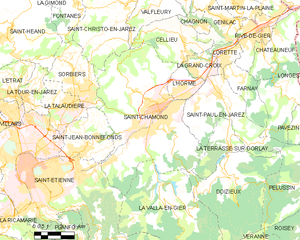
La Terrasse-sur-Dorlay (La Terrasse-sur-Dorlay)

- commune in Loire, France
- Country:

- Postal Code: 42740
- Coordinates: 45° 26' 54" N, 4° 35' 0" E


- GPS tracks (wikiloc): [Link]
- Area: 8.69 sq km
- Population: 787
- Wikipedia en: wiki(en)
- Wikipedia: wiki(fr)
- Wikidata storage: Wikidata: Q1105681
- Wikipedia Commons Category: [Link]
- Freebase ID: [/m/03nwbs2]
- Freebase ID: [/m/03nwbs2]
- GeoNames ID: Alt: [6456013]
- GeoNames ID: Alt: [6456013]
- SIREN number: [214203085]
- SIREN number: [214203085]
- BnF ID: [152598745]
- BnF ID: [152598745]
- INSEE municipality code: 42308
- INSEE municipality code: 42308
Shares border with regions:


Doizieux
- commune in Loire, France
- Country:
- Postal Code: 42740
- Coordinates: 45° 25' 38" N, 4° 35' 10" E
- GPS tracks (wikiloc): [Link]
- Area: 28.07 sq km
- Population: 832

Saint-Chamond
- commune in Loire, France
- Country:
- Postal Code: 42400
- Coordinates: 45° 28' 35" N, 4° 30' 53" E
- GPS tracks (wikiloc): [Link]
- AboveSeaLevel: 375 м m
- Area: 54.88 sq km
- Population: 34870
- Web site: [Link]

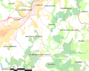
Saint-Paul-en-Jarez
- commune in Loire, France
- Country:
- Postal Code: 42740
- Coordinates: 45° 28' 59" N, 4° 34' 28" E
- GPS tracks (wikiloc): [Link]
- Area: 19.98 sq km
- Population: 4754


Pélussin
- commune in Loire, France
- Country:
- Postal Code: 42410
- Coordinates: 45° 25' 6" N, 4° 40' 51" E
- GPS tracks (wikiloc): [Link]
- Area: 32.16 sq km
- Population: 3757
- Web site: [Link]