La Valla-en-Gier (La Valla-en-Gier)

- commune in Loire, France
- Country:

- Postal Code: 42131
- Coordinates: 45° 24' 57" N, 4° 30' 59" E


- GPS tracks (wikiloc): [Link]
- AboveSeaLevel: 650 м m
- Area: 34.78 sq km
- Population: 999
- Wikipedia en: wiki(en)
- Wikipedia: wiki(fr)
- Wikidata storage: Wikidata: Q1105662
- Wikipedia Commons Category: [Link]
- Freebase ID: [/m/03nwbqq]
- Freebase ID: [/m/03nwbqq]
- GeoNames ID: Alt: [6614553]
- GeoNames ID: Alt: [6614553]
- SIREN number: [214203226]
- SIREN number: [214203226]
- BnF ID: [15259888v]
- BnF ID: [15259888v]
- VIAF ID: Alt: [188470355]
- VIAF ID: Alt: [188470355]
- SUDOC authorities ID: [077449592]
- SUDOC authorities ID: [077449592]
- INSEE municipality code: 42322
- INSEE municipality code: 42322
Shares border with regions:


Colombier
- commune in Loire, France
- Country:
- Postal Code: 42220
- Coordinates: 45° 20' 16" N, 4° 36' 0" E
- GPS tracks (wikiloc): [Link]
- AboveSeaLevel: 818 м m
- Area: 17.86 sq km
- Population: 301


Le Bessat
- commune in Loire, France
- Country:
- Postal Code: 42660
- Coordinates: 45° 22' 8" N, 4° 30' 53" E
- GPS tracks (wikiloc): [Link]
- Area: 10.06 sq km
- Population: 436


Doizieux
- commune in Loire, France
- Country:
- Postal Code: 42740
- Coordinates: 45° 25' 38" N, 4° 35' 10" E
- GPS tracks (wikiloc): [Link]
- Area: 28.07 sq km
- Population: 832

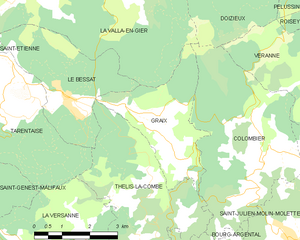
Graix
- commune in Loire, France
- Country:
- Postal Code: 42220
- Coordinates: 45° 20' 52" N, 4° 34' 9" E
- GPS tracks (wikiloc): [Link]
- Area: 8.58 sq km
- Population: 151

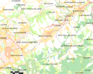
Saint-Chamond
- commune in Loire, France
- Country:
- Postal Code: 42400
- Coordinates: 45° 28' 35" N, 4° 30' 53" E
- GPS tracks (wikiloc): [Link]
- AboveSeaLevel: 375 м m
- Area: 54.88 sq km
- Population: 34870
- Web site: [Link]


Saint-Étienne
- commune in Loire, France
- Country:
- Postal Code: 42230; 42000; 42100
- Coordinates: 45° 26' 2" N, 4° 23' 23" E
- GPS tracks (wikiloc): [Link]
- AboveSeaLevel: 516 м m
- Area: 79.97 sq km
- Population: 171057
- Web site: [Link]