La Villeneuve (La Villeneuve)

- commune in Creuse, France
- Country:

- Postal Code: 23260
- Coordinates: 45° 53' 55" N, 2° 24' 34" E


- GPS tracks (wikiloc): [Link]
- AboveSeaLevel: 705 м m
- Area: 4.45 sq km
- Population: 68
- Wikipedia en: wiki(en)
- Wikipedia: wiki(fr)
- Wikidata storage: Wikidata: Q193316
- Wikipedia Commons Category: [Link]
- Freebase ID: [/m/03mflmh]
- Freebase ID: [/m/03mflmh]
- GeoNames ID: Alt: [6616141]
- GeoNames ID: Alt: [6616141]
- SIREN number: [212326508]
- SIREN number: [212326508]
- BnF ID: [152516511]
- BnF ID: [152516511]
- INSEE municipality code: 23265
- INSEE municipality code: 23265
Shares border with regions:

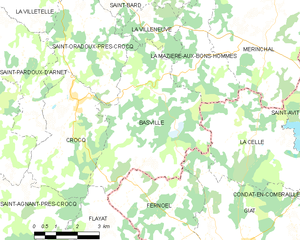
Basville
- commune in Creuse, France
- Country:
- Postal Code: 23260
- Coordinates: 45° 52' 16" N, 2° 23' 49" E
- GPS tracks (wikiloc): [Link]
- Area: 22.57 sq km
- Population: 162
Saint-Oradoux-près-Crocq
- commune in Creuse, France
- Country:
- Postal Code: 23260
- Coordinates: 45° 52' 42" N, 2° 23' 17" E
- GPS tracks (wikiloc): [Link]
- Area: 13.36 sq km
- Population: 100


Saint-Bard
- commune in Creuse, France
- Country:
- Postal Code: 23260
- Coordinates: 45° 54' 52" N, 2° 24' 1" E
- GPS tracks (wikiloc): [Link]
- Area: 9.36 sq km
- Population: 109

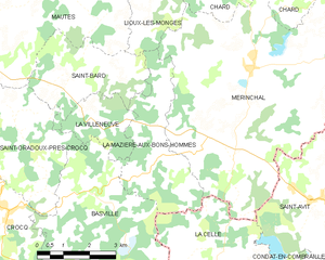
La Mazière-aux-Bons-Hommes
- commune in Creuse, France
- Country:
- Postal Code: 23260
- Coordinates: 45° 53' 2" N, 2° 26' 27" E
- GPS tracks (wikiloc): [Link]
- Area: 10.24 sq km
- Population: 68
- Web site: [Link]