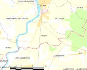
Labergement-lès-Seurre (Labergement-lès-Seurre)

- commune in Côte-d'Or, France
- Country:

- Postal Code: 21820
- Coordinates: 46° 59' 53" N, 5° 5' 33" E


- GPS tracks (wikiloc): [Link]
- Area: 28.83 sq km
- Population: 1000
- Web site: http://www.labergement-les-seurre.fr
- Wikipedia en: wiki(en)
- Wikipedia: wiki(fr)
- Wikidata storage: Wikidata: Q16893
- Wikipedia Commons Category: [Link]
- Freebase ID: [/m/03mfsc6]
- GeoNames ID: Alt: [6428682]
- SIREN number: [212103329]
- BnF ID: [152506199]
- INSEE municipality code: 21332
Shares border with regions:


Corberon
- commune in Côte-d'Or, France
- Country:
- Postal Code: 21250
- Coordinates: 47° 0' 30" N, 4° 59' 40" E
- GPS tracks (wikiloc): [Link]
- Area: 11.72 sq km
- Population: 447
- Web site: [Link]


Chivres
- commune in Côte-d'Or, France
- Country:
- Postal Code: 21820
- Coordinates: 46° 58' 35" N, 5° 5' 45" E
- GPS tracks (wikiloc): [Link]
- AboveSeaLevel: 182 м m
- Area: 8.23 sq km
- Population: 290
- Web site: [Link]


Bagnot
- commune in Côte-d'Or, France
- Country:
- Postal Code: 21700
- Coordinates: 47° 3' 33" N, 5° 4' 32" E
- GPS tracks (wikiloc): [Link]
- Area: 12.57 sq km
- Population: 160


Corgengoux
- commune in Côte-d'Or, France
- Country:
- Postal Code: 21250
- Coordinates: 46° 59' 27" N, 4° 59' 18" E
- GPS tracks (wikiloc): [Link]
- Area: 12.53 sq km
- Population: 389
- Web site: [Link]

Trugny
- commune in Côte-d'Or, France
- Country:
- Postal Code: 21250
- Coordinates: 46° 58' 56" N, 5° 8' 45" E
- GPS tracks (wikiloc): [Link]
- Area: 6.86 sq km
- Population: 136

Jallanges
- commune in Côte-d'Or, France
- Country:
- Postal Code: 21250
- Coordinates: 46° 59' 18" N, 5° 9' 0" E
- GPS tracks (wikiloc): [Link]
- Area: 7.48 sq km
- Population: 334
- Web site: [Link]


Pouilly-sur-Saône
- commune in Côte-d'Or, France
- Country:
- Postal Code: 21250
- Coordinates: 47° 1' 6" N, 5° 7' 2" E
- GPS tracks (wikiloc): [Link]
- Area: 5.15 sq km
- Population: 642


Montmain
- commune in Côte-d'Or, France
- Country:
- Postal Code: 21250
- Coordinates: 47° 1' 44" N, 5° 3' 52" E
- GPS tracks (wikiloc): [Link]
- AboveSeaLevel: 208 м m
- Area: 9.07 sq km
- Population: 146


Seurre
- commune in Côte-d'Or, France
- Country:
- Postal Code: 21250
- Coordinates: 46° 59' 55" N, 5° 8' 48" E
- GPS tracks (wikiloc): [Link]
- Area: 8.99 sq km
- Population: 2408
- Web site: [Link]


Palleau
- commune in Saône-et-Loire, France
- Country:
- Postal Code: 71350
- Coordinates: 46° 57' 23" N, 5° 1' 48" E
- GPS tracks (wikiloc): [Link]
- Area: 10.68 sq km
- Population: 229
- Web site: [Link]