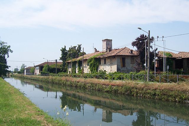
Lacchiarella (Lacchiarella)
.svg)
- Italian comune
 Hiking in Lacchiarella
Lacchiarella is a small town in the Lombardy region of Italy, located near the metropolitan area of Milan. While it might not be a well-known hiking destination compared to other Italian locales like the Dolomites or Cinque Terre, there are still plenty of opportunities for pleasant walks and hikes in the surrounding areas.
Here are some tips and insights for hiking in and around Lacchiarella:
Local Trails
-
Nature Reserves: Explore nearby nature reserves, such as the "Parco della Vernavola" or the "Parco Agricolo Sud Milano," which offer a mix of trails through scenic landscapes, forests, and fields.
-
Riverside Walks: The area near the Naviglio waterways can provide enjoyable flat walking paths and views of the canals, as well as birdwatching opportunities.
Hiking Preparation
- Trail Maps: Before heading out, ensure you have a good map of the trails in the area. Local tourist offices might provide maps and information about trail conditions.
- Gear: Since the terrain varies, wear appropriate hiking boots and bring along weather-appropriate clothing. A backpack with water, snacks, and a first-aid kit is always a good idea.
Timing and Weather
- The best time to hike in this region is during spring (April to June) and autumn (September to October) when the weather is generally mild and the landscapes are particularly beautiful.
- Summer can be hot, and winter may present challenges with muddy or icy trails.
Guided Hikes
If you want a guided experience, consider connecting with local hiking clubs or guides who can offer insights into the area's flora, fauna, and history.
Nearby Locations
If you’re willing to travel a bit, consider taking day trips to nearby hiking hotspots like:
- Parco Nazionale delle Foreste Casentinesi
- Lake Como region for stunning lake views and mountain trails.
- Valtellina for more challenging hikes in the Alps.
Overall, while Lacchiarella might not offer the most prominent hiking trails, its proximity to natural parks and reserves presents a serene hiking experience amid the beauty of the Lombardy countryside.
- Country:

- Postal Code: 20084
- Local Dialing Code: 02
- Licence Plate Code: MI
- Coordinates: 45° 19' 30" N, 9° 8' 24" E


- GPS tracks (wikiloc): [Link]
- AboveSeaLevel: 98 м m
- Area: 24.04 sq km
- Population: 8964
- Web site: http://www.comune.lacchiarella.mi.it
- Wikipedia en: wiki(en)
- Wikipedia: wiki(it)
- Wikidata storage: Wikidata: Q42422
- Wikipedia Commons Category: [Link]
- Freebase ID: [/m/0gj66h]
- GeoNames ID: Alt: [6536513]
- VIAF ID: Alt: [158914065]
- OSM relation ID: [44656]
- WOEID: [716944]
- UN/LOCODE: [ITLCR]
- Digital Atlas of the Roman Empire ID: [17141]
- ISTAT ID: 015115
- Italian cadastre code: E395
Shares border with regions:


Bornasco
- Italian comune
Hiking in Bornasco
Bornasco, a small town located in the Lombardy region of Italy, is surrounded by beautiful natural landscapes that offer a variety of hiking opportunities. While Bornasco itself may not have extensive hiking trails, its proximity to the Po Valley and the nearby hills makes it a great starting point for various outdoor adventures....
- Country:
- Postal Code: 27010
- Local Dialing Code: 0382
- Licence Plate Code: PV
- Coordinates: 45° 16' 0" N, 9° 13' 5" E
- GPS tracks (wikiloc): [Link]
- AboveSeaLevel: 85 м m
- Area: 12.93 sq km
- Population: 2710
- Web site: [Link]
Giussago
- Italian comune
Hiking in Giussago
Giussago is a small town located in the Lombardy region of Italy, not far from the city of Pavia. While it may not be as widely known for hiking compared to larger national parks or mountainous areas, there are still opportunities for outdoor enthusiasts to explore the scenic countryside and the nearby area....
- Country:
- Postal Code: 27010
- Local Dialing Code: 0382
- Licence Plate Code: PV
- Coordinates: 45° 17' 3" N, 9° 8' 24" E
- GPS tracks (wikiloc): [Link]
- AboveSeaLevel: 93 м m
- Area: 24 sq km
- Population: 5186
- Web site: [Link]
Vidigulfo
- Italian comune
Hiking in Vidigulfo
Vidigulfo is a small town located in the Lombardy region of Italy, near the larger city of Milan. While it may not be a well-known hiking destination, there are a few options for enjoying nature and outdoor activities nearby....
- Country:
- Postal Code: 27018
- Local Dialing Code: 0382
- Licence Plate Code: PV
- Coordinates: 45° 18' 0" N, 9° 14' 0" E
- GPS tracks (wikiloc): [Link]
- AboveSeaLevel: 88 м m
- Area: 16.14 sq km
- Population: 6422
- Web site: [Link]
Siziano
- Italian comune
Hiking in Siziano
Siziano, located in the Lombardy region of Italy, offers a pleasant hiking experience, particularly for those who enjoy exploring rural landscapes and the charm of the Italian countryside. While Siziano itself is not a major hiking destination, it is surrounded by scenic areas that are perfect for outdoor activities....
- Country:
- Postal Code: 27010
- Local Dialing Code: 0382
- Licence Plate Code: PV
- Coordinates: 45° 19' 0" N, 9° 12' 0" E
- GPS tracks (wikiloc): [Link]
- AboveSeaLevel: 93 м m
- Area: 11.79 sq km
- Population: 6074
- Web site: [Link]


Casarile
- Italian comune
Hiking in Casarile
Casarile is a small town located in the Lombardy region of Italy, and while it may not be as famous for hiking as some other areas in Italy, it can serve as a good starting point for exploring the surrounding countryside....
- Country:
- Postal Code: 20080
- Local Dialing Code: 02
- Licence Plate Code: MI
- Coordinates: 45° 19' 0" N, 9° 6' 0" E
- GPS tracks (wikiloc): [Link]
- AboveSeaLevel: 97 м m
- Area: 7.33 sq km
- Population: 4081
- Web site: [Link]


Basiglio
- Italian comune
Hiking in Basiglio
Basiglio, located just outside of Milan, Italy, is a charming area that offers some lovely hiking opportunities, particularly for those looking to escape the urban environment. While the area may not have extensive mountain trails, it boasts beautiful landscapes, parks, and a serene countryside that is perfect for leisurely walks and hikes....
- Country:
- Postal Code: 20080
- Local Dialing Code: 02
- Licence Plate Code: MI
- Coordinates: 45° 21' 0" N, 9° 10' 0" E
- GPS tracks (wikiloc): [Link]
- AboveSeaLevel: 97 м m
- Area: 8.49 sq km
- Population: 7846
- Web site: [Link]


Pieve Emanuele
- Italian comune
Hiking in Pieve Emanuele
Pieve Emanuele is located in the Lombardy region of Italy, near Milan. While the area itself is primarily urban and suburban, there are opportunities for hiking and enjoying nature in the surrounding regions. Here are some tips and ideas for hiking in and around Pieve Emanuele:...
- Country:
- Postal Code: 20090
- Local Dialing Code: 02
- Licence Plate Code: MI
- Coordinates: 45° 21' 0" N, 9° 12' 0" E
- GPS tracks (wikiloc): [Link]
- AboveSeaLevel: 97 м m
- Area: 12.91 sq km
- Population: 16118
- Web site: [Link]


Binasco
- Italian comune
Hiking in Binasco
Binasco, a small town located in the Lombardy region of Italy, is nestled near the banks of the Naviglio Pavese, which provides charming scenery and potential hiking opportunities. While Binasco itself may not be a well-known hiking destination, several routes and areas nearby can offer enjoyable hikes....
- Country:
- Postal Code: 20082
- Local Dialing Code: 02
- Licence Plate Code: MI
- Coordinates: 45° 20' 0" N, 9° 6' 0" E
- GPS tracks (wikiloc): [Link]
- AboveSeaLevel: 101 м m
- Area: 3.87 sq km
- Population: 7251
- Web site: [Link]

Zibido San Giacomo
- Italian comune
Hiking in Zibido San Giacomo
Zibido San Giacomo, a small town in the Lombardy region of Italy, is not as well-known for hiking as some other areas in the region, but it does offer opportunities for outdoor activities in its surrounding landscapes. Here are some key points about hiking in and around Zibido San Giacomo:...
- Country:
- Postal Code: 20080
- Local Dialing Code: 02
- Licence Plate Code: MI
- Coordinates: 45° 22' 0" N, 9° 7' 0" E
- GPS tracks (wikiloc): [Link]
- AboveSeaLevel: 111 м m
- Area: 24.58 sq km
- Population: 6856
- Web site: [Link]