Lacres (Lacres)

- commune in Pas-de-Calais, France
- Country:

- Postal Code: 62830
- Coordinates: 50° 36' 2" N, 1° 45' 31" E


- GPS tracks (wikiloc): [Link]
- Area: 8.23 sq km
- Population: 256
- Wikipedia en: wiki(en)
- Wikipedia: wiki(fr)
- Wikidata storage: Wikidata: Q1029019
- Wikipedia Commons Category: [Link]
- Freebase ID: [/m/02z7ckg]
- GeoNames ID: Alt: [6439648]
- SIREN number: [216204834]
- BnF ID: [15268924v]
- OSM relation ID: [1175392]
- INSEE municipality code: 62483
Shares border with regions:


Hubersent
- commune in Pas-de-Calais, France
- Country:
- Postal Code: 62630
- Coordinates: 50° 34' 53" N, 1° 43' 39" E
- GPS tracks (wikiloc): [Link]
- Area: 7.97 sq km
- Population: 261

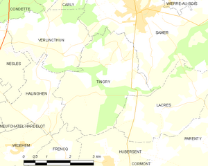
Tingry
- commune in Pas-de-Calais, France
- Country:
- Postal Code: 62830
- Coordinates: 50° 37' 6" N, 1° 43' 48" E
- GPS tracks (wikiloc): [Link]
- Area: 11.36 sq km
- Population: 285

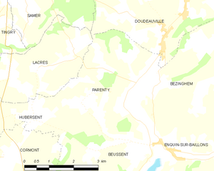
Parenty
- commune in Pas-de-Calais, France
- Country:
- Postal Code: 62650
- Coordinates: 50° 35' 16" N, 1° 48' 33" E
- GPS tracks (wikiloc): [Link]
- Area: 12.92 sq km
- Population: 534

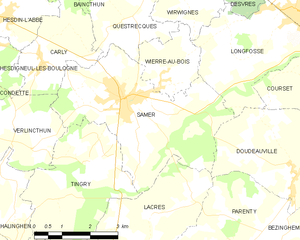
Samer
- commune in Pas-de-Calais, France
- Country:
- Postal Code: 62830
- Coordinates: 50° 38' 23" N, 1° 44' 43" E
- GPS tracks (wikiloc): [Link]
- Area: 16.78 sq km
- Population: 4162
- Web site: [Link]

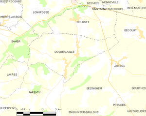
Doudeauville
- commune in Pas-de-Calais, France
- Country:
- Postal Code: 62830
- Coordinates: 50° 36' 43" N, 1° 49' 45" E
- GPS tracks (wikiloc): [Link]
- Area: 13.74 sq km
- Population: 552
- Web site: [Link]