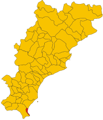
Laigueglia (Laigueglia)
- Italian comune
Laigueglia is a charming coastal town located in the Liguria region of Italy, known for its beautiful beaches and picturesque landscapes. While Laigueglia is primarily famous for its sunny shores and Mediterranean climate, it also offers some wonderful hiking opportunities in the surrounding hills and countryside.
Hiking Highlights in Laigueglia:
-
Panoramic Views: Many trails in the area offer stunning views of the Ligurian Sea and the coastline. The paths often lead through lush Mediterranean vegetation, with olive groves and aromatic herbs.
-
Monte Bignone: A popular hike near Laigueglia is to Monte Bignone, where you can find trails that take you to the summit. The views from the top are breathtaking, overlooking the coastline and surrounding hills.
-
Sentiero Azzurro: This is part of the larger "Cinque Terre" trail system and connects various coastal towns. Though it starts further away, sections of it are accessible from Laigueglia, offering beautiful coastal views and a chance to experience the region’s natural beauty.
-
Nature Reserves: The nearby Parco Naturale Regionale del Beigua is a fantastic place for hiking, with trails that take you through diverse ecosystems, woodlands, and panoramic viewpoints. This park is known for its rich biodiversity.
-
Historic Pathways: Some trails may lead you through ancient villages and historic sites, allowing you to immerse yourself in local culture and history while enjoying nature.
Tips for Hiking in Laigueglia:
- Footwear: Wear good hiking shoes, as some trails may be rocky or uneven.
- Water and Snacks: Always bring enough water and some snacks, especially if hiking in warmer months.
- Weather: Check the weather conditions before heading out, as storms can occur, and the terrain may become slippery.
- Trail Maps: It’s a good idea to carry a map or download a hiking app, as trail markings can vary.
- Respect Nature: Stick to marked trails, and remember to take any trash with you to preserve the beauty of the area.
Conclusion:
Hiking around Laigueglia can be a delightful experience, combining natural beauty with opportunities for adventure. Whether you're looking for a leisurely stroll along the coast or a more challenging hike in the hills, there’s something for every level of hiker to enjoy in this beautiful part of Italy.
- Country:

- Postal Code: 17053
- Local Dialing Code: 0182
- Licence Plate Code: SV
- Coordinates: 43° 58' 28" N, 8° 9' 30" E


- GPS tracks (wikiloc): [Link]
- AboveSeaLevel: 6 м m
- Area: 2.72 sq km
- Population: 1780
- Web site: http://www.comunelaigueglia.net/
- Wikipedia en: wiki(en)
- Wikipedia: wiki(it)
- Wikidata storage: Wikidata: Q270761
- Wikipedia Commons Category: [Link]
- Freebase ID: [/m/0f4grj]
- GeoNames ID: Alt: [6540556]
- VIAF ID: Alt: [158439874]
- OSM relation ID: [42789]
- Quora topic ID: [Laigueglia]
- ISTAT ID: 009033
- Italian cadastre code: E414
Shares border with regions:


Alassio
- Italian comune
Alassio, located on the Italian Riviera in the Liguria region, offers some beautiful hiking opportunities that provide stunning views of the Mediterranean Sea and the surrounding hills. Here are some highlights and tips for hiking in this picturesque area:...
- Country:

- Postal Code: 17021
- Local Dialing Code: 0182
- Licence Plate Code: SV
- Coordinates: 44° 0' 29" N, 8° 10' 23" E


- GPS tracks (wikiloc): [Link]
- AboveSeaLevel: 6 м m
- Area: 17.25 sq km
- Population: 10791
- Web site: [Link]


Andora
- Italian comune
Andorra, a small principality nestled in the Pyrenees mountains between France and Spain, offers a unique and stunning landscape for hiking enthusiasts. With its rugged terrain, picturesque villages, and rich biodiversity, Andorra is an ideal destination for hikers of all skill levels. Here are some key points about hiking in Andorra:...
- Country:

- Postal Code: 17051
- Local Dialing Code: 0182
- Licence Plate Code: SV
- Coordinates: 43° 57' 31" N, 8° 8' 22" E


- GPS tracks (wikiloc): [Link]
- AboveSeaLevel: 10 м m
- Area: 31.8 sq km
- Population: 7528
- Web site: [Link]

