Lamothe-Fénelon (Lamothe-Fénelon)

- commune in Lot, France
- Country:

- Postal Code: 46350
- Coordinates: 44° 50' 5" N, 1° 24' 51" E


- GPS tracks (wikiloc): [Link]
- Area: 13.99 sq km
- Population: 278
- Wikipedia en: wiki(en)
- Wikipedia: wiki(fr)
- Wikidata storage: Wikidata: Q283924
- Wikipedia Commons Category: [Link]
- Freebase ID: [/m/03nwl5f]
- GeoNames ID: Alt: [6434808]
- SIREN number: [214601528]
- BnF ID: [15260893g]
- INSEE municipality code: 46152
Shares border with regions:

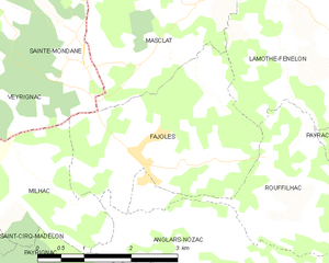
Fajoles
- commune in Lot, France
- Country:
- Postal Code: 46300
- Coordinates: 44° 48' 12" N, 1° 23' 47" E
- GPS tracks (wikiloc): [Link]
- Area: 8.98 sq km
- Population: 288


Masclat
- commune in Lot, France
- Country:
- Postal Code: 46350
- Coordinates: 44° 50' 7" N, 1° 23' 30" E
- GPS tracks (wikiloc): [Link]
- Area: 10.02 sq km
- Population: 354


Nadaillac-de-Rouge
- commune in Lot, France
- Country:
- Postal Code: 46350
- Coordinates: 44° 50' 57" N, 1° 25' 44" E
- GPS tracks (wikiloc): [Link]
- Area: 7.73 sq km
- Population: 161


Saint-Julien-de-Lampon
- commune in Dordogne, France
- Country:
- Postal Code: 24370
- Coordinates: 44° 51' 40" N, 1° 21' 47" E
- GPS tracks (wikiloc): [Link]
- Area: 13.24 sq km
- Population: 619


Payrac
- commune in Lot, France
- Country:
- Postal Code: 46350
- Coordinates: 44° 47' 47" N, 1° 28' 19" E
- GPS tracks (wikiloc): [Link]
- Area: 19.5 sq km
- Population: 631
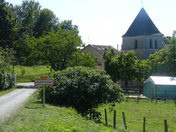

Rouffilhac
- commune in Lot, France
- Country:
- Postal Code: 46300
- Coordinates: 44° 47' 22" N, 1° 24' 56" E
- GPS tracks (wikiloc): [Link]
- Area: 6.5 sq km
- Population: 183


Loupiac
- commune in Lot, France
- Country:
- Postal Code: 46350
- Coordinates: 44° 49' 4" N, 1° 27' 39" E
- GPS tracks (wikiloc): [Link]
- AboveSeaLevel: 250 м m
- Area: 12.65 sq km
- Population: 259