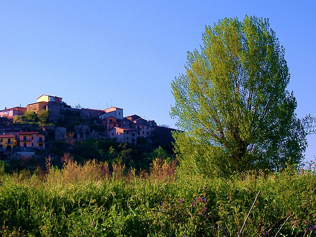
Lapio (Lapio)
- Italian comune
 Hiking in Lapio
Lapio is not a widely recognized hiking destination, but if you meant a specific region or mountain in Italy, Spain, or another country with similar names, I’d be happy to provide information based on that context.
If you meant hiking in a general sense within Italy or another natural area that might match "Lapio," here are some general tips for hiking in scenic areas:
-
Trail Selection: Research trails that fit your skill level, from easy walks to challenging scrambles. Look for local maps, hiking apps, or visitor center resources for guidance.
-
Seasonal Considerations: Some trails may be more accessible in certain seasons. Always check the weather and trail conditions before heading out.
-
Safety Precautions: Carry essentials such as water, snacks, a first-aid kit, a map or GPS, and appropriate clothing for varying weather conditions.
-
Leave No Trace: Follow eco-friendly practices by staying on trails, disposing of waste properly, and respecting wildlife.
-
Local Regulations: Be aware of any regulations specific to the area, such as permits or restricted zones.
If you have a specific location or more details in mind, feel free to share, and I can provide more tailored information!
- Country:

- Postal Code: 83030
- Local Dialing Code: 0825
- Licence Plate Code: AV
- Coordinates: 40° 58' 59" N, 14° 56' 47" E


- GPS tracks (wikiloc): [Link]
- AboveSeaLevel: 500 м m
- Area: 15.25 sq km
- Population: 1546
- Web site: http://www.comune.lapio.av.it
- Wikipedia en: wiki(en)
- Wikipedia: wiki(it)
- Wikidata storage: Wikidata: Q55046
- Wikipedia Commons Category: [Link]
- Freebase ID: [/m/0ffzcw]
- GeoNames ID: Alt: [6539996]
- OSM relation ID: [40934]
- UN/LOCODE: [ITLA2]
- ISTAT ID: 064042
- Italian cadastre code: E448
Shares border with regions:
Candida
- Italian comune
Hiking in Candida
Hiking in Candida, a small town in the Campania region of Italy, offers a delightful experience for nature lovers and outdoor enthusiasts. The area is part of the larger Irpinia region, known for its beautiful landscapes, rolling hills, and rich agricultural heritage. Here are some key points to consider about hiking in and around Candida:...
- Country:
- Postal Code: 83040
- Local Dialing Code: 0825
- Licence Plate Code: AV
- Coordinates: 40° 56' 36" N, 14° 52' 30" E
- GPS tracks (wikiloc): [Link]
- AboveSeaLevel: 579 м m
- Area: 5.35 sq km
- Population: 1121
- Web site: [Link]

Chiusano di San Domenico
- Italian comune
Hiking in Chiusano di San Domenico
Chiusano di San Domenico, located in the province of Avellino in Campania, Italy, offers a charming landscape for hiking enthusiasts. Nestled in the picturesque Irpinia region, this area is characterized by rolling hills, lush forests, and beautiful views of the surrounding countryside....
- Country:
- Postal Code: 83040
- Local Dialing Code: 0825
- Licence Plate Code: AV
- Coordinates: 40° 56' 3" N, 14° 55' 2" E
- GPS tracks (wikiloc): [Link]
- AboveSeaLevel: 700 м m
- Area: 24.6 sq km
- Population: 2219
- Web site: [Link]
Luogosano
- Italian comune
Hiking in Luogosano
Luogosano is a small town located in the Campania region of Italy, near the picturesque area of Irpinia in the province of Avellino. This region is known for its beautiful landscapes, rolling hills, and lush green valleys, making it an excellent destination for hiking enthusiasts....
- Country:
- Postal Code: 83040
- Local Dialing Code: 0827
- Licence Plate Code: AV
- Coordinates: 40° 59' 18" N, 14° 59' 30" E
- GPS tracks (wikiloc): [Link]
- AboveSeaLevel: 390 м m
- Area: 6.07 sq km
- Population: 1164
- Web site: [Link]

Montefalcione
- Italian comune
Hiking in Montefalcione
Montefalcione, located in the Campania region of Italy, is a picturesque village set amidst the beautiful Apennine Mountains. Hiking in this area offers stunning landscapes, rich flora and fauna, and a glimpse into the local culture and traditions....
- Country:
- Postal Code: 83030
- Local Dialing Code: 0825
- Licence Plate Code: AV
- Coordinates: 40° 57' 45" N, 14° 53' 5" E
- GPS tracks (wikiloc): [Link]
- AboveSeaLevel: 523 м m
- Area: 15.29 sq km
- Population: 3285
- Web site: [Link]
Montemiletto
- Italian comune
Hiking in Montemiletto
Montemiletto, located in the Campania region of Italy, is nestled in a picturesque area characterized by rolling hills and lush landscapes. While the area may not be as well-known as other hiking destinations in Italy, it offers several opportunities for outdoor enthusiasts to explore nature....
- Country:
- Postal Code: 83038
- Local Dialing Code: 0825
- Licence Plate Code: AV
- Coordinates: 41° 1' 0" N, 14° 54' 0" E
- GPS tracks (wikiloc): [Link]
- AboveSeaLevel: 600 м m
- Area: 21.64 sq km
- Population: 5288
- Web site: [Link]
Parolise
- Italian comune
Hiking in Parolise
Parolise, located in the province of Avellino in the Campania region of Italy, is not as widely known as some other hiking destinations, but it offers beautiful landscapes, rich flora, and a chance to explore the natural beauty of southern Italy....
- Country:
- Postal Code: 83050
- Local Dialing Code: 0825
- Licence Plate Code: AV
- Coordinates: 40° 56' 0" N, 14° 53' 0" E
- GPS tracks (wikiloc): [Link]
- AboveSeaLevel: 546 м m
- Area: 3.22 sq km
- Population: 661
- Web site: [Link]
San Mango sul Calore
- Italian comune
Hiking in San Mango sul Calore
San Mango sul Calore is a picturesque village located in the Campania region of southern Italy, surrounded by the lush landscapes of the Irpinia area. It offers a range of hiking opportunities, ideal for nature lovers and outdoor enthusiasts. Here are some highlights of hiking in this area:...
- Country:
- Postal Code: 83050
- Local Dialing Code: 0827
- Licence Plate Code: AV
- Coordinates: 40° 58' 0" N, 14° 58' 0" E
- GPS tracks (wikiloc): [Link]
- AboveSeaLevel: 480 м m
- Area: 14.59 sq km
- Population: 1169
- Web site: [Link]
Taurasi
- Italian comune
Hiking in Taurasi
Taurasi, a small town in the Campania region of Italy, is known for its beautiful landscapes, rolling hills, and robust wine culture, particularly its famous Taurasi wine. Hiking in and around Taurasi offers a wonderful opportunity to explore the natural beauty of the area, as well as its rich history and local culture....
- Country:
- Postal Code: 83030
- Local Dialing Code: 0827
- Licence Plate Code: AV
- Coordinates: 41° 0' 0" N, 14° 57' 0" E
- GPS tracks (wikiloc): [Link]
- AboveSeaLevel: 384 м m
- Area: 14.41 sq km
- Population: 2316
- Web site: [Link]