Lasserre (Lasserre)

- former commune in Haute-Garonne, France
- Country:

- Postal Code: 31530
- Coordinates: 43° 38' 20" N, 1° 10' 7" E


- GPS tracks (wikiloc): [Link]
- AboveSeaLevel: 179 м m
- Area: 9.51 sq km
- Population: 1021
- Web site: http://www.mairie-lasserre31.fr
- Wikipedia en: wiki(en)
- Wikipedia: wiki(fr)
- Wikidata storage: Wikidata: Q172901
- Wikipedia Commons Category: [Link]
- Freebase ID: [/m/03nt8l2]
- Freebase ID: [/m/03nt8l2]
- GeoNames ID: Alt: [6616474]
- GeoNames ID: Alt: [6616474]
- SIREN number: [213102775]
- SIREN number: [213102775]
- BnF ID: [15255272v]
- BnF ID: [15255272v]
- Quora topic ID: [Lasserre]
- Quora topic ID: [Lasserre]
- INSEE municipality code: 31277
- INSEE municipality code: 31277
Shares border with regions:


Léguevin
- commune in Haute-Garonne, France
- Country:
- Postal Code: 31490
- Coordinates: 43° 35' 56" N, 1° 13' 59" E
- GPS tracks (wikiloc): [Link]
- Area: 24.45 sq km
- Population: 8948
- Web site: [Link]
Pradère-les-Bourguets
- former commune in Haute-Garonne, France
- Country:
- Postal Code: 31530
- Coordinates: 43° 38' 27" N, 1° 9' 58" E
- GPS tracks (wikiloc): [Link]
- Area: 4.89 sq km
- Population: 441
- Web site: [Link]


Lévignac
- commune in Haute-Garonne, France
- Country:
- Postal Code: 31530
- Coordinates: 43° 39' 57" N, 1° 11' 40" E
- GPS tracks (wikiloc): [Link]
- Area: 12.22 sq km
- Population: 2022
- Web site: [Link]

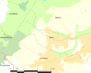
Brax
- commune in Haute-Garonne, France
- Country:
- Postal Code: 31490
- Coordinates: 43° 36' 49" N, 1° 14' 21" E
- GPS tracks (wikiloc): [Link]
- Area: 4.42 sq km
- Population: 2651
- Web site: [Link]


Pibrac
- commune in Haute-Garonne, France
- Country:
- Postal Code: 31820
- Coordinates: 43° 37' 1" N, 1° 17' 5" E
- GPS tracks (wikiloc): [Link]
- Area: 25.86 sq km
- Population: 8298
- Web site: [Link]


Mérenvielle
- commune in Haute-Garonne, France
- Country:
- Postal Code: 31530
- Coordinates: 43° 37' 40" N, 1° 9' 23" E
- GPS tracks (wikiloc): [Link]
- Area: 10.45 sq km
- Population: 485