Lasserre-de-Prouille (Lasserre-de-Prouille)

- commune in Aude, France
- Country:

- Postal Code: 11270
- Coordinates: 43° 10' 45" N, 2° 4' 59" E


- GPS tracks (wikiloc): [Link]
- Area: 4.16 sq km
- Population: 254
- Web site: http://www.lasserredeprouille.fr
- Wikipedia en: wiki(en)
- Wikipedia: wiki(fr)
- Wikidata storage: Wikidata: Q1149470
- Wikipedia Commons Gallery: [Link]
- Wikipedia Commons Category: [Link]
- Freebase ID: [/m/03m8zcw]
- GeoNames ID: Alt: [3006365]
- SIREN number: [211101936]
- BnF ID: [15246730b]
- VIAF ID: Alt: [243722399]
- INSEE municipality code: 11193
Shares border with regions:


Brézilhac
- commune in Aude, France
- Country:
- Postal Code: 11270
- Coordinates: 43° 10' 5" N, 2° 4' 46" E
- GPS tracks (wikiloc): [Link]
- Area: 6.82 sq km
- Population: 172
- Web site: [Link]
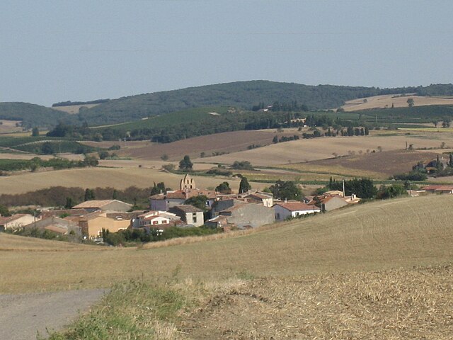
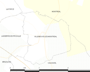
Villeneuve-lès-Montréal
- commune in Aude, France
- Country:
- Postal Code: 11290
- Coordinates: 43° 10' 48" N, 2° 6' 41" E
- GPS tracks (wikiloc): [Link]
- Area: 2.2 sq km
- Population: 271


Fanjeaux
- commune in Aude, France
- Country:
- Postal Code: 11270
- Coordinates: 43° 11' 13" N, 2° 2' 1" E
- GPS tracks (wikiloc): [Link]
- AboveSeaLevel: 363 м m
- Area: 25.49 sq km
- Population: 818
- Web site: [Link]
Cailhavel
- commune in Aude, France
- Country:
- Postal Code: 11240
- Coordinates: 43° 9' 43" N, 2° 7' 35" E
- GPS tracks (wikiloc): [Link]
- Area: 5.34 sq km
- Population: 124


La Force
- commune in Aude, France
- Country:
- Postal Code: 11270
- Coordinates: 43° 11' 39" N, 2° 5' 37" E
- GPS tracks (wikiloc): [Link]
- Area: 4.6 sq km
- Population: 217