Lasson (Lasson)

- commune in Yonne, France
- Country:

- Postal Code: 89570
- Coordinates: 48° 3' 32" N, 3° 49' 0" E


- GPS tracks (wikiloc): [Link]
- Area: 7.07 sq km
- Population: 140
- Wikipedia en: wiki(en)
- Wikipedia: wiki(fr)
- Wikidata storage: Wikidata: Q128219
- Wikipedia Commons Category: [Link]
- Freebase ID: [/m/03qf6z7]
- Freebase ID: [/m/03qf6z7]
- GeoNames ID: Alt: [6445899]
- GeoNames ID: Alt: [6445899]
- SIREN number: [218902195]
- SIREN number: [218902195]
- BnF ID: [15279676q]
- BnF ID: [15279676q]
- INSEE municipality code: 89219
- INSEE municipality code: 89219
Shares border with regions:

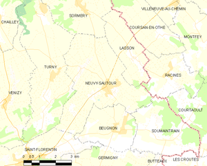
Neuvy-Sautour
- commune in Yonne, France
- Country:
- Postal Code: 89570
- Coordinates: 48° 2' 31" N, 3° 47' 38" E
- GPS tracks (wikiloc): [Link]
- Area: 19.06 sq km
- Population: 918


Sormery
- commune in Yonne, France
- Country:
- Postal Code: 89570
- Coordinates: 48° 5' 16" N, 3° 46' 17" E
- GPS tracks (wikiloc): [Link]
- Area: 30.56 sq km
- Population: 348


Coursan-en-Othe
- commune in Aube, France
- Country:
- Postal Code: 10130
- Coordinates: 48° 4' 18" N, 3° 50' 20" E
- GPS tracks (wikiloc): [Link]
- Area: 9.27 sq km
- Population: 104


Racines
- commune in Aube, France
- Country:
- Postal Code: 10130
- Coordinates: 48° 2' 59" N, 3° 50' 37" E
- GPS tracks (wikiloc): [Link]
- AboveSeaLevel: 131 м m
- Area: 7.5 sq km
- Population: 169