
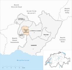
Lausanne (Lausanne)


- capital city of the Swiss Canton of Vaud
 Hiking in Lausanne
Lausanne, located on the shores of Lake Geneva in Switzerland, offers a variety of hiking opportunities, ranging from scenic lakeside strolls to challenging mountain trails. The city is beautifully situated amidst stunning landscapes, combining urban and natural environments.
Popular Hiking Areas Around Lausanne:
-
Lavaux Vineyard Terraces:
- This UNESCO World Heritage site features terraced vineyards along the lakeshore, providing breathtaking views of Lake Geneva and the Alps.
- The "Sentier des Vignes" (Vineyard Trail) is a popular hike that winds through the vineyards and offers tasting opportunities at local wineries.
-
Vallée de la Jeunesse:
- A picturesque valley a short distance from Lausanne, this area offers various trails, beautiful flora, and the chance to discover local wildlife.
- The path along the Flon River is particularly charming, making it suitable for families and casual walkers.
-
Signal de Bougy:
- Located just a short drive from Lausanne, this park offers hiking trails with panoramic views of Lake Geneva and the surrounding mountains.
- The park features a small zoo and various educational exhibits about nature.
-
Jorat Forest:
- This vast forest area is perfect for those who enjoy wooded trails. There are several marked paths suitable for hiking or jogging.
- It's a great place to experience the tranquility of nature, with ample opportunities for picnicking.
-
Mont Pelerin:
- A bit further out, Mont Pelerin offers more challenging hikes with stunning views of the Swiss Alps.
- The region is well-known for its hiking trails and is also accessible via cable car if you prefer to start higher up.
Tips for Hiking in Lausanne:
- Weather: Check the weather forecast before heading out, as conditions can change rapidly in the mountains.
- Trail Maps: Use local trail maps or apps like AllTrails to find the best routes and navigate your hikes easily.
- Hydration and Snacks: Bring plenty of water and snacks, as some trails can be lengthy and tiring.
- Appropriate Gear: Wear comfortable, sturdy shoes, and dress in layers to adapt to changing temperatures.
Accessibility:
Most of these hiking locations are accessible by public transport from Lausanne, making it easy to explore the natural beauty surrounding the city without needing a car.
Whether you're a seasoned hiker or a beginner looking for a leisurely walk, Lausanne and its surroundings provide a wealth of options to enjoy the stunning Swiss landscape.
- Country:

- Postal Code: 1017–1018; 1010–1012; 1000–1007; 1014–1015
- Local Dialing Code: 021
- Licence Plate Code: VD
- Coordinates: 46° 32' 0" N, 6° 38' 0" E


- GPS tracks (wikiloc): [Link]
- AboveSeaLevel: 495 м m
- Area: 41.37 sq km
- Population: 138905
- Web site: http://www.lausanne.ch
- Wikipedia en: wiki(en)
- Wikipedia: wiki(de)
- Wikidata storage: Wikidata: Q807
- Wikipedia Commons Gallery: [Link]
- Wikipedia Commons Category: [Link]
- Wikipedia Commons Maps Category: [Link]
- Freebase ID: [/m/04qdj]
- GeoNames ID: Alt: [7286283]
- BnF ID: [11881072f]
- VIAF ID: Alt: [147349797]
- OSM relation ID: [1685018]
- GND ID: Alt: [4034750-3]
- archINFORM location ID: [1653]
- Library of Congress authority ID: Alt: [n79121361]
- MusicBrainz area ID: [33f49521-f754-43cf-8d7a-d9e336fe56e6]
- Quora topic ID: [Lausanne-Switzerland]
- TGN ID: [7007299]
- Encyclopædia Britannica Online ID: [place/Lausonium]
- Gran Enciclopèdia Catalana ID: [0036679]
- Encyclopædia Universalis ID: [lausanne]
- HDS ID: [2408]
- EMLO location ID: [b4c41e4d-bc11-4826-8ffd-88994274657f]
- Facebook Places ID: [115456095134627]
- Great Russian Encyclopedia Online ID: [2182020]
- Swiss municipality code: [5586]
- ISNI: Alt: [0000 0001 0944 4810]
- DMOZ ID: Alt: [Regional/Europe/Switzerland/Cantons/Vaud/Lausanne/]
- National Library of Israel ID: [000977101]
- Klexikon article ID: [Lausanne]
- BabelNet ID: [00050233n]
- Brockhaus Enzyklopädie online ID: [lausanne]
- BNE ID: Alt: [XX455778]
- SELIBR ID: [152244]
- Encyclopedia of Modern Ukraine ID: [56194]
- BAV ID: [ADV12129120]
- US National Archives Identifier: 10045359
Shares border with regions:


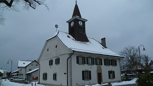
Bottens
- municipality in Switzerland
Hiking in Bottens
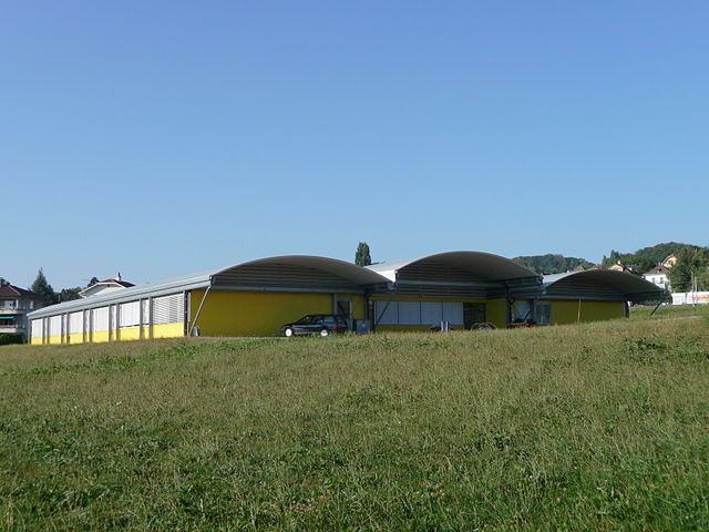
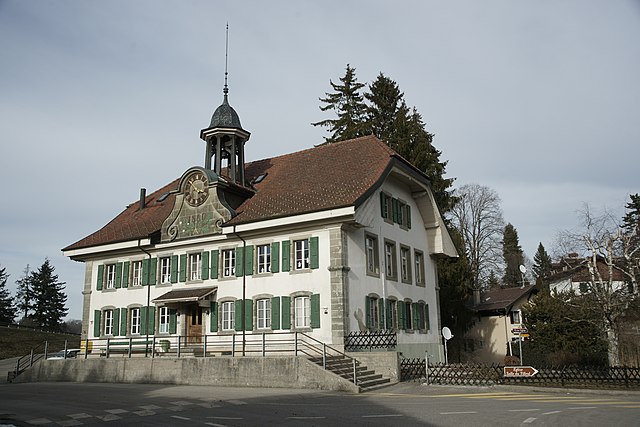
Bottens, located in the Vaud region of Switzerland, is a quaint village that serves as a lovely hub for hiking enthusiasts. The surrounding landscape is characterized by rolling hills, scenic views, and a mix of forests and farmland, making it a great destination for various hiking experiences....
- Country:
- Local Dialing Code: 021
- Licence Plate Code: VD
- Coordinates: 46° 36' 54" N, 6° 39' 43" E
- GPS tracks (wikiloc): [Link]
- AboveSeaLevel: 730 м m
- Area: 6.79 sq km
- Population: 1262
- Web site: [Link]

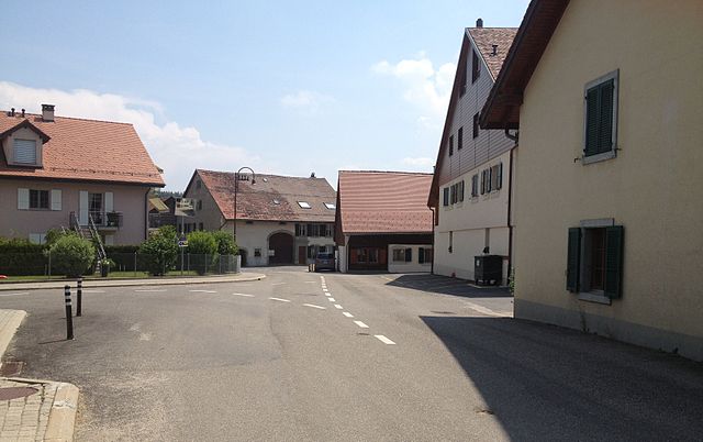
Bretigny-sur-Morrens
- municipality in Switzerland
Hiking in Bretigny-sur-Morrens
Bretigny-sur-Morrens, located in the Vaud region of Switzerland, offers a beautiful setting for hiking enthusiasts. The area is characterized by picturesque landscapes, rolling hills, and stunning views of the surrounding mountains, making it an attractive destination for outdoor activities....
- Country:
- Local Dialing Code: 021
- Licence Plate Code: VD
- Coordinates: 46° 36' 0" N, 6° 38' 0" E
- GPS tracks (wikiloc): [Link]
- AboveSeaLevel: 721 м m
- Area: 2.88 sq km
- Population: 823
- Web site: [Link]
Chavannes-près-Renens
- municipality in Switzerland
Hiking in Chavannes-près-Renens
Chavannes-près-Renens, located in the canton of Vaud in Switzerland, offers beautiful scenery and a range of opportunities for hiking enthusiasts. The region's picturesque landscapes, including views of the Alps and Lake Geneva, provide a stunning backdrop for outdoor activities....
- Country:
- Local Dialing Code: 021
- Licence Plate Code: VD
- Coordinates: 46° 31' 41" N, 6° 34' 34" E
- GPS tracks (wikiloc): [Link]
- AboveSeaLevel: 397 м m
- Area: 1.65 sq km
- Population: 7649
- Web site: [Link]


Cheseaux-sur-Lausanne
- municipality in Switzerland
Hiking in Cheseaux-sur-Lausanne
Cheseaux-sur-Lausanne is an attractive village located in the Vaud region of Switzerland, near Lake Geneva and the city of Lausanne. While it may not be as famous as other hiking destinations in Switzerland, it offers access to beautiful landscapes and scenic trails suitable for hiking enthusiasts of all levels....
- Country:
- Local Dialing Code: 021
- Licence Plate Code: VD
- Coordinates: 46° 35' 4" N, 6° 35' 44" E
- GPS tracks (wikiloc): [Link]
- AboveSeaLevel: 586 м m
- Area: 4.60 sq km
- Population: 4357
- Web site: [Link]


Crissier
- municipality in Switzerland
Hiking in Crissier
Crissier is a charming municipality located in the Canton of Vaud, Switzerland, near Lake Geneva and just a few kilometers from the city of Lausanne. While it's not primarily known as a hiking destination like some of the larger Swiss national parks or mountainous regions, the surrounding areas offer opportunities for pleasant hikes and walks....
- Country:
- Postal Code: 1023
- Local Dialing Code: 021
- Licence Plate Code: VD
- Coordinates: 46° 33' 30" N, 6° 34' 38" E
- GPS tracks (wikiloc): [Link]
- AboveSeaLevel: 489 м m
- Area: 5.50 sq km
- Population: 8037
- Web site: [Link]


Saint-Sulpice
- municipality in Switzerland
Hiking in Saint-Sulpice
Saint-Sulpice, located in the Vaud canton of Switzerland, offers a delightful setting for hiking enthusiasts. Situated on the shores of Lake Geneva and nestled at the foot of the Jura Mountains, this area boasts stunning natural landscapes, serene lake views, and lush countryside....
- Country:
- Postal Code: 1025
- Local Dialing Code: 021
- Licence Plate Code: VD
- Coordinates: 46° 31' 0" N, 6° 34' 0" E
- GPS tracks (wikiloc): [Link]
- AboveSeaLevel: 394 м m
- Area: 1.85 sq km
- Population: 4508
- Web site: [Link]

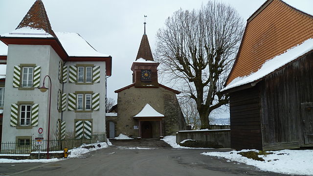
Froideville
- municipality in Switzerland
Hiking in Froideville
Froideville is a picturesque village in the canton of Vaud, Switzerland, known for its beautiful landscapes and proximity to the larger city of Lausanne. While it is a smaller and lesser-known destination for hiking, there are several options for outdoor enthusiasts looking to explore its natural beauty....
- Country:
- Postal Code: 1055
- Local Dialing Code: 021
- Licence Plate Code: VD
- Coordinates: 46° 35' 53" N, 6° 41' 30" E
- GPS tracks (wikiloc): [Link]
- AboveSeaLevel: 834 м m
- Area: 7.12 sq km
- Population: 2557
- Web site: [Link]


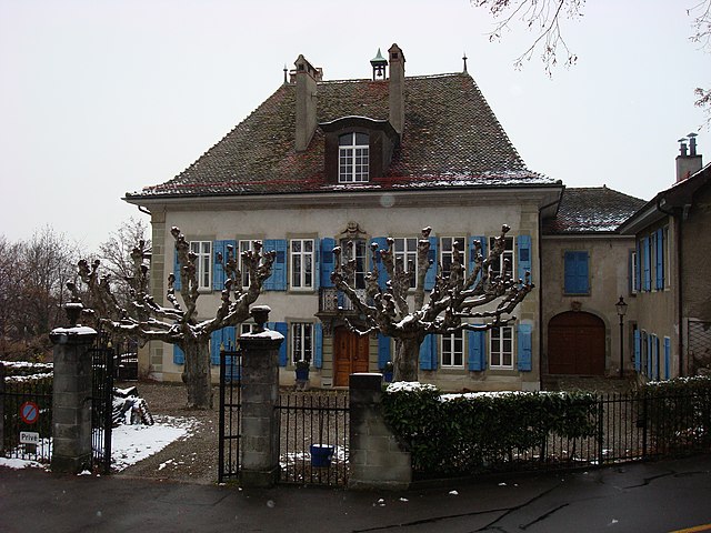
Cugy
- municipality in Switzerland
Hiking in Cugy
Cugy is a charming village located in the Canton of Vaud in Switzerland, nestled between rolling hills and picturesque landscapes. Hiking in this area offers a variety of trails that cater to different skill levels, making it an excellent destination for both casual walkers and seasoned hikers....
- Country:
- Postal Code: 1053
- Local Dialing Code: 021
- Licence Plate Code: VD
- Coordinates: 46° 34' 53" N, 6° 38' 37" E
- GPS tracks (wikiloc): [Link]
- AboveSeaLevel: 708 м m
- Area: 2.95 sq km
- Population: 2735
- Web site: [Link]

Morrens
- municipality in Switzerland
Hiking in Morrens
Morrens is a charming municipality located in the canton of Vaud in Switzerland, nestled near the beautiful Lake Geneva. It is surrounded by picturesque landscapes, and hiking enthusiasts will find a variety of trails in and around the area, offering opportunities to enjoy the stunning views of the Swiss Alps and the tranquil surroundings of the lake....
- Country:
- Postal Code: 1054
- Local Dialing Code: 021
- Licence Plate Code: VD
- Coordinates: 46° 35' 0" N, 6° 38' 0" E
- GPS tracks (wikiloc): [Link]
- AboveSeaLevel: 702 м m
- Area: 3.68 sq km
- Population: 1090
- Web site: [Link]


Epalinges
- municipality in Switzerland
Hiking in Epalinges
Épalinges is a picturesque municipality located in the Canton of Vaud in Switzerland, near the city of Lausanne. The area is known for its beautiful landscapes, rolling hills, and access to the surrounding natural beauty of the region, making it a great destination for hiking enthusiasts....
- Country:
- Postal Code: 1066
- Local Dialing Code: 021
- Licence Plate Code: VD
- Coordinates: 46° 33' 0" N, 6° 40' 0" E
- GPS tracks (wikiloc): [Link]
- AboveSeaLevel: 785 м m
- Area: 4.57 sq km
- Population: 9333
- Web site: [Link]


Ecublens
- municipality in the canton of Vaud, Switzerland
Hiking in Ecublens
Écublens is a charming town located in the canton of Vaud in Switzerland, near Lausanne. It offers various opportunities for hiking enthusiasts, with its proximity to the beautiful landscapes of the Vaud region and the nearby Lausanne area. Here are some highlights regarding hiking in and around Écublens:...
- Country:
- Postal Code: 1024
- Local Dialing Code: 021
- Licence Plate Code: VD
- Coordinates: 46° 32' 0" N, 6° 34' 0" E
- GPS tracks (wikiloc): [Link]
- AboveSeaLevel: 428 м m
- Area: 5.71 sq km
- Population: 12488
- Web site: [Link]


Pully
- municipality in Switzerland
Hiking in Pully
Pully, located in Switzerland near the shores of Lake Geneva, offers beautiful hiking opportunities that showcase stunning views of the lake and the surrounding alpine landscapes. Here are some highlights regarding hiking in the Pully area:...
- Country:
- Postal Code: 1009
- Local Dialing Code: 021
- Licence Plate Code: VD
- Coordinates: 46° 31' 17" N, 6° 40' 10" E
- GPS tracks (wikiloc): [Link]
- AboveSeaLevel: 566 м m
- Area: 5.84 sq km
- Population: 18160
- Web site: [Link]

Renens
- municipality in Switzerland
Hiking in Renens
Renens, located in the Vaud region of Switzerland, offers various hiking opportunities in a picturesque setting. While Renens itself is a largely urban area, it's conveniently positioned near the lush landscapes of the surrounding region, including the shores of Lake Geneva and the nearby Jura Mountains....
- Country:
- Postal Code: 1020
- Local Dialing Code: 021
- Licence Plate Code: VD
- Coordinates: 46° 32' 0" N, 6° 35' 0" E
- GPS tracks (wikiloc): [Link]
- AboveSeaLevel: 415 м m
- Area: 2.96 sq km
- Population: 21036
- Web site: [Link]

Prilly
- municipality in Switzerland
Hiking in Prilly
Prilly, located in Switzerland, is situated near the city of Lausanne in the Vaud canton. The region offers a variety of hiking opportunities, nestled in the scenic landscape of the Swiss foothills and near Lake Geneva. Here are some key points regarding hiking in and around Prilly:...
- Country:
- Postal Code: 1008
- Local Dialing Code: 021
- Licence Plate Code: VD
- Coordinates: 46° 32' 0" N, 6° 36' 0" E
- GPS tracks (wikiloc): [Link]
- AboveSeaLevel: 504 м m
- Area: 2.17 sq km
- Population: 12110
- Web site: [Link]


Le Mont-sur-Lausanne
- municipality in Switzerland
Hiking in Le Mont-sur-Lausanne
Le Mont-sur-Lausanne is a charming municipality located in the Vaud region of Switzerland, just a few kilometers from the city of Lausanne. The area is known for its beautiful landscapes, rolling hills, and scenic views of Lake Geneva and the surrounding Alps, making it a great destination for hiking enthusiasts of all levels....
- Country:
- Postal Code: 1052
- Local Dialing Code: 021
- Licence Plate Code: VD
- Coordinates: 46° 33' 34" N, 6° 38' 19" E
- GPS tracks (wikiloc): [Link]
- AboveSeaLevel: 733 м m
- Area: 9.81 sq km
- Population: 8097
- Web site: [Link]


Jouxtens-Mézery
- municipality in Switzerland
Hiking in Jouxtens-Mézery
Jouxtens-Mézery is a charming village located in the Vaud region of Switzerland, near Lausanne. It's a beautiful area for hiking, offering a mix of scenic views, lush landscapes, and access to the nearby natural sites. Here are some key points for hiking in and around Jouxtens-Mézery:...
- Country:
- Postal Code: 1008
- Local Dialing Code: 021
- Licence Plate Code: VD
- Coordinates: 46° 33' 0" N, 6° 36' 0" E
- GPS tracks (wikiloc): [Link]
- AboveSeaLevel: 525 м m
- Area: 1.93 sq km
- Population: 1469
- Web site: [Link]

Romanel-sur-Lausanne
- municipality in Switzerland
Hiking in Romanel-sur-Lausanne
Romanel-sur-Lausanne, nestled in the scenic region of Vaud in Switzerland, offers a wonderful environment for hiking enthusiasts. This charming municipality is located near the city of Lausanne, providing easy access to both urban amenities and beautiful natural landscapes....
- Country:
- Postal Code: 1032
- Local Dialing Code: 021
- Licence Plate Code: VD
- Coordinates: 46° 34' 0" N, 6° 36' 0" E
- GPS tracks (wikiloc): [Link]
- AboveSeaLevel: 592 м m
- Area: 2.87 sq km
- Population: 3298
- Web site: [Link]

Montpreveyres
- municipality in Switzerland
Hiking in Montpreveyres
Montpreveyres is a charming area in Switzerland that offers beautiful hiking opportunities, particularly known for its scenic views of the surrounding countryside and the nearby Lake Geneva. Here are some details to consider if you're planning a hike in this region:...
- Country:
- Postal Code: 1081
- Local Dialing Code: 021
- Licence Plate Code: VD
- Coordinates: 46° 34' 53" N, 6° 43' 50" E
- GPS tracks (wikiloc): [Link]
- AboveSeaLevel: 894 м m
- Area: 4.11 sq km
- Population: 647
- Web site: [Link]


Savigny
- municipality in Switzerland
Hiking in Savigny
Savigny, located in the canton of Vaud in Switzerland, is a charming village that offers access to beautiful hiking trails and stunning natural landscapes. Here are some highlights and tips for hiking in and around Savigny:...
- Country:
- Postal Code: 1073
- Local Dialing Code: 021
- Licence Plate Code: VD
- Coordinates: 46° 34' 0" N, 6° 43' 0" E
- GPS tracks (wikiloc): [Link]
- AboveSeaLevel: 793 м m
- Area: 16.0 sq km
- Population: 3348
- Web site: [Link]