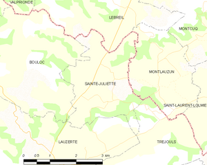
Lauzerte (Lauzerte)

- commune in Tarn-et-Garonne, France
- Country:

- Postal Code: 82110
- Coordinates: 44° 15' 21" N, 1° 8' 15" E


- GPS tracks (wikiloc): [Link]
- Area: 44.56 sq km
- Population: 1468
- Web site: http://www.lauzerte.fr
- Wikipedia en: wiki(en)
- Wikipedia: wiki(fr)
- Wikidata storage: Wikidata: Q919927
- Wikipedia Commons Category: [Link]
- Freebase ID: [/m/03qg1tv]
- Freebase ID: [/m/03qg1tv]
- GeoNames ID: Alt: [3005915]
- GeoNames ID: Alt: [3005915]
- SIREN number: [218200947]
- SIREN number: [218200947]
- BnF ID: [15277726z]
- BnF ID: [15277726z]
- VIAF ID: Alt: [136121260]
- VIAF ID: Alt: [136121260]
- Library of Congress authority ID: Alt: [n93119550]
- Library of Congress authority ID: Alt: [n93119550]
- PACTOLS thesaurus ID: [pcrtvSgLI2AUHY]
- PACTOLS thesaurus ID: [pcrtvSgLI2AUHY]
- INSEE municipality code: 82094
- INSEE municipality code: 82094
Shares border with regions:


Cazes-Mondenard
- commune in Tarn-et-Garonne, France
- Country:
- Postal Code: 82110
- Coordinates: 44° 13' 37" N, 1° 12' 8" E
- GPS tracks (wikiloc): [Link]
- Area: 58.23 sq km
- Population: 1195
Tréjouls
- commune in Tarn-et-Garonne, France
- Country:
- Postal Code: 82110
- Coordinates: 44° 16' 3" N, 1° 14' 9" E
- GPS tracks (wikiloc): [Link]
- Area: 13.86 sq km
- Population: 245


Saint-Amans-de-Pellagal
- commune in Tarn-et-Garonne, France
- Country:
- Postal Code: 82110
- Coordinates: 44° 13' 40" N, 1° 6' 32" E
- GPS tracks (wikiloc): [Link]
- Area: 14.51 sq km
- Population: 212

Sainte-Juliette
- commune in Tarn-et-Garonne, France
- Country:
- Postal Code: 82110
- Coordinates: 44° 17' 11" N, 1° 10' 10" E
- GPS tracks (wikiloc): [Link]
- Area: 7.3 sq km
- Population: 141


Montaigu-de-Quercy
- commune in Tarn-et-Garonne, France
- Country:
- Postal Code: 82150
- Coordinates: 44° 20' 25" N, 1° 1' 5" E
- GPS tracks (wikiloc): [Link]
- Area: 76.44 sq km
- Population: 1358
- Web site: [Link]


Belvèze
- commune in Tarn-et-Garonne, France
- Country:
- Postal Code: 82150
- Coordinates: 44° 19' 48" N, 1° 5' 30" E
- GPS tracks (wikiloc): [Link]
- Area: 13.88 sq km
- Population: 200


Touffailles
- commune in Tarn-et-Garonne, France
- Country:
- Postal Code: 82190
- Coordinates: 44° 16' 22" N, 1° 3' 2" E
- GPS tracks (wikiloc): [Link]
- Area: 24.34 sq km
- Population: 355
- Web site: [Link]


Bouloc-en-Quercy
- commune in Tarn-et-Garonne, France
- Country:
- Postal Code: 82110
- Coordinates: 44° 17' 58" N, 1° 7' 34" E
- GPS tracks (wikiloc): [Link]
- Area: 14.81 sq km
- Population: 192

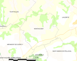
Montagudet
- commune in Tarn-et-Garonne, France
- Country:
- Postal Code: 82110
- Coordinates: 44° 14' 38" N, 1° 5' 29" E
- GPS tracks (wikiloc): [Link]
- Area: 12.18 sq km
- Population: 194