Lauzun (Lauzun)

- commune in Lot-et-Garonne, France
- Country:

- Postal Code: 47410
- Coordinates: 44° 37' 47" N, 0° 27' 38" E


- GPS tracks (wikiloc): [Link]
- AboveSeaLevel: 98 м m
- Area: 24.09 sq km
- Population: 730
- Web site: http://www.ville-lauzun.fr/
- Wikipedia en: wiki(en)
- Wikipedia: wiki(fr)
- Wikidata storage: Wikidata: Q1066975
- Wikipedia Commons Category: [Link]
- Freebase ID: [/m/03qfzf6]
- GeoNames ID: Alt: [6454181]
- SIREN number: [214701427]
- BnF ID: [15261223w]
- WOEID: [601772]
- INSEE municipality code: 47142
Shares border with regions:

Serres-et-Montguyard
- commune in Dordogne, France
- Country:
- Postal Code: 24500
- Coordinates: 44° 40' 26" N, 0° 27' 11" E
- GPS tracks (wikiloc): [Link]
- AboveSeaLevel: 50 м m
- Area: 6.85 sq km
- Population: 241
- Web site: [Link]
Douzains
- commune in Lot-et-Garonne, France
- Country:
- Postal Code: 47330
- Coordinates: 44° 38' 2" N, 0° 32' 21" E
- GPS tracks (wikiloc): [Link]
- Area: 12.66 sq km
- Population: 261


Saint-Aubin-de-Cadelech
- commune in Dordogne, France
- Country:
- Postal Code: 24500
- Coordinates: 44° 41' 35" N, 0° 28' 53" E
- GPS tracks (wikiloc): [Link]
- Area: 13.66 sq km
- Population: 330


Saint-Colomb-de-Lauzun
- commune in Lot-et-Garonne, France
- Country:
- Postal Code: 47410
- Coordinates: 44° 36' 51" N, 0° 28' 25" E
- GPS tracks (wikiloc): [Link]
- Area: 23.19 sq km
- Population: 490


Bourgougnague
- commune in Lot-et-Garonne, France
- Country:
- Postal Code: 47410
- Coordinates: 44° 37' 0" N, 0° 24' 59" E
- GPS tracks (wikiloc): [Link]
- Area: 11.73 sq km
- Population: 299


Sérignac-Péboudou
- commune in Lot-et-Garonne, France
- Country:
- Postal Code: 47410
- Coordinates: 44° 36' 53" N, 0° 32' 24" E
- GPS tracks (wikiloc): [Link]
- Area: 12.12 sq km
- Population: 176
Lalandusse
- commune in Lot-et-Garonne, France
- Country:
- Postal Code: 47330
- Coordinates: 44° 39' 24" N, 0° 31' 51" E
- GPS tracks (wikiloc): [Link]
- Area: 9.37 sq km
- Population: 218

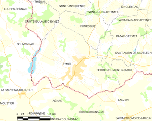
Eymet
- commune in Dordogne, France
- Country:
- Postal Code: 24500
- Coordinates: 44° 40' 3" N, 0° 23' 54" E
- GPS tracks (wikiloc): [Link]
- Area: 31.25 sq km
- Population: 2662
- Web site: [Link]