Lavenay (Lavenay)

- former commune in Sarthe, France
- Country:

- Postal Code: 72310
- Coordinates: 47° 47' 26" N, 0° 42' 5" E


- GPS tracks (wikiloc): [Link]
- Area: 7.7 sq km
- Population: 346
- Wikipedia en: wiki(en)
- Wikipedia: wiki(fr)
- Wikidata storage: Wikidata: Q1225933
- Wikipedia Commons Category: [Link]
- Freebase ID: [/m/03qk_8p]
- GeoNames ID: Alt: [6442591]
- BnF ID: [152737140]
- INSEE municipality code: 72159
Shares border with regions:
La Chapelle-Gaugain
- former commune in Sarthe, France
- Country:
- Postal Code: 72310
- Coordinates: 47° 47' 56" N, 0° 40' 50" E
- GPS tracks (wikiloc): [Link]
- Area: 10.66 sq km
- Population: 291


Sougé
- commune in Loir-et-Cher, France
- Country:
- Postal Code: 41800
- Coordinates: 47° 46' 13" N, 0° 43' 40" E
- GPS tracks (wikiloc): [Link]
- AboveSeaLevel: 62 м m
- Area: 16.88 sq km
- Population: 472
- Web site: [Link]


Couture-sur-Loir
- commune in Loir-et-Cher, France
- Country:
- Postal Code: 41800
- Coordinates: 47° 45' 13" N, 0° 41' 16" E
- GPS tracks (wikiloc): [Link]
- Area: 14.3 sq km
- Population: 413

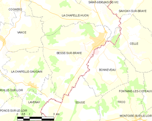
Bessé-sur-Braye
- commune in Sarthe, France
- Country:
- Postal Code: 72310
- Coordinates: 47° 50' 2" N, 0° 44' 58" E
- GPS tracks (wikiloc): [Link]
- Area: 20.6 sq km
- Population: 2233
- Web site: [Link]

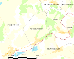
Poncé-sur-le-Loir
- former commune in Sarthe, France
- Country:
- Postal Code: 72340
- Coordinates: 47° 45' 43" N, 0° 39' 19" E
- GPS tracks (wikiloc): [Link]
- Area: 6.92 sq km
- Population: 342