
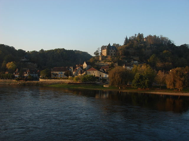
Le Bugue (Le Bugue)

- commune in Dordogne, France
- Country:

- Postal Code: 24260
- Coordinates: 44° 55' 12" N, 0° 55' 38" E


- GPS tracks (wikiloc): [Link]
- Area: 28.96 sq km
- Population: 2656
- Web site: http://le-bugue.reseaudescommunes.fr/communes/
- Wikipedia en: wiki(en)
- Wikipedia: wiki(fr)
- Wikidata storage: Wikidata: Q472132
- Wikipedia Commons Category: [Link]
- Freebase ID: [/m/03cvfps]
- Freebase ID: [/m/03cvfps]
- GeoNames ID: Alt: [3004935]
- GeoNames ID: Alt: [3004935]
- SIREN number: [212400675]
- SIREN number: [212400675]
- BnF ID: [15251718g]
- BnF ID: [15251718g]
- VIAF ID: Alt: [152451821]
- VIAF ID: Alt: [152451821]
- Library of Congress authority ID: Alt: [n81039940]
- Library of Congress authority ID: Alt: [n81039940]
- EMLO location ID: [0dd90cd4-62c7-4cb3-ae1e-541dc2b055f3]
- EMLO location ID: [0dd90cd4-62c7-4cb3-ae1e-541dc2b055f3]
- INSEE municipality code: 24067
- INSEE municipality code: 24067
Shares border with regions:


Saint-Chamassy
- commune in Dordogne, France
- Country:
- Postal Code: 24260
- Coordinates: 44° 52' 22" N, 0° 55' 39" E
- GPS tracks (wikiloc): [Link]
- Area: 15.6 sq km
- Population: 527
- Web site: [Link]


Savignac-de-Miremont
- commune in Dordogne, France
- Country:
- Postal Code: 24260
- Coordinates: 44° 58' 20" N, 0° 56' 41" E
- GPS tracks (wikiloc): [Link]
- Area: 7.62 sq km
- Population: 172

Limeuil
- commune in Dordogne, France
- Country:
- Postal Code: 24510
- Coordinates: 44° 53' 7" N, 0° 53' 20" E
- GPS tracks (wikiloc): [Link]
- Area: 10.57 sq km
- Population: 341
- Web site: [Link]


Paunat
- commune in Dordogne, France
- Country:
- Postal Code: 24510
- Coordinates: 44° 54' 21" N, 0° 51' 32" E
- GPS tracks (wikiloc): [Link]
- Area: 18.28 sq km
- Population: 305
- Web site: [Link]
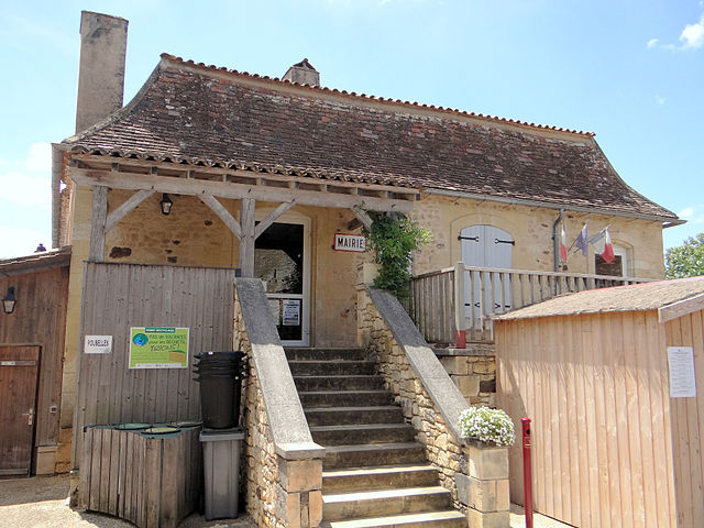
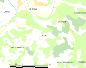
Audrix
- commune in Dordogne, France
- Country:
- Postal Code: 24260
- Coordinates: 44° 52' 52" N, 0° 56' 49" E
- GPS tracks (wikiloc): [Link]
- Area: 6.22 sq km
- Population: 286

Campagne
- commune in Dordogne, France
- Country:
- Postal Code: 24260
- Coordinates: 44° 54' 27" N, 0° 58' 1" E
- GPS tracks (wikiloc): [Link]
- Area: 14.4 sq km
- Population: 383
- Web site: [Link]

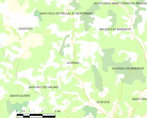
Journiac
- commune in Dordogne, France
- Country:
- Postal Code: 24260
- Coordinates: 44° 57' 56" N, 0° 53' 0" E
- GPS tracks (wikiloc): [Link]
- Area: 18.88 sq km
- Population: 455