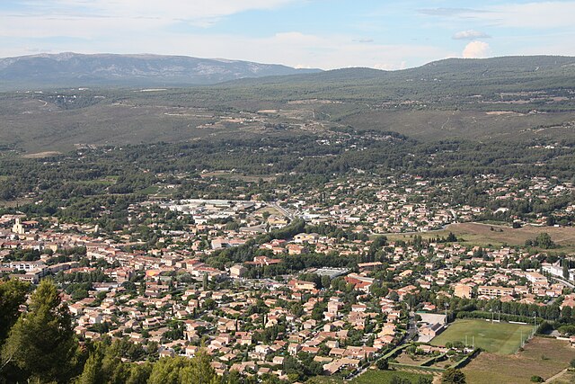
Le Castellet (Le Castellet)

- commune in Var, France
- Country:

- Postal Code: 83330
- Coordinates: 43° 12' 10" N, 5° 46' 36" E


- GPS tracks (wikiloc): [Link]
- AboveSeaLevel: 300 м m
- Area: 44.77 sq km
- Population: 3947
- Web site: http://www.ville-lecastellet.fr/
- Wikipedia en: wiki(en)
- Wikipedia: wiki(fr)
- Wikidata storage: Wikidata: Q817881
- Wikipedia Commons Category: [Link]
- Freebase ID: [/m/0281x3s]
- GeoNames ID: Alt: [6617824]
- SIREN number: [218300358]
- BnF ID: [152778623]
- Library of Congress authority ID: Alt: [no2007000865]
- PACTOLS thesaurus ID: [pcrt34WzPsXyzX]
- INSEE municipality code: 83035
Shares border with regions:


Cuges-les-Pins
- commune in Bouches-du-Rhône, France
- Country:
- Postal Code: 13780
- Coordinates: 43° 16' 35" N, 5° 42' 2" E
- GPS tracks (wikiloc): [Link]
- Area: 38.81 sq km
- Population: 5007
- Web site: [Link]


Sanary-sur-Mer
- commune in Var, France
- Country:
- Postal Code: 83110
- Coordinates: 43° 7' 9" N, 5° 48' 8" E
- GPS tracks (wikiloc): [Link]
- Area: 19.23 sq km
- Population: 16168
- Web site: [Link]


Roquefort-la-Bédoule
- commune in Bouches-du-Rhône, France
- Country:
- Postal Code: 13830
- Coordinates: 43° 14' 51" N, 5° 35' 27" E
- GPS tracks (wikiloc): [Link]
- Area: 31.15 sq km
- Population: 5528
- Web site: [Link]

Le Beausset
- commune in Var, France
- Country:
- Postal Code: 83330
- Coordinates: 43° 11' 54" N, 5° 48' 10" E
- GPS tracks (wikiloc): [Link]
- Area: 35.95 sq km
- Population: 9488
- Web site: [Link]


Signes
- commune in Var, France
 Hiking in Signes
Signes is a charming village located in the Var department of the Provence-Alpes-Côte d'Azur region in southeastern France. It offers a variety of hiking opportunities, showcasing the region's stunning natural landscapes, rich flora, and diverse fauna....
- Country:
- Postal Code: 83870
- Coordinates: 43° 17' 29" N, 5° 51' 46" E
- GPS tracks (wikiloc): [Link]
- Area: 133.1 sq km
- Population: 2779


La Cadière-d'Azur
- commune in Var, France
- Country:
- Postal Code: 83740
- Coordinates: 43° 11' 45" N, 5° 45' 20" E
- GPS tracks (wikiloc): [Link]
- Area: 37.42 sq km
- Population: 5499
- Web site: [Link]