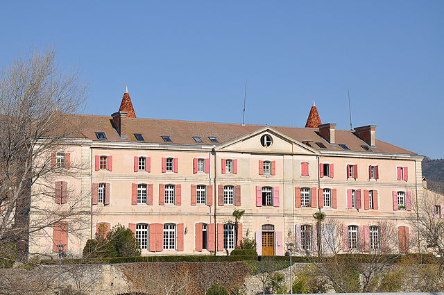
Le Chaffaut-Saint-Jurson (Le Chaffaut-Saint-Jurson)
- commune in Alpes-de-Haute-Provence, France
 Hiking in Le Chaffaut-Saint-Jurson
Le Chaffaut-Saint-Jurson is a charming commune located in the Alpes-de-Haute-Provence department in southeastern France. The region is characterized by its stunning natural landscapes, including the proximity to the Verdon Gorge and the picturesque countryside of Provence. Here are some key points about hiking in and around Le Chaffaut-Saint-Jurson:
Hiking Trails
-
Local Trails: There are several marked hiking trails that vary in difficulty, making it accessible for both beginners and experienced hikers. These trails allow you to explore the beautiful scenery, including forests, hills, and panoramic views of the surrounding area.
-
Verdon Gorge: A short drive away, the Verdon Gorge offers some spectacular hiking opportunities. The trails around the gorge provide stunning views of the turquoise waters and steep cliffs. Popular trails include the Sentier Martel and the Route des Crêtes.
-
Lac de Sainte-Croix: A little further out, this stunning lake is surrounded by hiking paths that offer a peaceful retreat and opportunities for swimming, cycling, and kayaking.
Preparing for Your Hike
-
Weather Conditions: Depending on the season, the weather can vary significantly. It’s wise to check the forecast and prepare appropriately with layers and rain gear if needed.
-
Footwear: Wear sturdy hiking boots or shoes with good traction, as the terrain can vary from rocky paths to smoother trails.
-
Water and Snacks: Always carry enough water and snacks, especially on longer hikes, to stay hydrated and energized.
-
Map or GPS: While many trails are marked, it’s a good idea to have a map or GPS device just in case you wander off the main paths.
Local Flora and Fauna
The region is home to a variety of plant and animal species. Keep an eye out for local wildlife, such as deer, birds, and various types of flora that are native to Provence.
Safety Tips
-
Trail Etiquette: Respect the trails and other hikers. Stay on designated paths, take your trash with you, and be considerate of nature.
-
Navigation: If you are unfamiliar with an area, consider joining a local hiking group or hiring a guide to enhance your experience and ensure your safety.
Conclusion
Hiking in Le Chaffaut-Saint-Jurson provides a great way to explore the natural beauty of the region. With varied trails and breathtaking landscapes, it’s an excellent destination for outdoor enthusiasts looking to enjoy the scenic beauty of southeastern France. Always remember to prioritize safety and conservation while enjoying your hiking adventures!
- Country:

- Postal Code: 04510
- Coordinates: 44° 2' 17" N, 6° 9' 1" E


- GPS tracks (wikiloc): [Link]
- Area: 36.2 sq km
- Population: 693
- Wikipedia en: wiki(en)
- Wikipedia: wiki(fr)
- Wikidata storage: Wikidata: Q871184
- Wikipedia Commons Category: [Link]
- Freebase ID: [/m/03m7w8d]
- Freebase ID: [/m/03m7w8d]
- GeoNames ID: Alt: [3027647]
- GeoNames ID: Alt: [3027647]
- SIREN number: [210400461]
- SIREN number: [210400461]
- INSEE municipality code: 04046
- INSEE municipality code: 04046
Shares border with regions:

Mézel
- commune in Alpes-de-Haute-Provence, France
Hiking in Mézel
Mézel is a picturesque village located in the Provence-Alpes-Côte d'Azur region of France, surrounded by beautiful landscapes and offering a variety of hiking opportunities. The area is characterized by its scenic trails, rolling hills, and diverse flora and fauna....
- Country:
- Postal Code: 04270
- Coordinates: 43° 59' 47" N, 6° 11' 46" E
- GPS tracks (wikiloc): [Link]
- Area: 21.36 sq km
- Population: 662


Saint-Jeannet
- commune in Alpes-de-Haute-Provence, France
Hiking in Saint-Jeannet
Saint-Jeannet is a charming village located in the Alpes-de-Haute-Provence region of southeastern France. This area is known for its stunning natural landscapes, making it an excellent destination for hiking enthusiasts. Here’s what you can expect when hiking around Saint-Jeannet:...
- Country:
- Postal Code: 04270
- Coordinates: 43° 57' 46" N, 6° 7' 37" E
- GPS tracks (wikiloc): [Link]
- Area: 21.14 sq km
- Population: 63
Malijai
- commune in Alpes-de-Haute-Provence, France
Hiking in Malijai
Malijai is a small commune in the Alpes-de-Haute-Provence department in southeastern France. It's nestled in a picturesque landscape, making it a great location for hiking enthusiasts. While it may not be as well-known as larger national parks or hiking regions in France, it offers several opportunities for outdoor activities....
- Country:
- Postal Code: 04510
- Coordinates: 44° 2' 45" N, 6° 1' 49" E
- GPS tracks (wikiloc): [Link]
- Area: 26.56 sq km
- Population: 1987

Mallemoisson
- commune in Alpes-de-Haute-Provence, France
Hiking in Mallemoisson
Mallemoisson is a picturesque commune located in the Alpes-de-Haute-Provence department in southeastern France. It's known for its stunning natural beauty, which makes it an appealing destination for hikers and outdoor enthusiasts....
- Country:
- Postal Code: 04510
- Coordinates: 44° 2' 31" N, 6° 7' 31" E
- GPS tracks (wikiloc): [Link]
- Area: 6.04 sq km
- Population: 1044

Mirabeau
- commune in Alpes-de-Haute-Provence, France
Hiking in Mirabeau
Mirabeau, located in the Alpes-de-Haute-Provence region of southeastern France, offers a variety of hiking opportunities that showcase the stunning natural beauty of the area. The region is characterized by its picturesque landscapes, including rolling hills, charming villages, and diverse flora and fauna....
- Country:
- Postal Code: 04510
- Coordinates: 44° 3' 46" N, 6° 5' 25" E
- GPS tracks (wikiloc): [Link]
- Area: 18.22 sq km
- Population: 510
- Web site: [Link]

Digne-les-Bains
- commune in Alpes-de-Haute-Provence, France
Hiking in Digne-les-Bains
Digne-les-Bains, located in the Alpes-de-Haute-Provence region in southeastern France, is a beautiful area known for its stunning landscapes, rich history, and warm climate. The region offers a variety of hiking opportunities suitable for all levels, from easy strolls to challenging mountain trails....
- Country:
- Postal Code: 04000
- Coordinates: 44° 5' 33" N, 6° 14' 8" E
- GPS tracks (wikiloc): [Link]
- Area: 117.07 sq km
- Population: 16246
- Web site: [Link]

Aiglun
- commune in Alpes-de-Haute-Provence, France
Hiking in Aiglun
Aiglun, located in the Alpes-de-Haute-Provence region of France, offers a range of hiking opportunities set against a stunning backdrop of natural beauty. This area is characterized by its mountainous landscapes, rugged terrain, and picturesque villages, making it a great destination for outdoor enthusiasts....
- Country:
- Postal Code: 04510
- Coordinates: 44° 3' 13" N, 6° 8' 26" E
- GPS tracks (wikiloc): [Link]
- Area: 14.89 sq km
- Population: 1384
- Web site: [Link]

Châteauredon
- commune in Alpes-de-Haute-Provence, France
Hiking in Châteauredon
Châteauredon is a charming village located in the Alpes-de-Haute-Provence region of France, surrounded by stunning natural landscapes that are ideal for hiking enthusiasts. Here are some details about hiking in and around Châteauredon:...
- Country:
- Postal Code: 04270
- Coordinates: 44° 0' 52" N, 6° 12' 53" E
- GPS tracks (wikiloc): [Link]
- Area: 10.53 sq km
- Population: 71